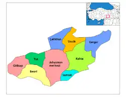
Kâhta
Kâhta (Kurdish: Kolîk,[3] Ottoman Turkish: کولک / Kölük[4]) is a large district of Adıyaman Province of Turkey. Population 63,216 (as of 2010).
Kâhta | |
|---|---|
 Kâhta | |
| Coordinates: 37°46′49″N 38°37′18″E | |
| Country | Turkey |
| Province | Adıyaman |
| Government | |
| • Mayor | Yusuf İbrahim Turanli (2019) Saadet partisi ((Turkey)) |
| • Kaymakam | Ahmet Gazi KAYA |
| Area | |
| • District | 1,358.82 km2 (524.64 sq mi) |
| Population (2012)[2] | |
| • Urban | 66,503 |
| • District | 117,794 |
| • District density | 87/km2 (220/sq mi) |
| Post code | 02400 |
| Website | www |
Kâhta is a small town in attractive countryside at the foot of Mount Nemrut and has a thriving business providing food, accommodation and transport (in the form of shared taxis or minibuses) to people visiting the mountain. Most businesses in the town are small and welcoming. The food found here includes grilled carp and trout, sis kebab, Turkish pizza.
Despite a growing tourism industry, this area is still classified as a developing rural region. The winters are especially cold and hard in these mountains. Families' Socio-economic status are below the average of Turkey. Since the 1970s in the face of these conditions many families from Kâhta have migrated to the cities of western Turkey.
The population of Kâhta is mostly of Kurdish origin from Reshwan tribe.
On 12 October 2018, cave drawings which date back to the Paleolithic era, were discovered in the Kâhta district, due to the decline of Atatürk Dam waters by 10–15 meters.[5]
Places of interest
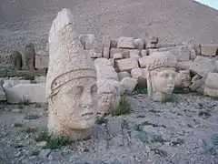
- Nemrut Dağı or Mount Nemrut - now a national park, famous for the antique statuary on the summit, dating back to the Commagene Kingdom.
- Karakuş Tumulus, with a large statue of an eagle.
- Kâhta castle
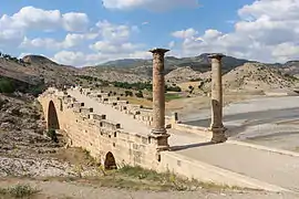
- Severan Bridge, a Roman bridge.
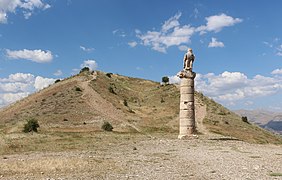 Tumulus of Karakuş
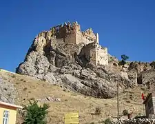 Kahta castle
References
| Wikivoyage has a travel guide for Kahta. |
- "Area of regions (including lakes), km²". Regional Statistics Database. Turkish Statistical Institute. 2002. Retrieved 2013-03-05.
- "Population of province/district centers and towns/villages by districts - 2012". Address Based Population Registration System (ABPRS) Database. Turkish Statistical Institute. Retrieved 2013-02-27.
- "Adıyaman - İbrahim Sediyani". Haksöz Haber (in Turkish). 28 August 2010. Retrieved 17 December 2019.
- Tahir Sezen, Osmanlı Yer Adları (Alfabetik Sırayla), T.C. Başbakanlık Devlet Arşivleri Genel Müdürlüğü, Yayın Nu 21, Ankara, p. 264.
- "Paleolithic art unveiled after dam water ebbs in Turkey's east". Hürriyet Daily News. 12 October 2018.
| Wikimedia Commons has media related to Kâhta. |
