Kadoma, Zimbabwe
Kadoma, formerly known as Gatooma, is a town in Zimbabwe.
Kadoma | |
|---|---|
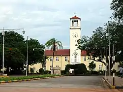 Kadoma Townhall | |
 Coat of arms | |
 Kadoma | |
| Coordinates: 18°20′24″S 29°54′00″E | |
| Country | Zimbabwe |
| Province | Mashonaland West |
| District | Kadoma District |
| City | Kadoma Municipality |
| Founded | 1890s |
| Government | |
| • Mayor | C. Chikozho |
| Elevation | 1,183 m (3,881 ft) |
| Population (2012 Census)[1] | |
| • Total | 91,633 |
| Time zone | UTC+2 (CAT) |
| Climate | Cwa |
| Website | http://kadomacity.org.zw/ |
Location
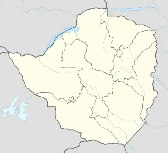
The city is located in Kadoma District, Mashonaland West Province, one of the 10 administrative provinces in Zimbabwe. This location lies approximately 166 kilometres (103 mi), by road, southwest of Harare, the national capital and largest city in the country.[2] This location lies on the main road, Highway A-5, between Harare and Bulawayo, approximately 305 kilometres (190 mi), further southwest of Kadoma.[3] Kadoma is situated at an elevation of 3,881 feet (1,183 m) above sea level.[4]
Overview
The city is at the centre of a mining area, which provides gold, copper and nickel. The most significant mine of the region is the Cam and Motor Mine, which is located in Eiffel Flats, about 10 kilometres (6.2 mi), by road, northeast of Kadoma.[5] Cam and Motor is the largest gold producer in Zimbabwe's history. Under the present regime, Cam and Motor is owned by Rio Tinto Zimbabwe.
Cotton is raised in the area and there was some development of related industries before 1990. The David Whithead Textile manufacturing company was opened in 1952.
ZB Bank Limited, a commercial bank, maintains a branch in the city.[6] Another commercial bank, Royal Bank Zimbabwe, also maintains a branch here.[7] Kadoma is also a peaceful town.
History
The city of Kadoma was known as Gatooma until 1982. Gatooma was founded in the 1890s as a mining camp, and constituted under a village management board in 1907. The settlement was named after the nearby kraal of Chief Katuma,[8] who is represented on the town's coat of arms by the mountain bearing his name and the chief's badge of office.[9]
The Specks Hotel was opened in 1907, and Jameson High School started the same year when Amelia Fitt, wife of the first mayor of Kadoma, started to give classes to the town children in her house.
In 1917 Gatooma Municipality was created.
A public electricity supply was introduced in Kadoma in 1922.
The Grand Hotel opened in 1925 and had a sprung floor for dancing, the first such floor in Zimbabwe.
The place that Kadoma is now situated was uninhabited it was a place where people from sanyati and mhondoro would come to only when they were hunting for wild animals. That is why it has one of its locations named Rimuka. For the Shona people they know that a hunting place kunonzi kumarimuka. The place became habitable after the completion of the railway line linking Bulawayo and Salisbury in 1901. A Mr Godwin and Mr John Mack got into a pact whereby Mr Godwin opened a bush canteen to cater for travellers and Mr John Mack wanted a place to offload his goods destined for his newly found claims of Gold at the current Golden Valley Mine.
The name Kadoma is driven from a nearby hill that is situated 26km away from the CBD. The place is known as milverton ranch or Kumacabbage. It is said that at that hill the Neuso and Mupamombe clan waged a vicious war at the hill and a lot of warriors fromu both clans perished and no one among those remaining wanted the issue to be spoke about. So painzi "Kusadoma" meaning musazozvitaurazve.
Population
In 2004, the population of the city was estimated at 79,174.[10] The population of Kadoma was estimated at 77,749 in 2012.[11]
In the 1969 census its population totalled 20,940, of whom 1,879 were Europeans and 18,740 were African. [12]
Climate
| Climate data for Kadoma (1961–1990) | |||||||||||||
|---|---|---|---|---|---|---|---|---|---|---|---|---|---|
| Month | Jan | Feb | Mar | Apr | May | Jun | Jul | Aug | Sep | Oct | Nov | Dec | Year |
| Average high °C (°F) | 28.6 (83.5) |
28.3 (82.9) |
28.6 (83.5) |
28.0 (82.4) |
26.1 (79.0) |
23.9 (75.0) |
23.9 (75.0) |
26.7 (80.1) |
30.3 (86.5) |
32.0 (89.6) |
30.3 (86.5) |
28.7 (83.7) |
28.0 (82.4) |
| Average low °C (°F) | 17.7 (63.9) |
17.4 (63.3) |
16.2 (61.2) |
14.6 (58.3) |
11.4 (52.5) |
8.8 (47.8) |
8.5 (47.3) |
10.4 (50.7) |
13.8 (56.8) |
16.8 (62.2) |
17.6 (63.7) |
17.8 (64.0) |
14.3 (57.7) |
| Average rainfall mm (inches) | 183.2 (7.21) |
146.8 (5.78) |
77.8 (3.06) |
29.9 (1.18) |
5.7 (0.22) |
1.6 (0.06) |
0.5 (0.02) |
1.3 (0.05) |
3.4 (0.13) |
33.2 (1.31) |
90.2 (3.55) |
165.0 (6.50) |
738.6 (29.08) |
| Average rainy days | 14 | 12 | 7 | 3 | 1 | 0 | 0 | 0 | 1 | 4 | 9 | 13 | 64 |
| Source: World Meteorological Organization[13] | |||||||||||||
Sister city
The city of Kadoma is twinned with Stevenage in the United Kingdom.
| City | Country | Year |
|---|---|---|
| Stevenage | 1989 |
See also
References
- Zimbabwe National Statistics Agency. "2012 Census Provincial Report: Matabeleland West". Retrieved 24 May 2018.
- Road Distance Between Harare And Kadoma With Map
- Map Showing Kadoma And Bulawayo With Distance Marker
- Elevation of Kadoma Above Sea Level
- Eiffel Flats Is A Suburb of Kadoma
- List of Branches of ZB Bank Limited
- Branches of Royal Bank Zimbabwe Archived 26 March 2012 at the Wayback Machine
- Room, A. (1997). Placenames of the World (2nd ed.). McFarland. ISBN 978-0-7864-2248-7. Retrieved 10 February 2009.
- "Coat of arms of Kadoma (Zimbabwe)". Heraldry of the World. Archived from the original on 5 December 2010. Retrieved 10 February 2009.
- Estimated Population In 2004
- 2012 Estimated Population By World Gazetteer Archived 30 September 2007 at the Wayback Machine
- "Archived copy". Archived from the original on 23 September 2015. Retrieved 8 December 2015.CS1 maint: archived copy as title (link)
- "World Weather Information Service – Kadoma". World Meteorological Organization. Retrieved 13 May 2016.
| Authority control |
|---|