Kaiserslautern
Kaiserslautern (German pronunciation: [ˌkaɪzɐsˈlaʊtɐn] (![]() listen)) is a city in southwest Germany, located in the Bundesland (State) of Rhineland-Palatinate (Rheinland-Pfalz) at the edge of the Palatinate Forest (Pfälzerwald). The historic centre dates to the 9th century. It is 459 kilometres (285 miles) from Paris, 117 km (73 miles) from Frankfurt am Main, 666 kilometers (414 miles) from Berlin, and 159 km (99 miles) from Luxembourg.
listen)) is a city in southwest Germany, located in the Bundesland (State) of Rhineland-Palatinate (Rheinland-Pfalz) at the edge of the Palatinate Forest (Pfälzerwald). The historic centre dates to the 9th century. It is 459 kilometres (285 miles) from Paris, 117 km (73 miles) from Frankfurt am Main, 666 kilometers (414 miles) from Berlin, and 159 km (99 miles) from Luxembourg.
Kaiserslautern | |
|---|---|
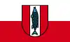 Flag  Coat of arms | |
Location of Kaiserslautern in Rhineland-Palatinate .svg.png.webp) | |
 Kaiserslautern  Kaiserslautern | |
| Coordinates: 49°26′41″N 7°46′8″E | |
| Country | Germany |
| State | Rhineland-Palatinate |
| District | Urban district |
| Government | |
| • Lord mayor | Klaus Weichel (SPD) |
| Area | |
| • Total | 139.74 km2 (53.95 sq mi) |
| Elevation | 251 m (823 ft) |
| Population (2019-12-31)[1] | |
| • Total | 100,030 |
| • Density | 720/km2 (1,900/sq mi) |
| Time zone | UTC+01:00 (CET) |
| • Summer (DST) | UTC+02:00 (CEST) |
| Postal codes | 67655–67663 |
| Dialling codes | 0631, 06301 |
| Vehicle registration | KL |
| Website | kaiserslautern.de |
Kaiserslautern is home to about 100,000 people. Additionally, approximately 45,000 NATO military personnel inhabit the city and its surrounding district (Landkreis Kaiserslautern), and contribute approximately US$1 billion annually to the local economy.[2] The city is also home to football club 1. FC Kaiserslautern that has won the German championship four times.
History
| Year | Pop. | ±% |
|---|---|---|
| 1611 | 2,120 | — |
| 1683 | 940 | −55.7% |
| 1810 | 3,654 | +288.7% |
| 1830 | 7,292 | +99.6% |
| 1871 | 17,896 | +145.4% |
| 1900 | 48,310 | +169.9% |
| 1910 | 54,659 | +13.1% |
| 1919 | 55,707 | +1.9% |
| 1933 | 62,619 | +12.4% |
| 1950 | 62,761 | +0.2% |
| 1961 | 86,259 | +37.4% |
| 1970 | 99,617 | +15.5% |
| 1987 | 97,326 | −2.3% |
| 2011 | 96,340 | −1.0% |
| 2018 | 99,845 | +3.6% |
| Population size may be affected by changes in administrative divisions. source:[3] | ||
| Largest groups of foreign residents | |
| Nationality | Population (2018) |
| 2,218 | |
| 1,722 | |
| 1,623 | |
| 1,477 | |
| 1,356 | |
| 1,115 | |
Prehistoric settlement in the area of what is now Kaiserslautern has been traced to at least 800 BC. Some 2,500-year-old Celtic tombs were uncovered at Miesau, a town about 29 kilometres (18 miles) west of Kaiserslautern. The recovered relics are now in the Museum for Palatinate History at Speyer.
Medieval period
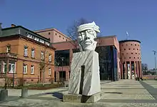
Kaiserslautern received its name from the favourite hunting retreat of Holy Roman Emperor Frederick Barbarossa[4] who ruled the Holy Roman Empire from 1155 until 1190. The small river Lauter made the old section of Kaiserslautern an island in medieval times. Ruins of Frederick's original castle, built 1152[4]–1160, can still be seen in front of the Rathaus (city hall). A second castle, Nanstein Castle, was built at Landstuhl to guard the western approach to the city. Barbarossa's influence on Kaiserslautern remains today, both in its nickname as a "Barbarossa city" and the open-mouthed pike on the city's coat of arms, reportedly his favorite dish.
The Stiftkirche, Kaiserslautern's oldest church, was constructed in 1250–1350. As the population of Kaiserslautern grew, King Rudolf von Habsburg chartered the town an imperial city in 1276.[5] St. Martin's Kirche (church) was built from 1300–1350 for an order of monks. Today a section of the original city wall still stands in the courtyard of the church.
By 1375, the city of Kaiserslautern was pledged to Electoral Palatinate[5] and therefore became subsequently part of the Wittelsbach inheritance.
Reformation
In 1519, Franz von Sickingen became the owner of Nanstein Castle. He became a Protestant, and in 1522 Nanstein was a stronghold for local nobles favouring the Reformation. Sickingen and the local nobles began their battle against the Archbishop of Trier; but the attack was unsuccessful, and they retreated to Nanstein. Nanstein was then besieged by cannon-armed German Catholic princes. Sickingen died after the castle surrendered, and the Protestant nobility of the Electoral Palatinate were subdued by the Catholic princes.
Count of the Electoral Palatinate Johann Casimir, came to Kaiserslautern during the Thirty Years' War (1618–1648). Spanish occupation in 1621–1632 ended when Protestant Swedish armies liberated the area. In 1635, however, Croatian troops of the Austrian emperor's army entered Kaiserslautern and killed 3,000 of the 3,200 residents in three days' plundering. Landstuhl was saved from a similar fate by surrendering without a fight. It took Kaiserslautern about 160 years to repopulate itself.
Conflict did not end with the Peace of Westphalia in 1648. The Elector of the Pfalz had difficulty with many of his subjects and ordered all castles, including Nanstein, destroyed. The French repeatedly invaded and occupied the area, residing in Kaiserslautern in 1686–1697. Nevertheless, after the treaty of Utrecht it was restored to be part of the Palatinate. During the unquiet episodes in the 18th century, the Palatinate was the scene of fighting between French and German troops of different states. In 1713, the French destroyed Barbarossa's castle[4] and the city's wall towers. From 1793 until Napoleon's defeat at Waterloo in 1815, the area was under French administration.
Bavarian province
As French power declined after 1815, Kaiserslautern and the Palatinate became a Bavarian province and remained so until 1918. After World War I, French troops again occupied the Palatinate for several years.
World War II
In World War II, Allied bombing destroyed more than 85% of Kaiserslautern. The railway and several main roads were primary targets, with the heaviest attacks occurring on 7 January, 11 August, and 28 September 1944. On 20 March 1945, as the last of the 1st Army crossed the Rhine at Remagen, the U.S. 80th Division, 319th Infantry, part of the 3rd US Army, seized Kaiserslautern without resistance. The city became part of the French occupation zone after the Second World War. The establishment of the state of Rhineland-Palatinate was ordered on August 30, 1946 as the last state in the western occupation zones by ordinance No. 57 of the French military government under General Marie-Pierre Kœnig. Little reconstruction took place until the currency reform of 1948. The pace of the economy remained slow until 1952, when construction for newly established garrisons of American troops brought economic growth to the area.
Unexploded ordnance from WWII continues to be discovered in and around Kaiserslautern. In May 2012 an unexploded 250-pound (110 kg) Allied bomb was found, buried deeply and reportedly covered by water pipe, during a construction project in the downtown area of the city. On 5 September 2013, another WWII bomb was found during construction near the train station in Enkenbach-Alsenborn.
Cold War era
In the late 1940s, Kaiserslautern area became the largest US garrison outside the United States (Kaiserslautern Military Community).
On November 14, 1956, a U.S. Air Force F-86 fighter jet crashed into the district office in the Burgstrasse / Maxstrasse area. In addition to the pilot, two other people died. Numerous people were injured.
With the incorporation of the previously independent communities of Dansenberg, Erfenbach, Erlenbach, Hohenecken, Mölschbach, Morlautern and Siegelbach on June 7, 1969, Kaiserslautern became a city. The University of Kaiserslautern was founded in 1970.
Industry flourished around the time of the first oil crisis (1973). In the 1970s, many industrial companies went through a crisis. In 1981, the spinning mill went bankrupt; Pfaff and Opel fired employees. The downsizing of the American garrison and the withdrawal of the French garrison cost more jobs.
Climate
Kaiserslautern has a moderate climate with adequate rainfall year-round. It is classified as a "Cfb" (Marine West Coast Climate/Oceanic climate) by the Köppen Climate Classification system.[6]
| Climate data for Kaiserslautern | |||||||||||||
|---|---|---|---|---|---|---|---|---|---|---|---|---|---|
| Month | Jan | Feb | Mar | Apr | May | Jun | Jul | Aug | Sep | Oct | Nov | Dec | Year |
| Average high °C (°F) | 4 (39) |
5 (41) |
10 (50) |
13 (55) |
19 (66) |
22 (72) |
25 (77) |
25 (77) |
20 (68) |
15 (59) |
9 (48) |
5 (41) |
14 (58) |
| Daily mean °C (°F) | 1.3 (34.3) |
2.1 (35.8) |
5.7 (42.3) |
9.5 (49.1) |
13.9 (57.0) |
15.0 (59.0) |
19.1 (66.4) |
18.4 (65.1) |
14.3 (57.7) |
10.0 (50.0) |
5.2 (41.4) |
2.3 (36.1) |
9.7 (49.5) |
| Average low °C (°F) | −1 (30) |
−2 (28) |
2 (36) |
3 (37) |
8 (46) |
12 (54) |
14 (57) |
13 (55) |
9 (48) |
6 (43) |
3 (37) |
1 (34) |
6 (42) |
| Average precipitation mm (inches) | 65 (2.6) |
59 (2.3) |
65 (2.6) |
53 (2.1) |
69 (2.7) |
64 (2.5) |
64 (2.5) |
63 (2.5) |
59 (2.3) |
74 (2.9) |
66 (2.6) |
81 (3.2) |
782 (30.8) |
| Average precipitation days | 18 | 15 | 13 | 15 | 14 | 14 | 15 | 14 | 13 | 14 | 16 | 17 | 178 |
| Average relative humidity (%) | 86 | 83 | 76 | 71 | 70 | 75 | 76 | 79 | 80 | 83 | 88 | 90 | 80 |
| Mean monthly sunshine hours | 48 | 77 | 118 | 169 | 194 | 207 | 224 | 211 | 154 | 102 | 54 | 38 | 1,596 |
| Source 1: Deutscher Wetterdienst[7] | |||||||||||||
| Source 2: Wetterkontor[8] | |||||||||||||
Attractions
Today, Kaiserslautern is a modern centre of information and communications technology and home to a well-known university, a technical college and many international research institutes located throughout the city.
The Palatine Gallery dates from 1874 featuring exhibits of painting and sculpture from the 19th century to the present day.
.jpg.webp)
Town Hall Kaiserslautern is one of the tallest buildings and is located in the city centre. The bar and coffee shop on the top floor provides a panoramic view of the city and surrounding countryside.
The tallest building in the centre of Kaiserslautern is St. Mary's, a Roman Catholic church, whilst the highest structure in all Kaiserslautern is the television tower in the suburb of Dansenberg, southwest of the city centre.
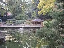
Kaiserslautern's large botanical gardens feature a Japanese-style garden. Another unusual feature is the Waschmühle (also known as "Wesch"), an enormous 160-metre (520 ft) public swimming pool that is the largest in Europe. There are several pedestrian-only shopping zones with numerous and varied restaurants and bars located in the city centre surrounding the old city (Altstadt). In the Altstadt you will find the "Kaiserbrunnen", a large ornamental fountain with symbols of the city's history such as a sewing machine, as produced by the Pfaff company in the city, a football representing the city's football club and various animals that children can climb.
Culture and sports
Pfalztheater Kaiserslautern
Local theatre Pfalztheater employs more than 300 people and features plays, operas, ballets, concerts, and musicals. The first German performance of West Side Story took place there. As the arts in Germany are significantly subsidized by the government, its ticket prices are reasonably low. Pfalztheater Kaiserslautern hosts the Else-Lasker-Schüler-Preis awards for German literature.
The Kammgarn
The Kammgarn is classified as a historical site. It served as a spinning factory before being transformed into the cultural heart of Kaiserslautern. This renovation has preserved its historical character while incorporating the latest sound and lighting technologies. The Kammgarn stands among the top venues in Germany and serves as a first-call club for rising groups and performers as well as established jazz, rock, blues and pop artists in Europe. Performances have included international stars B.B. King, Manfred Mann's Earth Band, Pat Metheny, Uriah Heep and Jan Garbarek.
Gartenschau (Garden exhibition)
Better known as the 'Dino Park' because of its lifesize dinosaur models, the Gartenschau is open from April through October and is popular with families. Having begun as a series of botanical displays and enjoying success at the first State Garden Exhibition of Rhineland-Palatinate in Kaiserslautern in 2000, this 54-acre (220,000 m2) park has been transformed into one of the most multi-dimensional cultural centres in Germany.
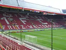
Fritz-Walter-Stadium
The Fritz-Walter-Stadion accommodates 48,500 football fans. In June 2006, after renovation, Kaiserslautern was one of 12 German cities to host the 2006 FIFA World Cup. During the five matches played, the first goal ever from an Australian team in a Football World Cup match was scored (by Tim Cahill).
Kaiserslautern is also home to the Football team 1. FC Kaiserslautern, which achieved the title "Deutscher Meister" (German champions) four times and the wheelchair basketball team FCK Rolling Devils.
Kaiserslautern Zoo
The Kaiserslautern Zoo was founded in 1968 and is located in Kaiserslautern's Siegelbach neighbourhood. It is home to many different animals including some nearly extinct regional species.
Museums and libraries
- Palatinate Gallery of Art Pfalzgalerie (artgallery, mainly pictures and sculptures from the 19th and 20th century)
- Wadgasserhof/ Theodor-Zink-Museum (local history)
- Stadtbibliothek (Municipal Library)
- Universitätsbibliothek (university library of Kaiserslautern)
- Hochschulbibliothek (Bibliothek of Fachhochschule)
- Pfalzbibliothek (scientific library with a main focus on the Electorate of the Palatinate issues)
Nature
Kaiserslautern is located in one of the largest contiguous forested areas in Central Europe, the Palatinate Forest, which offers numerous hiking trails and lakes to visitors.
Other places of interest in Kaiserslautern are:
- The Humberg Tower, an observation tower on the Humberg hill which was built in 1900 and offers a great view over the Palatinate Forest
- Kaiserslautern Zoo at Siegelbach
- Karlstal (a whitewater canyon)
- Kaiserpfalz, the castle of emperor Barbarossa (Redbeard)
- Nanstein Castle, Landstuhl, a castle in the district
- Hohenecken Castle, in a suburb/ward of Kaiserslautern
- Gartenschau, a horticultural show, including the largest dinosaur show in the EU
- Quaidersberg (394 metres or 1,293 feet), a hill and natural monument 500 metres (1,600 feet) outside the city
- The Japanischer Garten (Japanese Garden), the largest garden of its kind in Europe.
Universities in Kaiserslautern
- The University of Kaiserslautern was founded on 13 July 1970. Earlier, it was part of the twin University of Trier/Kaiserslautern. It started with the departments of Mathematics, Physics and Technology. Later many more faculties were added.
- University of Applied Sciences, Kaiserslautern was founded on 1971. The main departments including Applied Logistics & Polymer Sciences, Building and Design, Business Administration, Engineering and Computer Sciences / Microsystems Technology.
Research Centre in Kaiserslautern
Religion
Churches
The largest church is St. Mary's (Marienkirche) - a Roman Catholic church. There is also the historic Protestant Church of the Apostle (Apostelkirche). Right at the heart of the city is the very large and old Stiftskirche (also Protestant). All three have very large pipe organs and occasionally host concerts.
The oldest house in town is the Spinnraedel, a guesthouse, only a few steps from the Stiftskirche in the centre of town.
Mosques
The city has two mosques. The first was built by the Turkish community living in the city. Another one built more recently is the Islamic Centre (which is an Arabic organization).
Synagogue
The city was once the site of the magnificent Moorish Revival Kaiserslautern synagogue. Built in 1886, the synagogue's great dome could be seen from across the city. It was destroyed on 31 August 1938, a few months before Kristallnacht.[9]
Businesses
Kaiserslautern has a broad-based commercial economy. Among the big companies located in the city are:
- Adam Opel AG (engines and components factory)
- AMEC Earth & Environmental (Environmental Consulting and Engineering)
- Avid Technology (formerly Blue-Order)
- Empolis GmbH (Content & Knowledge Management Software)
- General Dynamics European Land Systems-Germany (until 2002 Eisenwerke Kaiserslautern; amphibious vehicles, mobile bridges for military use)
- IKEA
- John Deere Research and Development branch
- Johnson Controls, formerly Keiper (carseats)
- Pfaff Industrie Maschinen AG (sewing machines)
- EuroMaint
US military base
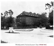
Between 1950 and 1955, Kaiserslautern developed into the largest US military community outside of the United States. For this reason Kaiserslautern is also referred to as "K-town"; a term coined by the early American military population who had difficulty pronouncing the name. The Kaiserslautern Military Community (KMC) is a combined community consisting of Army and Air Force components. The KMC consists of Army facilities at Kleber, Panzer, Dänner-Kaserne, Landstuhl, Miesau, Einsiedlerhof, Pirmasens, Sembach, Rhine Ordnance Barracks and Pulaski Barracks along with Air Force facilities located at Ramstein Air Base, Vogelweh, and Kapaun Air Station.
International relations
Kaiserslautern is twinned with:[10]
 Davenport, United States, since 1960
 Douzy, France, since 1967
- Saint-Quentin, France, since 1967
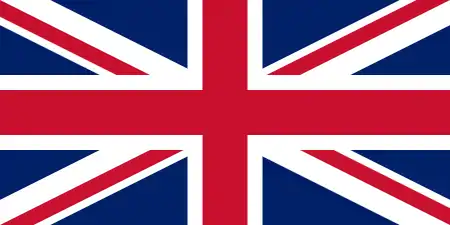 Newham, United Kingdom, since 1974
 Bunkyō (Tokyo), Japan, since 1988
 Brandenburg an der Havel, Germany, since 1988
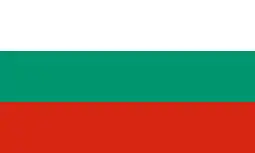 Pleven, Bulgaria, since 1999
- Columbia, United States, since 2000
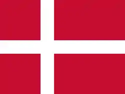 Silkeborg, Denmark, since 2000
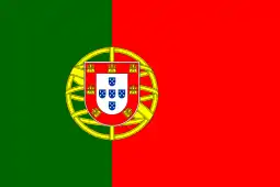 Guimarães, Portugal, since 2000
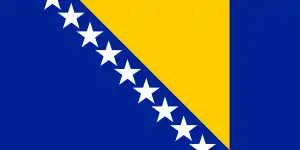 Banja Luka, Bosnia and Herzegovina, since 2003
Notable residents
- Countess Palatine Dorothea of Simmern (1581–1631), countess
- Mathias Abel (b. 1981), footballer
- Otto Bradfisch (1903–1994), economist, jurist, and SS-Obersturmbannführer
- Wolfgang Demtröder (b. 1931), physicist and spectroscopist
- Ludwig Fischer (1905–1947), National Socialist lawyer, politician and a convicted war criminal
- Mark Forster (b. 1983), singer
- Wilhelm Frick (1877–1946), politician of the NSDAP, who served as Reich Minister of the Interior in the Hitler Cabinet from 1933 to 1943
- Florian Fromlowitz (b. 1986), goalkeeper
- Reiner Gies (b. 1963), boxer
- Stefanie Giesinger (b. 1996), model
- Theo Härder (b. 1945), Computer Science Professor
- Johann Adam Philipp Hepp (1797–1867), physician and lichenologist
- Hans Robert Hiegel (b. 1954), architect
- Raphael Holzdeppe (b. 1989), pole vaulter, who was world champion at his event
- Nikki Hornsby (2004-2007), GRAMMY voter, international singer, songwriter, musician, recording artist.
- Johann Heinrich Jung (1740–1817), author
- Klaus Knopper (b. 1968), electrical engineer and free software developer
- Werner Kohlmeyer (1924–1974), footballer, part of the German national team that won the 1954 World Cup
- Werner Liebrich (1927–1995), footballer, part of the German national team that won the 1954 World Cup
- Markus Merk (b. 1962), football referee
- Karl Mildenberger (b. 1937), heavyweight boxer
- Willi Orbán (b. 1992), footballer
- Vanden Plas (b. 1986), progressive metal band
- Johan Adam Pollich (1741–1780), doctor, botanist and entomologist
- Johann Heinrich Roos (1631–1685), Baroque era landscape painter and etcher
- Albert Speer (1934–2017), architect and urban planner
- Heinrich Steiner (1911–2009), painter and printmaker
- Johanna Terwin (1884–1962), stage and film actress
- Stefanie Tücking (1962-2018), radio and television presenter
- Fritz Walter (1920–2002), footballer, captained the German national team during their 1954 World Cup win; brother of Ottmar Walter
- Ottmar Walter (1924–2013), footballer, part of the German national team that won the 1954 World Cup; brother of Fritz Walter
- Miriam Welte (b. 1986), track cyclist
- Zedd (b. 1989), Russian-German record producer, DJ, multi-instrumentalist and songwriter
See also
- Betzenberg, a Kaiserslautern district
- Betzenberg Wildlife Park
References
- "Bevölkerungsstand 2019, Kreise, Gemeinden, Verbandsgemeinden". Statistisches Landesamt Rheinland-Pfalz (in German). 2020.
- "IMCOM Region Europe — Fact Sheets". U.S. Army Installation Management Command - Europe Region. Archived from the original on 28 March 2008.
- German Wikipedia: "Population development of Gelsenkirchen"
- Chisholm, Hugh, ed. (1911). . Encyclopædia Britannica. 15 (11th ed.). Cambridge University Press. p. 636.
- "Kaiserslautern". Encyclopædia Britannica. Retrieved 25 July 2020.
- Climate Summary for Kaiserslautern
- "Mittelwerte 30-jähriger Perioden". Retrieved 31 May 2013.
- "Klima Deutschland, Ramstein". Retrieved 31 May 2013.
- "synagogue KL". Kaiserslautern: Medienzentrum Kaiserslautern - Aktuelles. Archived from the original on 20 November 2005.
- "Partnerstädte". kaiserslautern.de (in German). Kaiserslautern. Retrieved 24 November 2019.
External links
| Wikimedia Commons has media related to Kaiserslautern. |
 Kaiserslautern travel guide from Wikivoyage
- Official website
 (in German)
 - History of Kaiserslautern
- Website about some restaurant and festival reviews in and around K-Town
| Authority control |
|---|