Kangsha River
Kangsha River (Bengali: কংস নদী) (also known as the Kangsai or the Kangsabati[1]) is a river in the northern parts of Mymensingh[2] and Netrakona[3] districts of Bangladesh. The Someshwari is one of the rivers that join it from the north.
| Kangsha River | |
|---|---|
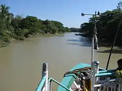
 View of the Kangsha River from a launch | |
| Location | |
| Country | Bangladesh |
| Districts | |
| Physical characteristics | |
| Discharge | |
| • location | Surma River |
Course
At Gaglajuri the Dhanu is joined by the Kangsha which coming from the Garo Hills past Nalitabari as the Bhogai is at its best in the Netrakona subdivision at Deotukon and Barhatta. After Mohanganj it becomes a narrow winding khal with banks little higher than its own lowest level.
The river flows past Barhatta, Mohanganj and Dharampasha. The Dhala and Dhanu rivers which flow into Kishoreganj District are branches of Kangsha.[3] The Kangsha flows into Surma River in Sunamganj District.
Watershed
According to a report on wetland protection, “All floodwaters come from the Garo/Meghalaya Hills through a number of hill streams and rivers. These in turn eventually drain out of the area through the Kaliganga-Kangsha River, which is part of the Sylhet Basin Haor complex of rivers and streams. Topographically a low-lying plain generally sloping from the north-west to south-east, this site was once a large lake. Presently the wet season water area is about 82.1 square kilometres with a dry season water area of about 9 square kilometres. About 623,000 people inhabit the area, about 90% of households catch fish, and 9% are full time fishing households. The catchment area is about 212.39 km². The higher land surrounding the site is intensively cropped. Massive changes have occurred in the last 20 years with rapid and almost complete deforestation of the upper watershed and lower wetland areas, followed by a rapid loss of connection due to embankments and increased sedimentation.”[4]
Gallery
 A farmer busy on the banks of the Kangsha River
 A brick kiln at Dharampasha on the banks of the Kangsha River
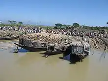
 The bamboo market at Pashukhali
See also
References
- Sultana Nasrin Baby (2012). "Kangsa River". In Sirajul Islam and Ahmed A. Jamal (ed.). Banglapedia: National Encyclopedia of Bangladesh (Second ed.). Asiatic Society of Bangladesh.
- "Map of Mymensingh District". Banglapedia. Asiatic Society of Bangladesh. Retrieved 2007-12-02.
- "Map of Netrokona District". Banglapedia. Asiatic Society of Bangladesh. Retrieved 2007-12-02.
- Md Liaqat Ali and Paul Thompson. "Wetland Protection and Enhancement through Sanctuaries in Bangladesh: Management of Aquatic Ecosystems through Community Husbandry" (PDF). MACH Technical Paper 4. Winrock International, Bangladesh Center for Advanced Studies, Centre for Natural Resource Studies, Caritas, Bangladesh. Retrieved 13 February 2014.