Mohanganj Upazila
Mohanganj (Bengali: মোহনগঞ্জ) is an upazila of Netrokona District[1] in the Mymensingh division of Bangladesh. It is one of the 10 upazilas of Netrakona district. Mohanganj is largely known as the capital of Lower Bangladesh as it is the economic heart of Lower Bangladesh generally known as Haor.
Mohanganj
মোহনগঞ্জ | |
|---|---|
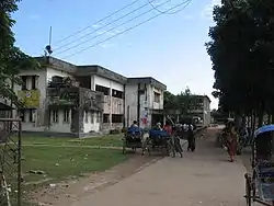 Skyline of Mohanganj, Bangladesh | |
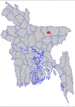 | |
 Mohanganj Location in Bangladesh | |
| Coordinates: 24°52′N 90°58′E | |
| Country | |
| Division | Mymensingh Division |
| District | Netrokona District |
| Area | |
| • Total | 243.2 km2 (93.9 sq mi) |
| Population (2011) | |
| • Total | 167,507 |
| • Density | 690/km2 (1,800/sq mi) |
| Time zone | UTC+6 (BST) |
| Website | http://mohongonj.netrokona.gov.bd/ |
Geography
Mohanganj is located at 24.8667°N 90.9667°E. It has 24011 households and a total area of 243.2 km2. The Upazila is bounded by Barhatta and Sunamganj Upazilas on the north, Khaliajuri and Sunamganj Upazilas on the east, Madan Upazila on the south and Atpara Upazila on the west.
Mohanganj is a true example of riverine Bangladesh. This part of Bangladesh is beautified by the famous Kangsha River (Bengali: কংস নদী) which also the backbone of transportation and economic system. Except this, numerous canals, small rivers crisscrossed that holy land and established itself as an important Upazila of rural Bangladesh.
Demographics
According to 2011 Bangladesh census, Mohanganj had a population of 167,507. Males constituted 50.28% of the population and females 49.72%. Muslims formed 84.09% of the population, Hindus 15.82%, Christians 0.05% and others 0.03%. Mohanganj had a literacy rate of 42.13% for the population 7 years and above.[2]
As of the 1991 Bangladesh census, Mohanganj has a population of 129415. Males constitute 51.4% of the population, and females 48.6%. Upazila's 18+ population is 65417. Mohanganj has an average literacy rate of 64.73%, and the national average of 72.89% literate according to 2017 data.[3][4]
Points of interest
There is an ancient fort at the village Betham (Sultan Alauddin Hussain Shah period), Sheikh Bari Mosque (same period), and Daulatpur Temple (876 BS).
Economy
Agriculture 48.25%, fishing 2.62%, agricultural laborer 21.21%, wage laborer 2.53%, commerce 9.84%, service 3.49% and others 12.06%.
Fertile land 24864.43 hectares, fallow land 390.84 hectares; single crop 52%, double crop 38% and treble crop land 10%; land under irrigation 71%.
Administration
Mohanganj Upazila is divided into Mohanganj Municipality and seven union parishads: Barkashia Birampur, Baratali Banihari, Gaglajur, Maghan Siadhar, Samaj Sahialdeo, Suair, and Tentulia. The union parishads are subdivided into 111 mauzas and 163 villages.[5]
Mohanganj Municipality is subdivided into 9 wards and 18 mahallas.[5]
Transport
Mohanganj Upazila has a strong waterway connection with Sylhet, Sunamganj, Bhairab Bazar and Dhaka. Alongside, the road network system connected it with Netrokona, Mymensingh and to the capital, Dhaka. There is two intercity train now running from Dhaka to Mohanganj. Haor express departs at 11:50pm from kamlapur railway station and Mohanganj express departs Dhaka at 2:20 pm. Visiting Tanguar Haor through this route is also a good option other than the popular Sunamganj route.
Gallery
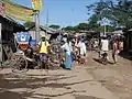 Rickshaw stand near the market
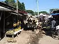 Market alley
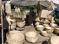 Bamboo products of Mohanganj
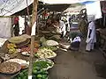 Vegetable market
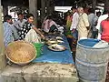 Fish market
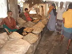 Dry fish market
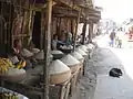 Rice market
- Government hospital
References
- Syed Marufuzzaman (2012), "Mohanganj Upazila", in Sirajul Islam and Ahmed A. Jamal (ed.), Banglapedia: National Encyclopedia of Bangladesh (Second ed.), Asiatic Society of Bangladesh
- "Bangladesh Population and Housing Census 2011: Zila Report – Netrakona" (PDF). Table P01 : Household and Population by Sex and Residence, Table P05 : Population by Religion, Age group and Residence, Table P09 : Literacy of Population 7 Years & Above by Religion, Sex and Residence. Bangladesh Bureau of Statistics (BBS), Ministry of Planning, Government of the People’s Republic of Bangladesh. Retrieved 14 December 2018.
- "Bangladesh - Literacy rate". Retrieved 17 February 2019.
- মোহনগঞ্জ উপজেলা. http (in Bengali). Retrieved 2019-02-17.
- "District Statistics 2011: Netrokona" (PDF). Bangladesh Bureau of Statistics. Archived from the original (PDF) on 13 November 2014. Retrieved 14 July 2014.
| Upazilas | ||
|---|---|---|
| Constituencies | ||
| Attractions and sites | ||
| History | ||
| Inhabited areas | ||
| Rivers | ||
| Educational institutions | ||
| Transport | ||
Headquarters: Mymensingh | ||
| Jamalpur District | 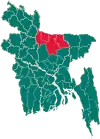 | |
| Mymensingh District | ||
| Netrokona District | ||
| Sherpur District | ||