Kollipara
Kollipara is a village in Guntur district of the Indian state of Andhra Pradesh. It is the headquarters of Kollipara mandal in Tenali revenue division. And it was one of the capital for Pericchedi [4]
Kollipara | |
|---|---|
Village | |
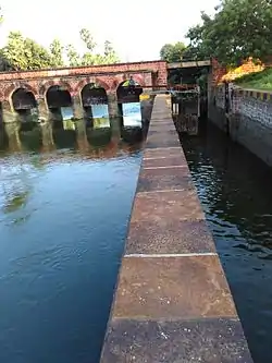 Kollipara lock | |
.svg.png.webp) Kollipara Location in Andhra Pradesh, India | |
| Coordinates: 16.287735°N 80.751927°E | |
| Country | India |
| State | Andhra Pradesh |
| District | Guntur |
| Mandal | Kollipara |
| Government | |
| • Type | Panchayati raj |
| • Body | Kollipara gram panchayat |
| Area | |
| • Total | 1,743 ha (4,307 acres) |
| Population (2011)[3] | |
| • Total | 12,982 |
| • Density | 740/km2 (1,900/sq mi) |
| Languages | |
| • Official | Telugu |
| Time zone | UTC+5:30 (IST) |
| Area code(s) | +91– |
| Vehicle registration | AP |
Geography
Kollipara is situated at 16.2910°N 80.6816°E. It is spread over an area of 1,743 ha (4,310 acres).[2] Kollipara is located at a distance of 21 km from Tenali . The Nearest city to kollipara is Tenali.
Governance
Kollipara gram panchayat is the local government of the village.[1] It is divided into wards and each ward is represented by a ward member.[5] The village forms a part of Andhra Pradesh Capital Region and is under the jurisdiction of APCRDA.[6]
Economy and transportation
The major occupation of the village is agriculture, which includes cultivation of paddy.[7]
APSRTC operates buses to Tenali and other parts of the state. The nearest railway stations include Kolakaluru halt and Tenali Junction railway station
Education
As per the school information report for the academic year 2018–19, the village has 16 schools. These include 9 private and 7 Zilla/Mandal Parishad schools.[8]
See also
References
- "Gram Panchayat Identification Codes" (PDF). Saakshar Bharat Mission. National Informatics Centre. p. 105. Archived from the original (PDF) on 18 August 2017. Retrieved 7 May 2019.
- "District Census Hand Book : Guntur (Part B)" (PDF). Census of India. Directorate of Census Operations, Andhra Pradesh. 2011. pp. 14, 402. Retrieved 1 June 2019.
- "Population". Census of India. Registrar General and Census Commissioner of India. Retrieved 8 May 2019.
- "District Census Handbook : Guntur (Part A)" (PDF). Census of India. Directorate of Census Operations, Andhra Pradesh. 2011. pp. 5, 638–639. Retrieved 5 June 2019.
- Seetharam, Mukkavilli (1 January 1990). Citizen Participation in Rural Development. Mittal Publications. p. 34. ISBN 9788170992271.
- "Declaration of A.P. Capital Region" (PDF). Andhra Pradesh Capital Region Development Authority. Municipal Administration and Urban Development Department, Andhra Pradesh. 30 December 2014. p. 4. Archived from the original (PDF) on 11 May 2019. Retrieved 16 May 2019.
- "Helen causes extensive damage to crops". The New Indian Express. Vijayawada. 25 November 2013. Retrieved 26 February 2016.
- "School Information". Commissionerate of School Education. Government of Andhra Pradesh. Retrieved 7 May 2019.