Lac Baker Parish, New Brunswick
Lac Baker is a civil parish in Madawaska County, New Brunswick, Canada.[2]
Lac-Baker | |
|---|---|
 | |
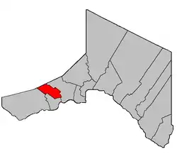 Location within Madawaska County. | |
| Coordinates: 47.36°N 68.68°W | |
| Country | |
| Province | |
| County | Madawaska |
| Erected | 1912 |
| Area | |
| • Land | 24.30 km2 (9.38 sq mi) |
| Population (2016)[1] | |
| • Total | 5 |
| • Density | 0.2/km2 (0.5/sq mi) |
| • Change 2011-2016 | No change |
| • Dwellings | 4 |
| Time zone | UTC-4 (AST) |
| • Summer (DST) | UTC-3 (ADT) |
For governance purposes it is divided between the village of Lac-Baker[3] and the incorporated rural community of Haut-Madawaska,[4] both of which are members of the Northwest Regional Service Commission (NWRSC).[5]
Origin of name
The parish takes its name from Baker Lake, which takes its name from John Baker, an American leader in the Aroostook War.[6] Baker remained in the area after the boundary settlement awarded the area to New Brunswick.
History
Lac Baker was erected as Baker Lake in 1912 from Clair Parish;[7] the boundary was slightly altered later that year.[8]
The parish was renamed Lac Baker and its boundaries affected by the major reorganisation of Madawaska County parish lines in 1946.[9]
Delineation
Lac Baker Parish is defined in the Territorial Division Act[2] as being bounded:
- Beginning at a point in the New Brunswick-Quebec Boundary line where it is intersected by the northwesterly prolongation of the west limit of Range Three west of Baker Lake thence southeasterly along said prolongation and said limit of Range Three to the southwest angle of lot No. 40 in Range Three, thence in a northeasterly direction along the southwest limit of said lot No. 40 to the western limit of Range Two thence southeasterly along said western limit of Range Two to the western limit of lots in the Second Tier west of Caron Brook thence along the said western limit to the northwest angle of lot No. 15 granted to Joseph Souci and thence easterly along the northern limit of said lot No. 15, lot Letter "I" granted to George Carriveau and the northern limit of the lots fronting on the St. John River to the southeast angle of lot No. 1 east side of Caron Brook, thence northerly along the east limit of lots fronting on the east side of Caron Brook to the northeast angle of lot No. 9 granted to Louis Lavoie, thence westerly along the north limit of said lot No. 9 to the northeast limit of lot No. 10 E thence northwesterly along said limit of said lot No. 10 E to the southwest angle of lot letter "D" granted to Thomas Ouellette thence northeasterly along the southeast limit of said lot Letter "D" and lot Letter "C" to the eastern limit of Range Four Val-Nadeau[lower-alpha 1] thence northwesterly along said limit of Range Four, to the northeast angle of lot No. 17 in Range Four, thence southwesterly along the northwest limit of lot No. 17 to the east limit of Range Five, thence northwesterly along said limit of Range Five to the northeast angle of lot No. 33 in Range Five, thence southwesterly along the northwest limit of said lot No. 33 to the east limit of lots fronting on the east side of Baker Lake, thence northwesterly along the said limit to the New Brunswick-Quebec Boundary line thence westerly along the said boundary line to the place of beginning.
Communities
Parish population total does not include incorporated municipalities (in bold) and communities within their respective boundaries (in italics).
- Boundary
- Lac-Baker
- Portage-du-Lac
- Rang-des-Collin
- Saint-Castin
- Pelletiers Mill
- Soucy
Census data
Population
Census data refers only to the Census subdivision of the parish, much of which was annexed by the village of Lac-Baker in 2008.[10]
| Canada census – Lac Baker Parish, New Brunswick community profile | |||
|---|---|---|---|
| 2016 | 2011 | 2006 | |
| Population: | 5 (-83.3% from 2011) | 5 (-83.3% from 2006) | 566 (+16.0% from 2001) |
| Land area: | 24.30 km2 (9.38 sq mi) | 24.29 km2 (9.38 sq mi) | 57.38 km2 (22.15 sq mi) |
| Population density: | 0.2/km2 (0.52/sq mi) | 9.9/km2 (26/sq mi) | |
| Median age: | N/A (M: , F: ) | N/A (M: , F: ) | 50.3 (M: 50.5, F: 50.2) |
| Total private dwellings: | 4 | 4 | 444 |
| Median household income: | $.N/A | $.N/A | $53,676 |
| Notes: 2011 and 2016 income data for this area has been suppressed for data quality or confidentiality reasons. – References: 2016[11] 2011[12] 2006[13] earlier[14] | |||
|
|
| ||||||||||||||||||||||||||||||
| [15][1] (A) adjustment due to boundary change. | ||||||||||||||||||||||||||||||||
Language
| Canada Census Mother Tongue - Lac-Baker Parish, New Brunswick 2011 and 2016 language data for this area has been suppressed for data quality or confidentiality reasons.[15] | ||||||||||||||||||
|---|---|---|---|---|---|---|---|---|---|---|---|---|---|---|---|---|---|---|
| Census | Total | French |
English |
French & English |
Other | |||||||||||||
| Year | Responses | Count | Trend | Pop % | Count | Trend | Pop % | Count | Trend | Pop % | Count | Trend | Pop % | |||||
2011 |
n/a |
n/a | 0.00% | n/a | 0.00% | n/a | 0.00% | n/a | 0.00% | |||||||||
2006 |
570 |
520 | 0.00% | 50 | 0.00% | 0 | 0.00% | 0 | 0.00% | |||||||||
2001 |
485 |
470 | 96.91% | 15 | 3.09% | 0 | 0.00% | 0 | 0.00% | |||||||||
1996 |
475 |
465 | n/a | 97.89% | 10 | n/a | 2.11% | 0 | n/a | 0.00% | 0 | n/a | 0.00% | |||||
See also
Notes
- Actually Nadeau Settlement; the confusion is caused by the community of Val-Nadeau which is within that settlement.
References
- "Census Profile, 2016 Census: Lac-Baker, Parish [Census subdivision], New Brunswick". Statistics Canada. Retrieved September 23, 2019.
- "Chapter T-3 Territorial Division Act". Government of New Brunswick. Retrieved 13 November 2020.
- "New Brunswick Regulation 85-6 under the Municipalities Act (O.C. 85-45)". Government of New Brunswick. Retrieved 19 July 2020.
- "New Brunswick Regulation 2017-3 under the Municipalities Act (O.C. 2017-52)". Government of New Brunswick. Retrieved 19 July 2020.
- "Communities in each of the 12 Regional Service Commissions (RSC) / Les communautés dans chacune des 12 Commissions de services régionaux (CSR)" (PDF), Government of New Brunswick, July 2017, retrieved 2 February 2021
- Ganong, William F. (1896). A Monograph of the Place-Nomenclature of the Province of New Brunswick. Royal Society of Canada. p. 218.
- "1 Geo. V c. 46 An Act to amend Chapter 2 of The Consolidated Statutes, 1903, respecting the Division of the Province into Counties, Towns and Parishes, so far as relates to the County of Madawaska.". Acts of the Legislative Assembly of New Brunswick Passed in the Month of April, 1911. Fredericton: Government of New Brunswick. 1911. pp. 167–170.
- "2 Geo. V c. 16 An Act to amend Chapter 2 of the Consolidated Statutes, 1903, respecting the Division of the Province into Counties, Towns and Parishes, so far as relates to the County of Madawaska.". New Brunswick Acts of the Legislative Assembly Passed in the Months of March and April, 1912. Fredericton: Government of New Brunswick. 1912. pp. 131–132.
- "10 Geo. VI. c. 95 An Act to amend Chapter 2 of the Revised Statutes, 1927, respecting the division of the Province into Counties, Towns and Parishes, in so far as it relates to the County of Madawaska.". Acts of the Legislative Assembly of New Brunswick Passed During the Session of 1946. Fredericton: Government of New Brunswick. 1946. pp. 321–339.
- "New Brunswick Regulation 2008-35 under the Municipalities Act (O.C. 2008-108)" (PDF). The Royal Gazette. Fredericton, New Brunswick: Office of the Queen's Printer. 166: 573–574. 26 March 2008. ISSN 1714-9428. Retrieved 28 July 2020.
- "2016 Community Profiles". 2016 Canadian Census. Statistics Canada. February 21, 2017. Retrieved 2019-09-23.
- "2011 Community Profiles". 2011 Canadian Census. Statistics Canada. July 5, 2013. Retrieved 2014-03-22.
- "2006 Community Profiles". 2006 Canadian Census. Statistics Canada. March 30, 2011. Retrieved 2014-03-22.
- "2001 Community Profiles". 2001 Canadian Census. Statistics Canada. February 17, 2012.
- Statistics Canada: 1996, 2001, 2006, 2011 census
Places adjacent to Lac Baker Parish, New Brunswick | |
|---|---|
| Subdivisions | |
|---|---|
| Cities | |
| Counties | |
| |