Lafayette, Minnesota
Lafayette is a city in Nicollet County, Minnesota, United States. The population was 504 at the 2010 census.[6] It is a farming community just outside the larger town of New Ulm, Minnesota.
Lafayette | |
|---|---|
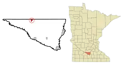 Location of Lafayette, Minnesota | |
| Coordinates: 44°26′50″N 94°23′41″W | |
| Country | United States |
| State | Minnesota |
| County | Nicollet |
| Government | |
| • Type | Mayor - Council |
| • Mayor | Darren Saffert |
| Area | |
| • Total | 1.26 sq mi (3.26 km2) |
| • Land | 1.26 sq mi (3.26 km2) |
| • Water | 0.00 sq mi (0.00 km2) |
| Elevation | 1,010 ft (308 m) |
| Population | |
| • Total | 504 |
| • Estimate (2019)[3] | 493 |
| • Density | 391.89/sq mi (151.36/km2) |
| Time zone | UTC-6 (Central (CST)) |
| • Summer (DST) | UTC-5 (CDT) |
| ZIP code | 56054 |
| Area code(s) | 507 |
| FIPS code | 27-33920[4] |
| GNIS feature ID | 0646312[5] |
Lafayette is part of the Mankato–North Mankato Metropolitan Statistical Area.
History
Lafayette was platted in 1897, and named for Gilbert du Motier, Marquis de Lafayette (1757–1834), a French general and American Revolutionary War general.[7]
Geography
According to the United States Census Bureau, the city has a total area of 1.15 square miles (2.98 km2), all of it land.[8] The South Branch Rush River starts near Lafayette.
Minnesota State Highway 15 serves as a main route in the community.
Demographics
| Historical population | |||
|---|---|---|---|
| Census | Pop. | %± | |
| 1910 | 195 | — | |
| 1920 | 309 | 58.5% | |
| 1930 | 389 | 25.9% | |
| 1940 | 400 | 2.8% | |
| 1950 | 438 | 9.5% | |
| 1960 | 516 | 17.8% | |
| 1970 | 498 | −3.5% | |
| 1980 | 507 | 1.8% | |
| 1990 | 462 | −8.9% | |
| 2000 | 529 | 14.5% | |
| 2010 | 504 | −4.7% | |
| 2019 (est.) | 493 | [3] | −2.2% |
| U.S. Decennial Census[9] 2018 Estimate[10] | |||
As of 2000 the median income for a household in the city was $36,719, and the median income for a family was $43,611. Males had a median income of $31,250 versus $21,563 for females. The per capita income for the city was $15,347. About 3.1% of families and 2.9% of the population were below the poverty line, including 2.8% of those under age 18 and 7.0% of those age 95 or over.
2010 census
As of the census[2] of 2010, there were 504 people, 218 households, and 131 families residing in the city. The population density was 438.3 inhabitants per square mile (169.2/km2). There were 244 housing units at an average density of 212.2 per square mile (81.9/km2). The racial makeup of the city was 97.8% White, 0.2% Native American, 0.2% Asian, 1.2% from other races, and 0.6% from two or more races. Hispanic or Latino of any race were 2.4% of the population.
There were 218 households, of which 33.0% had children under the age of 18 living with them, 47.2% were married couples living together, 4.6% had a female householder with no husband present, 8.3% had a male householder with no wife present, and 39.9% were non-families. 36.2% of all households were made up of individuals, and 20.6% had someone living alone who was 65 years of age or older. The average household size was 2.31 and the average family size was 2.95.
The median age in the city was 36.9 years. 27% of residents were under the age of 18; 6.2% were between the ages of 18 and 24; 25.6% were from 25 to 44; 26.3% were from 45 to 64; and 14.7% were 65 years of age or older. The gender makeup of the city was 49.4% male and 50.6% female.
Notable people
Lafayette was the childhood home of Tippi Hedren, the star of Alfred Hitchcock's The Birds. In Hedren's book Cats of Shambala, she wrote that she was born in New Ulm, as Lafayette didn't have a hospital.
References
- "2019 U.S. Gazetteer Files". United States Census Bureau. Retrieved July 26, 2020.
- "U.S. Census website". United States Census Bureau. Retrieved November 13, 2012.
- "Population and Housing Unit Estimates". United States Census Bureau. May 24, 2020. Retrieved May 27, 2020.
- "U.S. Census website". United States Census Bureau. Retrieved January 31, 2008.
- "US Board on Geographic Names". United States Geological Survey. October 25, 2007. Retrieved January 31, 2008.
- "2010 Census Redistricting Data (Public Law 94-171) Summary File". American FactFinder. United States Census Bureau. Retrieved April 27, 2011.
- Upham, Warren (1920). Minnesota Geographic Names: Their Origin and Historic Significance. Minnesota Historical Society. p. 372.
- "US Gazetteer files 2010". United States Census Bureau. Archived from the original on July 2, 2012. Retrieved November 13, 2012.
- "Census of Population and Housing". Census.gov. Retrieved June 4, 2015.
- "Population Estimates". United States Census Bureau. Retrieved July 5, 2019.
Municipalities and communities of Nicollet County, Minnesota, United States | ||
|---|---|---|
| Cities | 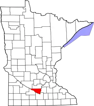 Map of Minnesota highlighting Nicollet County | |
| Townships | ||
| Unincorporated communities | ||
| Ghost town | ||
| Footnotes | ‡This populated place also has portions in an adjacent county or counties | |
| ||
| Core Cities | 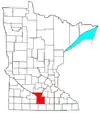 | ||||
|---|---|---|---|---|---|
| Incorporated Places |
| ||||
| Counties | |||||
† indicates a county seat. ‡ indicates that it is partially in the metropolitan area. | |||||
| Authority control |
|---|