List of Ontario colonization roads
The colonization roads were created during the 1840s and 1850s to open up or provide access to areas in Central and Eastern Ontario for settlement and agricultural development. The colonization roads were used by settlers to lead them toward areas for settlement, much like modern-day highways.

History
During the early 1800s, the government of Upper Canada (present-day Ontario) appropriated settlers to various lots which had been surveyed along the lake shores of Lake Erie and Lake Ontario. The townships established along these fronts contained generally fertile land composed of glacial till and clay-rich loam. As these townships filled up, business opportunities presented themselves for investors to purchase native lands and open them to settlement. The Canada Company was the most successful of these ventures and brought settlers to vast areas of land in Western Ontario by building routes such as Huron Road and Toronto–Sydenham Road during the 1830s and 1840s.[1] As these areas also filled, the government came under pressure to open up the unforgiving terrain of the Canadian Shield to settlement and sought to establish a network of east–west and north–south roads between the Ottawa Valley and Georgian Bay. This area was known as the Ottawa–Huron Tract.[2]
In 1847, an exploration survey was carried out by Robert Bell to lay out the lines that would become the Opeongo, Hastings, and Addington Roads. The Public Lands Act, passed in 1853, permitted the granting of land to settlers who were at least 18. Those settlers who cleared at least 12 acres (49,000 m2) within four years, built a house within a year, and resided on the grant for at least five years would receive the title to that land. The government subsequently built over 1,600 kilometres (1,000 mi) of roads over the following 20 years to provide access to these grants.[3]
However, the promises of fertile land in this new northern tract of wilderness proved false. Beneath thin layers of sparsely spread soil was solid granite. Where this granite descended deeper, valleys formed and filled with muskeg. Despite an early influx of settlers, the vast majority of grants were abandoned by the turn of the century; only 40% remained. During the first half of the 1900s, many of these colonization roads were incorporated into the growing provincial highway network. Some sections were improved to modern highway standards, while others were subsequently bypassed or abandoned. The roads that were not incorporated as highways either became local roads or were consumed by nature.[4]
Though many other roads in the province can be considered "colonization roads", such as Yonge Street, Hurontario Street, Provincial Road (later Highway 2), Talbot Trail, and the Penetanguishene Road, they were either constructed for military purposes or by private investment.
In October 2016, the imagineNATIVE Film + Media Arts Festival premiered a documentary titled Colonization Road at the TIFF Bell Lightbox in Toronto. The documentary explores these roads within various treaty territories of Canada and the relationships which surround them. The film has toured throughout Canada, and in January 2017, the Firsthand program on CBC Television aired a broadcast version of Colonization Road.[5]
Description
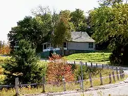
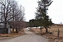
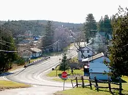
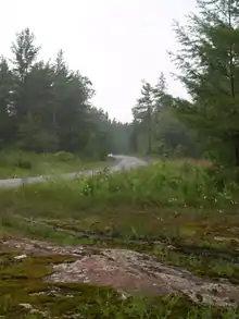
The terrain these roads pass through is interlaced with many hills, lakes, forests, swamps and bedrock outcroppings. The location of many of these roads is in the Canadian Shield, among the most rugged terrain in Ontario. The soil is generally thin and unsuitable for the agricultural development that these roads were built to spur.
Most of the colonization roads are not provincially maintained highways. Instead, they follow county roads and local town/township roads. A few have even been converted into hiking trails and bike trails.
List of colonization roads
Below is a list of all the colonization roads.
The Addington Road
| The Addington Road | |
|---|---|
| Location | Clareview–Brudenell |
| Length | 113 km (70 mi) |
| Formed | 1855–1865 |
The Addington Colonization Road was one of the initial routes surveyed in 1847. The contract to construct the road was awarded to A. B. Perry, who completed more than half of the length from the Clare River to the Opeongo Line by 1856.[6] In the south, it began in the village of Clareview and travelled north to the Opeongo Line, where the village of Brudenell was established. From north of Clareview to the community of Ferguson Corners (southwest of Denbigh), Highway 41 follows the old road, though in many places bypasses have been constructed and the old road named the Addington Road followed by a number from one to eight. North of Ferguson Corners, the old road has been overtaken by the forest, though short spurs are evident west of Denbigh and north and south of Quadeville.
The Bobcaygeon Road

| The Bobcaygeon Road | |
|---|---|
| Location | Bobcaygeon–Dorset |
| Length | 89 km (55 mi) |
| Formed | 1856–1863 |
The Bobcaygeon Colonization Road opened up the northern half of Peterborough and Victoria counties and much of Haliburton County. The road begins in the village of Bobcaygeon and travels north through Minden, ending north of the Peterson Road (Highway 118). The old road was surveyed as far north as the Oxtongue River but never continued beyond that. It now forms the boundary between Minden and Algonquin Highlands and the boundary between Muskoka and Haliburton further north. The former Highway 649 and Highway 121 were eventually routed the majority of the southern half of this road. From Minden north to Highway 118, the road is a paved township road. Between Ox Narrows and Dorset, Highway 35 generally follows the original survey line.
The Buckhorn Road
| The Buckhorn Road | |
|---|---|
| Location | Buckhorn–Gooderham |
| Length | 48 km (30 mi) |
| Formed | 1855–1865 |
The Buckhorn Road begins just north of Peterborough at Lakefield Road. From Peterborough to the town of Buckhorn, the Buckhorn Road is referred to as Highway 23 and is still labelled as the Buckhorn Road at many intersections. North of Buckhorn, the road is listed as Highway 36 until Flynn's Turn. From there, Highway 507 is renamed the Buckhorn Road until it reaches the town of Gooderham. Slightly west of Gooderham, the old colonization road continues via Highway 3, also known as Glamorgan Road, until it reaches Highway 118 just outside Haliburton.
The Burleigh Road
| The Burleigh Road | |
|---|---|
| Location | Burleigh Falls–The Peterson Road |
| Length | 32 km (20 mi) |
| Formed | 1850s |
The Burleigh Road begins in Burleigh Falls and continues north along Ontario Highway 28. The highway bypasses the town Apsley. However, inside the town is the old colonization road by the name of Burleigh Street. Continuing up Highway 28, it overlapped Cheddar Road (Dyno Road or Haliburton County Road 48) after passing Kidds Corners. As it continued past the Dyno mine site, it turned west and went through the town of Cheddar, then continued to the town of Cope Falls. From there, it was known as the Burleigh Road again and continued north on the east side of Cope Creek, towards Cope Lake. In Cope Lake, it met Deer Lake Road, which ran east to the town of Deer Lake and Ontario Highway 500. The Burleigh Road then turned west, crossing over Cope Creek and the Irondale River, and into the town of Wilberforce. It then turned north onto Ontario Highway 500 and passed the Wilberforce Public School. From here on, it was again called the Burleigh Road and continued northeast, running on the east side of Clement Lake and the west side of Grace Lake. The road ended at the colonial Kennaway Road in the town of Haliburton.
South of Wilberforce, much of the old Burleigh Road is private, rendering it unusable to the general population. Some of it is being used as snowmobile trails. The middle part is walkable, from the Wilberforce Public School to Clement Lake. Farms are very common along this part of the road. The northern part of the road can be reached by following Loop Road to the Wilberforce Legion.
The Cameron Road
| The Cameron Road | |
|---|---|
| Location | Rosedale–Minden |
| Formed | 1850s |
The Cameron Road ran north from Rosedale to Minden and is now the route of Highway 35.
The Frontenac Road
| The Frontenac Road | |
|---|---|
| Location | Kingston – Matawatchan |
| Length | 66 km (41 mi) |
| Formed | 1852–1862 |
The Frontenac Road travelled north from Kingston to the Madawaska River at Matawatchan.
The road was first surveyed in 1852 and 1853 by Provincial Land Surveyor Thomas Fraser Gibbs. Warren Godfrey (for whom a town along the road is named) oversaw construction, completing the road as far north as the Mississippi Road at Plevna via Parham, Mountain Grove and Ardoch. This task was finished by 1862. An extension northwest to the Madawaska River at Matawatchan was completed by 1869.[7] However, much of this section has been lost to the forest.
The Garafraxa Road
| The Garafraxa Road | |
|---|---|
| Location | Guelph – Owen Sound |
| Formed | 1837–1848 |
The Garafraxa Road was built to extend Brock Road north from Guelph to the new settlement of Sydenham, renamed Owen Sound in 1851, on Georgian Bay. An Order in Council was passed that called for the building of this road on April 13, 1837. Deputy Surveyor Charles Rankin was allowed to lay a line between Oakville and Sydenham. Rankin surveyed the line north of Arthur before the 1837 Upper Canada Rebellion broke out in Toronto. In 1839, John McDonald was hired to resurvey the line. He completed the survey between Guelph and Fergus that year, and to Arthur by October 1842.[8] Construction of the line between Arthur and Sydenham began at both ends in 1843.[9] The entire route was navigable by 1848. By 1861, the majority had been gravelled, and tollgates were briefly established between Fergus and Owen Sound. The entire route became part of Highway 6 in 1920.[8]
The Great North Road
| The Great North Road | |
|---|---|
| Location | Parry Sound – Commanda |
| Length | 97 km (60 mi) |
| Formed | 1867–1871 |
The Great North Road connected Parry Sound Road in Parry Sound with the Nipissing Road in Commanda. Today, Highway 124 largely follows the old road.[10]
The Hastings Road
| The Hastings Road | |
|---|---|
| Location | Madoc – Whitney |
| Length | 113 km (70 mi) |
| Formed | 1854–1858 |
The Hastings Road was surveyed and built to the northern boundary of Hastings county, north of the hamlet of Lake St. Peter. It was continued north into the district of Nipissing as the North Road, and at one time could be driven to an intersection with the current Highway 60 between Whitney and Madawaska. It previously intersected with the Snow, Monck and Peterson roads.[11]
The Lavant Road
| The Lavant Road | |
|---|---|
| Location | The Snow Road – former Ontario Highway 511 |
The Mississippi Road
| The Mississippi Road | |
|---|---|
| Location | Plevna–Bancroft |
| Length | 98 km (61 mi) |
| Formed | 1856–1866 |
The Mississippi Road began at a junction with the Frontenac Road and the Snow Road in the village of Plevna and travelled northwest, bisecting the Addington Road near Denbigh. It ended at the Hastings Road in Bancroft, where the Monck Road continued west. Today, Brule Lake Road and Buckshot Lake Road (Lennox and Addington County Road 30) follow a majority of the southwest portion of the road. Between Denbigh and Bancroft, Highway 28 travels adjacent to the old road, which has generally been overrun by trees.
The Monck Road
| The Monck Road | |
|---|---|
| Location | Atherley–Bancroft |
| Length | 172 km (107 mi) |
| Formed | 1866–1873 |
The Monck Road was a dual-purpose road that established colonization and military routes east from Lake Couchiching to the junction of the Hastings and Mississippi colonization roads at what is now Bancroft. The Monck Road was surveyed through 1864 and 1865. Construction began the following year under Chief Engineer and was completed seven years later in 1873. It was named in honour of Charles Stanley Monck, who was Governor General of Canada at that time.[12] It is one of the oldest provincial roads north of Toronto.
The Monck Road starts at Atherley and runs beside Simcoe County 45 (Rama Road), then turns into the city of Kawartha Lakes. It crosses Highway 35 at Norland and carries on to Kimount, then turns right and crosses over the Burnt River. The Monck Road then turns left up the hill and continues towards Haliburton County 503, which runs from Furnace Falls to Bancroft. From Lake Couchiching, it extends 150 kilometres east to the Hastings Road at Bancroft.
The Muskoka Road
| The Muskoka Road | |
|---|---|
| Location | Severn Bridge – North Bay |
| Length | 203 km (126 mi) |
| Formed | 1858–1875 |
The Muskoka Road, most of which now forms Highway 11, was constructed in the late 1850s and early 1860s, quickly becoming the primary trunk road to Lake Nipissing. A series of towns eventually would flourish along its length, the first of which was Bracebridge. East of Muskoka Falls, Thomas J. McMurray established a 400-acre (1,600,000 m2) townsite in the spring of 1861 at the intersection of the Muskoka Road and the Peterson Road.[13]
Construction on the Muskoka Road began in 1858. At the time of Bracebridge's founding, the road did not extend beyond the Muskoka River.[13] It was opened as far as Sundridge by 1875. Today Highway 11 follows a majority of the route but bypasses it in several locations, notably between Bracebridge and Huntsville.
The Ottawa and Opeongo Road
| The Ottawa and Opeongo Road | |
|---|---|
| Location | Opeongo Lake – Renfrew |
| Length | 106 km (66 mi) |
| Formed | 1854–1865 |
The Ottawa and Opeongo Road, also known as the Opeongo Line, was one of the initial colonization roads surveyed by Hamlet Burritt and A. H. Sims under the supervision of Robert Bell in 1851–52. It was constructed westward from Renfrew beginning in 1854, reaching as far as the Hastings Road in Whitney by 1865; thereafter the survey line continued to Opeongo Lake.[14] Today, Highway 60 follows the old road between Algonquin Park and east of Barry's Bay. At that point, the road branches out to the southeast, following portions of Renfrew County Road 66, 512 and 64. Approximately 5 kilometres (3.1 mi) west of Dacre, it encounters Highway 41. From there to Renfrew, Highway 132 follows the old road.[15] Several songs have been written about the Opeongo Line, one of the most recent by Canadian singer-songwriter Terry McLeish. His song, "The Opeongo Line", has been included in several musicals and a tourist CD production of this historic road.
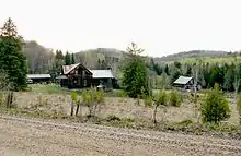
The now-abandoned settlement of Newfoundout was created as a result of the Opeongo Road and Public Land Act. Thirteen pioneer families took up occupation on the land they had been granted up a mountainside 6 kilometres (3.7 mi) off the main road. These families struggled to farm the rocky soil for thirty years, from the 1860s to the 1890s, while their settlement failed to attract institutions or other settlers. It was officially declared abandoned by 1948. More recently, the ruined log cabins have occasionally attracted photographers due to their high level of preservation.[16]
The Parry Sound Road
| The Parry Sound Road | |
|---|---|
| Location | Parry Sound – Falkenburg Station |
| Length | 72 km (45 mi) |
| Formed | 1862–1865 |
| Horseshoe Lake Road, Highway 141, Raymond Road, Manitoba Street
| Highway 400/Highway 69, Highway 141, Muskoka District Road 35, Muskoka District Road 4
| Parry Sound
| Bracebridge
| Parry Sound
Horseshoe Lake
Rosseau
Bracebridge
The Pembroke and Mattawan Road
| The Pembroke and Mattawan Road | |
|---|---|
| Location | Pembroke–Mattawa |
| Length | 158 km (98 mi) |
| Formed | 1856–1866 |
The Pembroke and Mattawan Road was proposed by the Minister of Agriculture Allan McNab in 1852. A survey was conducted in 1853 and construction began in 1854. By 1875, the road was officially open in the summer months. The original road went through what is now Canadian Forces Base Petawawa and the Atomic Energy lands north of the town of Chalk River. It followed what is now the Balmer Bay road east of the town of Deep River. West of Deep River, the old road winds back and forth across Highway 17, which was built in the 1930s.[17]
The Peterson Road
| The Peterson Road | |
|---|---|
| Location | Bracebridge – Barry's Bay |
| Length | 164 km (102 mi) |
| Formed | 1858–1863 |
The Peterson Road began in Bracebridge and travelled east to Maynooth, where it met the Hastings Road. From Maynooth, it snaked its way northeast to Barry's Bay to meet the Opeongo Line. It was surveyed by Joseph Peterson and built between 1858 and 1863 at a cost of around $39,000. Poor soil led to little settlement in the area and some sections were already overgrown by the 1870s, but the Maynooth-Combermere section proved to be a useful logging route.
Today, the section from Bracebridge to Maynooth has mostly been consumed by the forest, though Highway 118 follows adjacent to the old road as far as Haliburton.[18] A small section remains as a local township road east of Carnarvon named Tulip Road. The old road that runs from Haliburton to the north end of Benoir Lake, on the Elephant Lake Road is now untraceable. This part runs through the south end of Algonquin Park.
The section from Maynooth to Combermere to Barry's Bay is now the route of Highway 62.
The Rosseau-Nipissing Road
| The Nipissing Road | |
|---|---|
| Location | Rosseau–Nipissing |
| Length | 111 km (69 mi) |
| Formed | 1864–1875 |
The Rosseau-Nipissing Road, also called the Nipissing Road, encouraged settlement in what is now Parry Sound. The project was authorized in 1864, with surveying done from 1864–1865. Construction began in 1866, and the road was open by 1873. A railway from Gravenhurst to Callander rendered the Rosseau-Nipissing road obsolete by 1886, yet much of it is still often used.[19]
The Snow Road
| The Snow Road | |
|---|---|
| Location | Maberly–Plevna |
The Snow Road is a short, minor branch of the colonization road network that connected the northern end of the agricultural settlement in Maberly with the southeastern end of the Mississippi Road in Plevna. The Lavant Road branches off to the east at the midpoint of the road. Today, County Road 36 follows the Snow Road through Lanark County, while part of Highway 7 follows the portion lying within Frontenac County.
The Victoria Road
| The Victoria Road | |
|---|---|
| Location | Glenarm–Vankoughnet |
The Victoria Road continued north of its current terminus in Uphill into what is now the Queen Elizabeth II Wildlands Provincial Park. It then followed the Black River north-east to the Peterson Road in Vankoughnet; this part of the road fell into disuse in the late 1800s. Between 1956 and 1998, the portion of The Victoria Road between Highway 46 (Highway 48 after 1975) and Highway 503 was designated as Secondary Highway 505. On January 1, 1998, the entire road south of Uphill was designated as Victoria County Road 35. Victoria County was restructured as the city Kawartha Lakes on January 1, 2001. At the same time, the Victoria Road was renamed as Kawartha Lakes Road 35.
References
- Footnotes
- Shragge 1984, pp. 31, 40.
- Shragge 1984, p. 17.
- Shragge 1984, pp. 17–19.
- Shragge 1984, p. 21.
- Dargicevic, Nina (January 26, 2017). "The Documentary 'Colonization Road' Is About Real, Actual Roads". CBC Television. Retrieved March 29, 2017.
- Country Road Maps - Mazinaw Country
- Frontenac Road Historical Plaque
- Hutchinson, Jean F (1998). The History of Wellington County. Landsborough Printing Ltd. p. 12.
- Hutchinson, Jean F (1998). The History of Wellington County. Landsborough Printing Ltd. p. 423.
- Shragge 1984, p. 20.
- Miller 1978, pp. 93-95, maps.
- Monck Road Historical Plaque
- Parry Sound: Gateway to Northern Ontario. p. 47
- Miller 1978, pp. 77-84, maps.
- Shragge 1984, pp. 18, 20.
- McIntyre, Tobi (1 September 2005). "Ottawa Valley Ghost Towns: Bypassed - Newfoundout, Ontario". Canadian Geographic. Retrieved 12 February 2020.
- Mercer, Jennifer (1998). Staying the Run - A History of the Unified Townships of Rolph, Buchannan, Wylie and McKay. Pembroke Ontario: The Rolph, Buchannan, Wylie and McKay Historical Society. pp. 33–36. ISBN 0-9683918-0-X.
- Miller 1978, pp. 92-93, maps.
- Ontario Plaque
- Bibliography
- Shragge, John; Bagnato, Sharon (1984). From Footpaths to Freeways. Ontario Ministry of Transportation and Communications, Historical Committee. ISBN 0-7743-9388-2.
- Miller, Marilyn G.; Bucovetsky, Joe; Sisam, Elizabeth (1978). Straight lines in curved space : colonization roads in eastern Ontario. Ontario Ministry of Culture and Recreation, Historical Planning and Research Branch. ISBN 0-7743-2978-5.

