Little Rock to Cantonment Gibson Rd-Fourth Street Segment
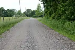
The Little Rock to Cantonment Gibson Rd-Fourth Street Segment is a history stretch of 19th-century roadbed in rural Pope County, Arkansas. It consists of about one mile of gravel roadway, now designated Fourth Street, east of Atkins, extending from Union Grove Loop in the west to Oakland Drive in the east. It is about 18 feet (5.5 m) wide, and is built on an embankment for much of its length. Completed by early 1828 as a military road connecting Little Rock to what is now Fort Gibson in Oklahoma, the road is historically significant for its use as part of the Trail of Tears removal of eastern Native Americans to the Indian Territory that is now Oklahoma.[2]
Little Rock to Cantonment Gibson Rd--Fourth Street Segment | |
 | |
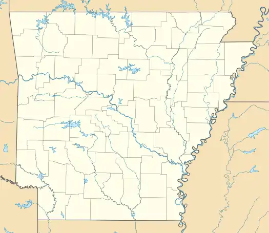  | |
| Nearest city | Atkins, Arkansas |
|---|---|
| Coordinates | 35°14′20″N 92°53′24″W |
| Area | less than one acre |
| Built | 1828 |
| Built by | Joseph Henderson |
| MPS | Cherokee Trail of Tears MPS |
| NRHP reference No. | 08001342[1] |
| Added to NRHP | January 22, 2009 |
The road section was listed on the National Register of Historic Places in 2009.[1]
References
- "National Register Information System". National Register of Historic Places. National Park Service. July 9, 2010.
- "NRHP nomination for Little Rock to Cantonment Gibson Rd-Fourth Street Segment" (PDF). Arkansas Preservation. Retrieved 2016-04-24.
| Topics | |
|---|---|
| Lists by state |
|
| Lists by insular areas | |
| Lists by associated state | |
| Other areas | |
| Related | |
| |