National Register of Historic Places listings in Pope County, Arkansas
This is a list of the National Register of Historic Places listings in Pope County, Arkansas.
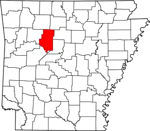
Location of Pope County in Arkansas
This is intended to be a complete list of the properties and districts on the National Register of Historic Places in Pope County, Arkansas, United States. The locations of National Register properties and districts for which the latitude and longitude coordinates are included below, may be seen in a map.[1]
There are 38 properties and districts listed on the National Register in the county. Another property was formerly listed but has been removed.
- This National Park Service list is complete through NPS recent listings posted February 5, 2021.[2]
Current listings
| [3] | Name on the Register[4] | Image | Date listed[5] | Location | City or town | Description |
|---|---|---|---|---|---|---|
| 1 | Archeological Site 3PP141 | November 8, 2006 (#06000837) |
Address Restricted |
Atkins | ||
| 2 | Archeological Site 3PP142 | November 8, 2006 (#06000839) |
Address Restricted |
Atkins | ||
| 3 | Archeological Site 3PP614 | May 23, 2007 (#07000203) |
Address Restricted |
Sand Gap | ||
| 4 | Atkins Commercial Historic District | 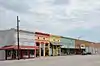 Atkins Commercial Historic District |
September 18, 2009 (#09000739) |
Roughly bounded by Main, Church, and 1st Sts., Ave. 2. 35°14′33″N 92°56′18″W |
Atkins | |
| 5 | Caraway Hall-Arkansas Tech University | 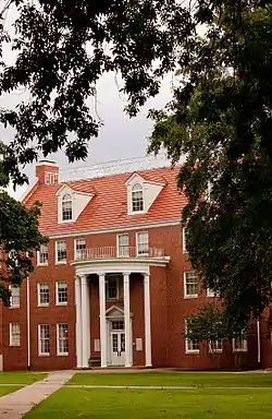 Caraway Hall-Arkansas Tech University |
September 10, 1992 (#92001213) |
N. Arkansas St. 35°17′33″N 93°08′02″W |
Russellville | |
| 6 | Center Valley Well House | 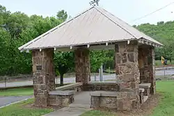 Center Valley Well House |
September 10, 1992 (#92001206) |
Highway 124 35°19′47″N 93°05′09″W |
Center Valley | |
| 7 | Confederate Mothers Memorial Park | 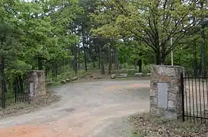 Confederate Mothers Memorial Park |
May 3, 1996 (#96000500) |
Junction of Highway 326 and S. Glenwood Ave. 35°15′30″N 93°08′26″W |
Russellville | |
| 8 | Crow Mountain Petroglyph | 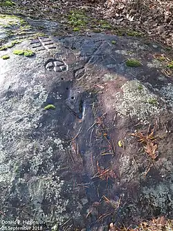 Crow Mountain Petroglyph |
May 4, 1982 (#82004838) |
Address Restricted |
Dover | |
| 9 | Fair View School | 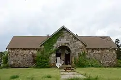 Fair View School |
February 4, 2000 (#00000030) |
2367 Mill Creek Rd. 35°21′13″N 93°12′41″W |
Russellville | |
| 10 | First Christian Church | 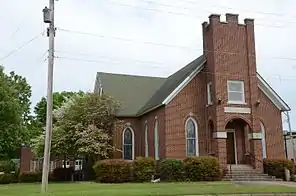 First Christian Church |
May 24, 2006 (#06000418) |
103 S. Boston Ave. 35°16′47″N 93°07′55″W |
Russellville | |
| 11 | Girls' Domestic Science and Arts Building-Arkansas Tech University | 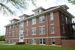 Girls' Domestic Science and Arts Building-Arkansas Tech University |
September 18, 1992 (#92001212) |
East of N. El Paso St. 35°17′33″N 93°08′04″W |
Russellville | |
| 12 | Thomas J. Hankins House | 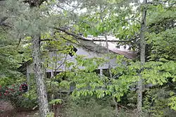 Thomas J. Hankins House |
September 30, 2013 (#13000788) |
Western side of Highway 7 approximately 375 feet north of its junction with Highway 123 35°43′19″N 93°05′47″W |
Pelsor | |
| 13 | Hughes Hall-Arkansas Tech University | 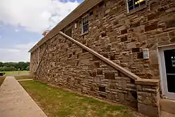 Hughes Hall-Arkansas Tech University |
September 18, 1992 (#92001210) |
W. M St. 35°17′32″N 93°08′20″W |
Russellville | |
| 14 | Henry R. Koen Forest Service Building | 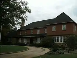 Henry R. Koen Forest Service Building |
December 11, 1989 (#89001628) |
605 W. Main St. 35°16′43″N 93°08′20″W |
Russellville | |
| 15 | Latimore Tourist Home | 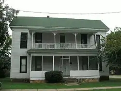 Latimore Tourist Home |
January 27, 2012 (#11001049) |
318 S. Houston Ave. 35°16′36″N 93°08′26″W |
Russellville | part of the Arkansas Highway History and Architecture Multiple Property Submission |
| 16 | Little Rock to Cantonment Gibson Rd-Fourth Street Segment | 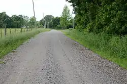 Little Rock to Cantonment Gibson Rd-Fourth Street Segment |
January 22, 2009 (#08001342) |
4th St. between Union Grove and Blackland Sts. 35°14′15″N 92°53′56″W |
Atkins | A Trail of Tears site[6] |
| 17 | Missouri-Pacific Depot-Atkins |  Missouri-Pacific Depot-Atkins |
June 11, 1992 (#92000600) |
U.S. Route 64 35°14′30″N 92°56′07″W |
Atkins | |
| 18 | Missouri-Pacific Depot-Russellville | 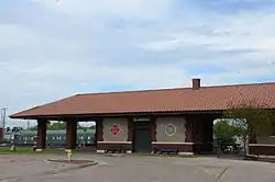 Missouri-Pacific Depot-Russellville |
June 11, 1992 (#92000620) |
North of the junction of C St. and Denver Ave. 35°16′49″N 93°08′07″W |
Russellville | |
| 19 | Mountain View School | 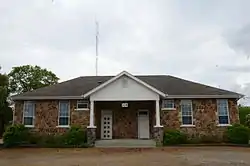 Mountain View School |
September 10, 1992 (#92001207) |
109 Hilltop Dr. (Highway 326) 35°16′32″N 93°10′14″W |
Russellville | Now used as a fire station |
| 20 | Norristown Cemetery | 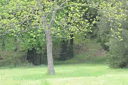 Norristown Cemetery |
April 14, 1995 (#94001415) |
Off Highway 78 on Lock and Dam Rd. 35°14′35″N 93°09′01″W |
Russellville | |
| 21 | William H. Norwood House | May 29, 2019 (#100003988) |
1602 W. Main St. 35°16′56″N 93°08′54″W |
Russellville | ||
| 22 | Old South Restaurant |  Old South Restaurant |
September 3, 1999 (#99001064) |
1330 E. Main St. 35°16′41″N 93°07′01″W |
Russellville | |
| 23 | Physical Education Building-Arkansas Tech University | 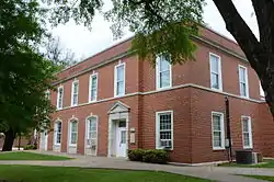 Physical Education Building-Arkansas Tech University |
September 10, 1992 (#92001211) |
Southeastern corner of the junction of N. El Paso and W. O Sts. 35°17′36″N 93°08′11″W |
Russellville | |
| 24 | Potts Inn | 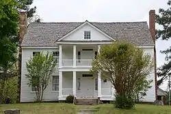 Potts Inn |
June 22, 1970 (#70000123) |
Main and Center Sts. 35°14′54″N 93°02′42″W |
Pottsville | |
| 25 | Pottsville Citizen's Bank | 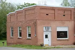 Pottsville Citizen's Bank |
March 28, 2002 (#02000261) |
156 E. Ash St. 35°14′59″N 93°02′45″W |
Pottsville | |
| 26 | Pottsville Commercial Historic District | 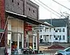 Pottsville Commercial Historic District |
January 20, 2005 (#04001510) |
155, 160, 162, and 164 E. Ash St. 35°15′07″N 93°02′50″W |
Pottsville | |
| 27 | Pottsville Dipping Vat | 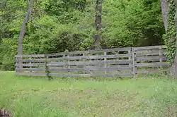 Pottsville Dipping Vat |
March 2, 2006 (#06000086) |
Corner of Rankin Park on E. Ash St. 35°15′08″N 93°02′48″W |
Pottsville | |
| 28 | Riggs-Hamilton American Legion Post No. 20 |  Riggs-Hamilton American Legion Post No. 20 |
August 15, 1994 (#94000855) |
215 N. Denver Ave. 35°16′48″N 93°08′09″W |
Russellville | |
| 29 | Russellville Downtown Historic District | 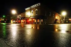 Russellville Downtown Historic District |
September 3, 1996 (#96000941) |
Roughly bounded by W. 2nd St., Arkansas Ave., the former Missouri Pacific railroad tracks, and El Paso St. 35°16′44″N 93°08′06″W |
Russellville | |
| 30 | Russellville Masonic Temple | 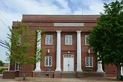 Russellville Masonic Temple |
June 1, 2005 (#05000499) |
205 S. Commerce 35°16′39″N 93°08′07″W |
Russellville | |
| 31 | Russellville Public Library | 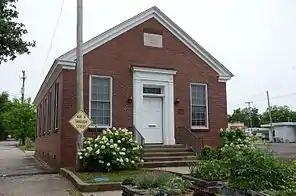 Russellville Public Library |
November 20, 2000 (#00001319) |
114 E. 3rd St. 35°16′32″N 93°08′00″W |
Russellville | 1937 WPA Colonial Revival building, next to the current library. |
| 32 | Threlkeld House | 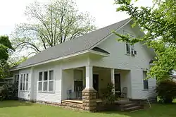 Threlkeld House |
June 2, 2000 (#00000610) |
1301 N. Boston Ave. 35°17′27″N 93°07′56″W |
Russellville | |
| 33 | Old US 64, Scotia Segment |  Old US 64, Scotia Segment |
September 19, 2007 (#07000959) |
South of U.S. Route 64, east of Cedar Ln. 35°19′56″N 93°17′40″W |
London | A Trail of Tears site[6] |
| 34 | John W. White House | 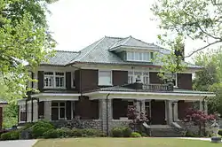 John W. White House |
May 5, 1988 (#88000524) |
1509 W. Main St. 35°16′55″N 93°08′48″W |
Russellville | |
| 35 | W.J. White House | 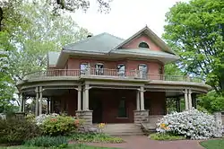 W.J. White House |
December 13, 1978 (#78000617) |
1412 W. Main St. 35°16′57″N 93°08′54″W |
Russellville | |
| 36 | Williamson Hall-Arkansas Tech University | 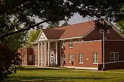 Williamson Hall-Arkansas Tech University |
September 18, 1992 (#92001208) |
N. El Paso St. 35°17′25″N 93°08′13″W |
Russellville | Apr 03, 2019 - Fire destroyed a major part of the building |
| 37 | Wilson Hall-Arkansas Tech University | 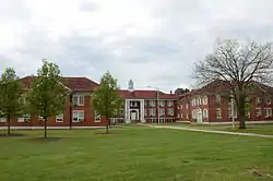 Wilson Hall-Arkansas Tech University |
September 18, 1992 (#92001209) |
N. El Paso St. 35°17′33″N 93°08′15″W |
Russellville | |
| 38 | Wilson House | 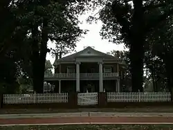 Wilson House |
March 29, 1978 (#78000618) |
214 E. 5th St. 35°16′25″N 93°07′51″W |
Russellville |
Former listing
| [3] | Name on the Register | Image | Date listed | Date removed | Location | City or town | Summary |
|---|---|---|---|---|---|---|---|
| 1 | Galla Creek Bridge | (#93000090) | March 31, 2000 | Old AR 64 over Galla Cr. |
Pottsville |
See also
| Wikimedia Commons has media related to National Register of Historic Places in Pope County, Arkansas. |
References
- The latitude and longitude information provided in this table was derived originally from the National Register Information System, which has been found to be fairly accurate for about 99% of listings. Some locations in this table may have been corrected to current GPS standards.
- "National Register of Historic Places: Weekly List Actions". National Park Service, United States Department of the Interior. Retrieved on February 5, 2021.
- Numbers represent an alphabetical ordering by significant words. Various colorings, defined here, differentiate National Historic Landmarks and historic districts from other NRHP buildings, structures, sites or objects.
- "National Register Information System". National Register of Historic Places. National Park Service. March 13, 2009.
- The eight-digit number below each date is the number assigned to each location in the National Register Information System database, which can be viewed by clicking the number.
- "Trail Of Tears National Historic Trail: National Register Research". National Park Service. Retrieved January 22, 2013.
| Topics | |
|---|---|
| Lists by state |
|
| Lists by insular areas | |
| Lists by associated state | |
| Other areas | |
| Related | |
| |
Municipalities and communities of Pope County, Arkansas, United States | ||
|---|---|---|
| Cities | Map of Arkansas highlighting Pope County | |
| Town | ||
| Unincorporated communities |
| |
| Townships | ||
| ||
This article is issued from Wikipedia. The text is licensed under Creative Commons - Attribution - Sharealike. Additional terms may apply for the media files.