Main Street Banking Historic District
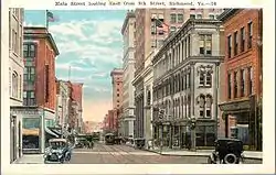
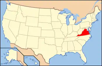
The Main Street Banking Historic District is a national historic district located in downtown Richmond, Virginia. The district encompasses 19 contributing buildings located south of the Virginia State Capitol and west of the Shockoe Slip Historic District. It is the location of a number of buildings built for or occupied by banking institutions. The district includes representative examples of the Late Victorian and International Style architecture built between about 1865 and 1965. Notable buildings include the Virginia Employment Commission Building (1960), the 700 Building (1964), the Ross Building (1964), the Fidelity Building (1965). Located in the district is the separately listed First National Bank Building.[4]
Main Street Banking Historic District | |
 Main Street, East at 8th Street, 1929 | |
  | |
| Location | E. Main St. between 7th & Governors Sts.; 700, 703, 705-711, 801, 830-838 Main St., E., 7 7th & 28 6th Sts., S., Richmond, Virginia |
|---|---|
| Coordinates | 37°32′17″N 77°26′11″W |
| Area | 13 acres (5.3 ha) |
| Built | 1865-1965 |
| Architect | Robinson, Charles M.; et al. |
| Architectural style | Late Victorian, Late 19th And 20th Century Revivals, International Style |
| NRHP reference No. | 05000527, 13000644 (Boundary Increase)[1][2] |
| VLR No. | 127-6031 |
| Significant dates | |
| Added to NRHP | June 1, 2005, August 27, 2013 (Boundary Increase) |
| Designated VLR | March 16, 2005; June 19, 2013[3] |
It was added to the National Register of Historic Places in 2005, with a boundary increase in 2013.[1][2]
References
- "National Register Information System". National Register of Historic Places. National Park Service. July 9, 2010.
- "National Register of Historic Places Listings". Weekly List of Actions Taken on Properties: 8/23/13 through 8/30/13. National Park Service. 2013-09-06.
- "Virginia Landmarks Register". Virginia Department of Historic Resources. Retrieved 19 March 2013.
- Mary Harding Sadler & Robert J. Taylor Jr. (February 2013). "National Register of Historic Places Inventory/Nomination: Main Street Banking Historic District (Boundary Increase)" (PDF). Virginia Department of Historic Resources. and Accompanying four photos and Accompanying map

