Manigod
Manigod is a commune in the Haute-Savoie department and Auvergne-Rhône-Alpes region of eastern France.
Manigod | |
|---|---|
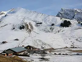 View of the Merdassier ski area | |
Location of Manigod 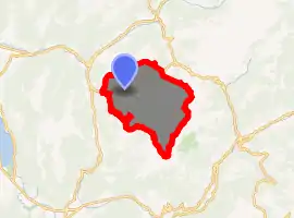
| |
 Manigod  Manigod | |
| Coordinates: 45°51′42″N 6°22′14″E | |
| Country | France |
| Region | Auvergne-Rhône-Alpes |
| Department | Haute-Savoie |
| Arrondissement | Annecy |
| Canton | Faverges |
| Intercommunality | Communauté de communes des Vallées de Thônes |
| Government | |
| • Mayor (2014–2020) | Bruno Sonnier |
| Area 1 | 44.12 km2 (17.03 sq mi) |
| Population (2017-01-01)[1] | 1,004 |
| • Density | 23/km2 (59/sq mi) |
| Demonym(s) | Manigodins / Manigodines |
| Time zone | UTC+01:00 (CET) |
| • Summer (DST) | UTC+02:00 (CEST) |
| INSEE/Postal code | 74160 /74230 |
| Elevation | 719–2,485 m (2,359–8,153 ft) |
| 1 French Land Register data, which excludes lakes, ponds, glaciers > 1 km2 (0.386 sq mi or 247 acres) and river estuaries. | |
The area
The linked area of Manigod consists of several different ski areas: La Croix Fry, Merdassier, and Manigod Village, among others.
Village
The village itself is small and traditional with very few shops, all selling local produce such as the locally made Reblochon.
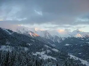
Aravis valley from Manigod
Plateau de Beaugarde
Famous local walk with a view of Mont Blanc.
Geography
The River Fier has its source in the commune.
Nearby
Nearby villages include Thônes, La Clusaz, Saint-Jean-de-Sixt, and Le Grand Bornand. Further away are the larger towns of Annecy and Chamonix.
References
- "Populations légales 2017". INSEE. Retrieved 6 January 2020.
| Wikimedia Commons has media related to Manigod. |
| Authority control |
|
|---|
This article is issued from Wikipedia. The text is licensed under Creative Commons - Attribution - Sharealike. Additional terms may apply for the media files.