Menthonnex-en-Bornes
Menthonnex-en-Bornes is a commune in the Haute-Savoie department in the Auvergne-Rhône-Alpes region in south-eastern France.
Menthonnex-en-Bornes | |
|---|---|
 Coat of arms | |
Location of Menthonnex-en-Bornes 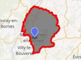
| |
 Menthonnex-en-Bornes  Menthonnex-en-Bornes | |
| Coordinates: 46°03′12″N 6°10′26″E | |
| Country | France |
| Region | Auvergne-Rhône-Alpes |
| Department | Haute-Savoie |
| Arrondissement | Saint-Julien-en-Genevois |
| Canton | La Roche-sur-Foron |
| Intercommunality | CC Pays de Cruseilles |
| Government | |
| • Mayor (2020–2026) | Guy Demolis[1] |
| Area 1 | 8.48 km2 (3.27 sq mi) |
| Population (2017-01-01)[2] | 1,076 |
| • Density | 130/km2 (330/sq mi) |
| Time zone | UTC+01:00 (CET) |
| • Summer (DST) | UTC+02:00 (CEST) |
| INSEE/Postal code | 74177 /74350 |
| Elevation | 690–964 m (2,264–3,163 ft) (avg. 792 m or 2,598 ft) |
| 1 French Land Register data, which excludes lakes, ponds, glaciers > 1 km2 (0.386 sq mi or 247 acres) and river estuaries. | |
Geography
Menthonnex-en-Bornes is located 16.3 km (10.1 mi) as the crow flies to the north of the departmental seat, the commune of Annecy.[3]
By road, the commune is about halfway between Geneva (33 km (21 mi)[4]) and Annecy (25.0 km (15.5 mi)[5]) on the plateau of Bornes. It is separated from the mountain Salève by the Les Usses river valley, which forms its western border. The southern border is defined by the stream Grand Verray.
Pronunciation
The final ex in Menthonnex is not pronounced; it should be read as Menthonné.
References
- "Répertoire national des élus: les maires". data.gouv.fr, Plateforme ouverte des données publiques françaises (in French). 2 December 2020. Retrieved 7 December 2020.
- "Populations légales 2017". INSEE. Retrieved 6 January 2020.
- "Orthodromie entre "Menthonnex-en-Bornes" et "Annecy"" [Orthodromy between "Menthonnex-en-Bornes" and "Annecy"]. lion1906.com. Archived from the original on 6 February 2018. Retrieved 6 February 2018.
- "Relation: Menthonnex-en-Bornes (75198)". openstreetmap.org. OpenStreetMap. Retrieved 6 February 2018.
- "Relation: Menthonnex-en-Bornes (75198)". openstreetmap.org. OpenStreetMap. Retrieved 6 February 2018.
| Wikimedia Commons has media related to Menthonnex-en-Bornes. |
| Authority control |
|---|
This article is issued from Wikipedia. The text is licensed under Creative Commons - Attribution - Sharealike. Additional terms may apply for the media files.