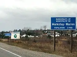
Markstay-Warren
Markstay-Warren is a town in the Canadian province of Ontario, located in the Sudbury District. Highway 17, from the city limits of Greater Sudbury to the Sudbury District's border with Nipissing District, lies entirely within Markstay-Warren. The town had a population of 2,656 in the Canada 2016 Census.[1]
Markstay-Warren | |
|---|---|
| Municipality of Markstay-Warren | |
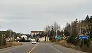
 Entering Markstay-Warren on Highway 17 westbound at Warren. | |
 Markstay-Warren | |
| Coordinates: 46°30′N 80°30′W | |
| Country | Canada |
| Province | Ontario |
| District | Sudbury |
| Incorporated | 1999 |
| Government | |
| • Type | Town |
| • Mayor | Stephen Salonin |
| • Governing Body | Markstay-Warren Town Council |
| • MP | Marc Serré (Liberal) |
| • MPP | John Vanthof (NDP) |
| Area | |
| • Total | 512.78 km2 (197.99 sq mi) |
| Population (2016)[1] | |
| • Total | 2,656 |
| • Density | 5.2/km2 (13/sq mi) |
| Time zone | UTC-5 (EST) |
| • Summer (DST) | UTC-4 (EDT) |
| Area code(s) | 705 |
| Highways | |
| Website | www.markstay-warren.ca |
The town was created on January 1, 1999 by amalgamating the political townships of Ratter and Dunnet and Hagar, the geographic township of Awrey, and parts of the geographic townships of Hawley, Henry, Loughrin and Street.[2] Along with the municipalities of St. Charles and French River, it is part of the region known as Sudbury East.[3]
In the Canada 2016 Census, Markstay-Warren was added for the first time to Greater Sudbury's census metropolitan area.
Communities
The town includes the communities of Appleby Corner, Callum, Dunnet Corner, Hagar, Markstay, Rivière-Veuve, Stinson and Warren. Markstay is the location of the town's municipal offices.
Stinson, Callum, Hagar and Warren are all located directly on Highway 17, a branch of the Trans-Canada Highway. Appleby Corner is located south of Hagar on Highway 535. The other communities are all located along local roads that branch off from one of these two highways. In 2010, planning commenced on a future extension of Highway 17's freeway alignment in Sudbury, which will eventually see the freeway's eastern terminus located near Main Street into Markstay.[4]
History
Much of the area owes its existence to the Canadian Pacific Railway. Most settlers were French-Canadian Roman Catholics who came by rail from the province of Quebec.
Shortly after the completion of the transcontinental line of the CPR in 1885, a station and community was established at Rivière-Veuve, taking its name from the Veuve River that flows through this area. In 1890, the Warren family of Toronto established a sawmill, slightly east of Rivière-Veuve, operating under the name Imperial Lumber Company. A standard gauge logging railroad was also constructed to bring logs to the mill.
In the first part of the 20th century, lumber and agriculture were the main economic activities in the area. By the 1960s, Warren's population and economy grew steadily and because of its proximity (60 km) to Sudbury, many area residents were employed in the mines of the Sudbury area. By the 1970s, important local employers included Ontario Hydro and the Ontario Provincial Police.
The economic recession of the early 1990s hit the Warren area significantly hard as corporate restructuring and downsizing at Ontario Hydro and the OPP resulted in the closure of the Ontario Hydro office and reductions in staff at the OPP. As a consequence, Warren's population suffered and many residents moved to larger centres such as Sudbury or North Bay.
Demographics
| Year | Pop. | ±% |
|---|---|---|
| 2006 | 2,475 | — |
| 2011 | 2,297 | −7.2% |
| 2016 | 2,656 | +15.6% |
| [5][1] | ||
| Canada census – Markstay-Warren community profile | |||
|---|---|---|---|
| 2016 | 2011 | ||
| Population: | 2,656 (+15.6% from 2011) | 2,297 (-7.2% from 2006) | |
| Land area: | 512.78 km2 (197.99 sq mi) | 513.1 km2 (198.1 sq mi) | |
| Population density: | 5.2/km2 (13/sq mi) | 4.5/km2 (12/sq mi) | |
| Median age: | 46.9 (M: 46.2, F: 48.1) | 47.0 (M: 47.0, F: 46.9) | |
| Total private dwellings: | 1,276 | 1,182 | |
| Median household income: | $68,147 | ||
| References: 2016[6] 2011[7] earlier[8] | |||
Images
- Communities in Markstay-Warren
 Markstay
46°29′30″N 80°32′30″W Warren
46°26′30″N 80°18′30″W
References
- "Census Profile, 2016 Census: Markstay-Warren". Statistics Canada. Retrieved July 9, 2019.
- "In the wake of amalgamation, residents of Markstay-Warren look to the future with renewed hope". Sudbury Star, August 6, 2000.
- Sudbury East Planning Board.
- "Highway 17- Sudbury to Markstay". Stantec Consulting. Archived from the original on 3 March 2016. Retrieved 2 January 2020.
- "2011 Census Profile".
- "2016 Community Profiles". 2016 Canadian Census. Statistics Canada. February 21, 2017. Retrieved 2019-07-09.
- "2011 Community Profiles". 2011 Canadian Census. Statistics Canada. July 5, 2013. Retrieved 2019-07-09.
- "2001 Community Profiles". 2001 Canadian Census. Statistics Canada. February 17, 2012.
External links
Places adjacent to Markstay-Warren | |
|---|---|
| Towns | 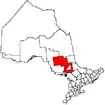 | |
|---|---|---|
| Townships | ||
| First Nations | ||
| Indian reserves | ||
| Unorganized area | ||
| Local services boards | ||
| ||