Wiikwemkoong First Nation
The Wiikwemkoong First Nation is a First Nation on Manitoulin Island in Northern Ontario. The Wiikwemkoong Unceded Territory (nicknamed Wiky, previously named Wikwemikong) is the First Nation reserve in the north-eastern section of Manitoulin Island in Manitoulin District, Ontario, Canada. Wiikwemkoong is an unceded Indigenous reserve in Canada, which means that it has not "relinquished title to its land to the government by treaty or otherwise."
Wiikwemkoong | |
|---|---|
| Wiikwemkoong Unceded Reserve | |
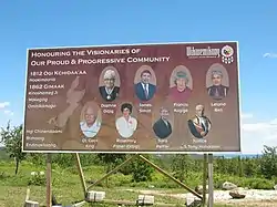 Welcome sign | |
| Nickname(s): Wiiki | |
 Wiikwemkoong | |
| Coordinates: 45°42′N 81°43′W | |
| Country | |
| Province | |
| District | Manitoulin |
| First Nation | Wiikwemkoong |
| Government | |
| • Type | First Nation |
| • Chief | Duke Peltier |
| • MP | Carol Hughes (NDP) |
| • MPP | Michael Mantha (NDP) |
| Area | |
| • Land | 412.97 km2 (159.45 sq mi) |
| Population (2011)[1] | |
| • Total | 2,592 |
| • Density | 6.3/km2 (16/sq mi) |
| Time zone | UTC-5 (EST) |
| • Summer (DST) | UTC-4 (EDT) |
| Postal code span | P0P 2J0 |
| Area code(s) | 705 |
| Website | www.wiikwemkoong.ca |
The local Ojibwe placename is wiikwemkong (Manitoulin dialect; notice the vowel dropping) with the locative -ong ('at') form of wiikwemik 'bay with a gently sloping bottom'.[1] The spelling Wikwemikong is from dialects spoken elsewhere (or in earlier times) that retain the i. The initial element wiikwe- occurs in other forms as 'bay'; the final element -mik cannot be for amik 'beaver' (its local form is mik), a folk etymology that violates the rules for Algonquian stem formation. It can be identified as a variant of the medial element aamik-, which appears, for example, in Southwestern Ojibwe minaamikaa 'there are breakers, shoals, banks (of sand or rocks)',[2] which has initial min- 'islandlike'. The plus or minus of aa- is found in several medial elements in Ojibwe and other Algonquian languages.[3]
The reserve's former name was Manitoulin Unceded Indian Reserve. The Wiikwemkoong Band changed it on August 20, 1968 to Wikwemikong Unceded Indian Reserve.
The reserve is occupied by Ojibwa, Odawa, and Potawatomi peoples under the Council of Three Fires. The current band chief is Duke Peltier.
Geography
Wiikwemkoong occupies a large peninsula on the eastern end of Manitoulin Island, which is connected to the rest of the island by an isthmus separating South Bay from Manitowaning Bay. The reserve's primary access is via Wiikwemkoong Way, which continues off the reserve as Cardwell Street and connects to Highway 6 at Manitowaning. The reserve has a land area of 412.97 km² and is the fifth-largest Indian reserve in Canada by area. It is bordered on its west by Assiginack township, by which the peninsula is connected to the rest of Manitoulin Island. The vast majority of the reserve's border is, however, a water boundary with Northeastern Manitoulin and the Islands, by which it is nearly surrounded except for its border with Assiginack.
The Point Grondine Park, located on the mainland near Killarney, also belongs to the Wiikwemkoong band. This area, which has been unpopulated since the Point Grondine band moved to Wiikwemkoong proper in the 1940s,[4] remained unoccupied and virtually unused by the band until the park was established in 2015.[5]
History
From 1836 to 1862, a considerable portion of Manitoulin Island was set aside as the "Manitoulin Island Indian Reserve" under the Bond Head Treaty. The most important of the pre-confederation treaties were the Robinson Treaties because all subsequent treaties were modeled after these. In 1850, William B. Robinson, a government negotiator and former fur trader, proposed that First Nations reserves be created on the Crown Land acquired through treaties. These Reserves were intended to be the answer to what the immigrant settlers needed for land settlement. First Nation peoples would be set apart on reserves from the new settlers. The Robinson-Huron and Robinson-Superior treaties were signed in September 1850 for large territories north of the two Great Lakes.
According to written records, Lake Huron and Lake Superior area leaders surrendered nearly 15 000 000 hectares of land and the islands in exchange for the establishment of 24 reserves and a payment of approximately $10 000 to be followed by additional annual payment of $2700.
In 1862, most of the islands were again ceded to the government of Canada under the MacDougall Treaty for new settlement by non-natives, resulting in the creation of new reserves at West Bay, Sheguiandah, Sheshegwaning, Cockburn Island and Sucker Creek. However, two bands which occupied the land that now comprises Wiikwemkoong claimed that the bands that signed the Treaty did not represent them, and thus continued to exist as a remnant of the Manitoulin Island Indian Reserve.
In 1968, an amalgamation took place among three bands: Manitoulin Island Unceded Indian Reserve, Point Grondine and South Bay. This amalgamation created the Wikwemikong Unceded Indian Reserve.[6]
The band filed a claim with the Canadian government on the issue of the jurisdiction of the Wikwemikong islands in 1984, but the government denied that the band had any right to these islands in 1997. The two parties restarted negotiations in 2007. As of 2012, the claim is still ongoing.[7]
In 2014 the Constitution – Wiikwemkoong G'chi Naaknigewin was ratified, subsequently changing the name to Wiikwemkoong Unceded Territory.[8]
Communities
In addition to the primary settlement at Wiikwemkoong, smaller settlements on the reserve include Buzwah, Kaboni, Murray Hill, South Bay, Two O'Clock, Wabozominissing and Wikwemikonsing.
The reserve is served by four churches:
- Holy Cross Church
- Buzwah Church (Saint Ignatius)
- Kaboni Catholic Church (St. Anthony Daniel Parish)
- South Bay Catholic Church (Our Lady of Grace)
There are two elementary school, Wasse Abin Junior School (JK, SK, Grades 1-4) and Wasse Abin Pontiac School (Grades 5-8) and Wasse Abin High School.
Two health clinics provide basic services:
- Nadmadwin Mental Health Clinic
- Wiikwemkoong Health Centre
Transportation
Wiikwemkoong Way is the key route in the communities and connects with Ontario Highway 6.
The closest airport is Manitowaning/Manitoulin East Municipal Airport in Manitowaning, Ontario. There is no commercial service from this airport.
Ontario Northland operates a twice daily bus that connects to other places on Manitouland Island as well as the nearest major city, Sudbury, Ontario.[9]
Culture
The reserve is also home to the Wiikwemkoong Cultural Festival (Wiikwemkoong Pow-Wow) which is held annually every Civic Holiday weekend (first weekend in August).
This annual event is touted as the largest and oldest pow-wow in Eastern Canada. Considered to be one of the major pow wows in North America, it is attended by many aboriginal dancers who participate in competition of all age ranges, demonstrating traditional, grass, jingle and fancy dancing.
Wiikwemkoong is also home to a professional theatre company, De-ba-jeh-mu-jig Theatre Group, which stages and produces plays about First Nations life and culture, within the missions ruins next to Holy Cross Church.
People
Notable people from Wiikwemkoong include indigenous women's rights advocate Jeannette Corbiere Lavell, Chef Joseph Shawana,[10] country music artist Crystal Shawanda, Federal Court of Canada judge Leonard S. Mandamin, former NHL player Chris Simon, actor Sladen Peltier, artist Daphne Odjig, water activist Autumn Peltier, and Wasse-abin junior school's fastest runner in the running program, record of completing the big loop in 3 minutes and 16 seconds Jarrett Assiniwe
References
- Richard A. Rhodes: Eastern Ojibwa-Chippewa-Ottawa Dictionary, 1985, p. 363.
- Frederic Baraga 1880
- Ives Goddard, pers. comm. to Carl Masthay, 2016.
- John S. Marsh and Bruce W. Hodgins, Changing Parks: The History, Future and Cultural Context of Parks and Heritage Landscapes. Dundurn Press, 1998. ISBN 9781459718357. p. 69.
- "First Nation opens new park in northern Ontario". CBC Northern Ontario, August 21, 2015.
- "History - Wiikwemkoong Unceded Territory". wiikwemkoong.ca. Retrieved 2018-07-26.
- Expositor Staff (2012-01-25). "Wikwemikong islands claim progressing". Manitoulin Expositor. Retrieved 2019-03-04.
- "History - Wiikwemkoong Unceded Territory". wiikwemkoong.ca. Retrieved 2018-07-26.
- "Station Locator | Ontario Northland".
- "Ku-kum: Philosophy".
External links
- Wiikwemkoong Unceded Indian Reserve
- Wiikwemkoong Heritage Organization
- Indigenous and Northern Affairs Canada profile
- Map of Wiikwemkoong Unceded at Statcan
- "Pupils at Indian residential schools : 1911 Wikwemikong, 1921 Spanish and Carleton Ontario census, Updated edition (August 2016) Eric Pouliot-Thisdale" (PDF). Library and Archives Canada. Retrieved April 22, 2019.
Places adjacent to Wiikwemkoong First Nation | |
|---|---|
| Robinson Superior Treaty, 1850 | |
|---|---|
| Robinson Huron Treaty, 1850 | |
| Saugeen Surrenders, 1854 | |
| Pennefather Treaty, 1859 | |
| Non-signatories | |
| |
| Towns | 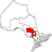 | |
|---|---|---|
| Townships | ||
| First Nations | ||
| Indian reserves | ||
| Unorganized area | ||
| Local services boards | ||
| ||