Melbourne tram route 55
Route 55 was a tram route on the Melbourne tram network. The 12.5-kilometre (7.8-mile) route operated between Pascoe Vale South (signed West Coburg) and Domain Interchange, using Z and B-class trams from Essendon depot.[1][2] The service ceased on 30 April 2017.[3]
| Route 55 | |
|---|---|
| West Coburg - Domain Interchange | |
 | |
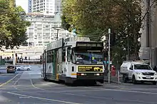 B class tram on Market Street in May 2013 | |
| Overview | |
| System | Melbourne |
| Operator | Yarra Trams |
| Depot | Essendon |
| Vehicle | Z class B class |
| Status | Discontinued |
| Began service | 30 April 1995 |
| Ended service | 30 April 2017 |
| Predecessors | Route 56 (1946-1995) |
| Route | |
| Locale | Melbourne, Australia |
| Start | Pascoe Vale South |
| Via | Brunswick West Parkville North Melbourne West Melbourne Melbourne CBD (William St) Southbank |
| End | Domain Interchange |
| Length | 12.5 km (7.8 mi) |
| Service | |
| Journey time | 40-50 minutes |
| Operates | Daily |
| Zone(s) | Free Zone: Stops 10-1 Myki Zone 1: Stops 45-11, 112-119, 20 |
| Annual patronage | 6.8 million |
| Timetable | Route 55 timetable |
| Map | Route 55 map |
History
Proposals for a tram or railway route to West Coburg date to the late 19th century. Construction of the tramway began in 1923, initially only to Brunswick West, then extended to Bell Street in 1927. The tramway was extended south to St Kilda Road during World War II to alleviate congestion during the war.[4] Proposed extensions north of Bell Street have not been constructed.
Until 30 April 1995, route 55 operated from West Coburg to St Kilda Beach via William Street.[5][6] Route 56 offered a truncated service that ran from West Coburg to Domain Road. Following the construction of a terminating platform at Domain Road on 14 November 1986, through-routing to St. Kilda Beach was discontinued and all services terminated at Domain Road. A strange phenomenon occurred in which services heading towards West Coburg showed route 55, and services heading towards Domain Road showed route 56. On 30 April 1995, Route 55 was finally amended to terminate at Domain Interchange when shared route operations between depots ended.[7][8]
Between 1971 and July 2005 route 55 and 56 (before 1995) only operated on Mondays to Saturdays. On Sundays, the section from West Coburg to the city was covered by route 68.[6][9][10]
During the 2006 Commonwealth Games the route was merged with route 5 to Malvern to alleviate congestion along St Kilda Road.[11]
In October 2016, it was announced that as part of works associated with the construction of Domain railway station, route 55 would be extended from Domain Interchange to Toorak to partly replace route 8 and be renumbered route 58.[12][13]
| Dates | Route | Notes |
|---|---|---|
| 1946 - 14 November 1986 | St. Kilda Beach - West Coburg | via William Street |
| 15 November 1986 - 6 August 2005 | Domain & St. Kilda Road - West Coburg | Monday - Saturday (and Public Holidays with a Saturday timetable) |
| 8 August 2005 – 11 March 2006 | Domain & St. Kilda Road - West Coburg | Full-time service |
| 12 March 2006 - 26 March 2006 | Malvern - Burke Road to West Coburg | Temporarily extended during Commonwealth Games, replacing that section of Route 5. |
| 27 March 2006 - 30 April 2017 | Domain & St. Kilda Road - West Coburg | Merged into route 58 |
Route description
The route ran along Melville Road from the Bell Street intersection, then Dawson Street, Grantham Street, through to Royal Park along a scenic track passing the Royal Park Golf Course and the Melbourne Zoo, coming out at Flemington Road where it intersected Abbotsford Street, then it travelled along Peel Street, William Street, Flinders Lane, Market Street, Queens Bridge, Queensbridge Street, Kings Way and finally Park Street before terminating at the Domain Interchange.
This tram route was notable for its windiness and the traverse through Royal Park for some distance. The route also includes passes the State Netball & Hockey Centre and the Melbourne Zoo with an occasional peek at the elephant's shed.
Route 68
Route 68 was a Sunday-only version of the route 55 service from West Coburg, diverting at Haymarket roundabout to operate along Elizabeth Street to Flinders Street station, instead of along William Street from Domain Interchange. First operated on 6 July 1971, the route was withdrawn on 31 July 2005 when route 55 was altered to operate seven days a week.[9][14]
Route map
Route 55 | ||||||||||||||||||||||||||||||||||||||||||||||||||||||||||||||||||||||||||||||||||||||||||||||||||||||||||||||||||||||||||||||||||||||||||||||||||||||||||||||||||||||||||||||||||||||||||||||||||||||||||||||||||||||||||||||||||||||||||||||||||||||||||||||||||||||||||||||||||||||||||||||||||||||||||||||||||||||||||||||||||||||||||||||||||||||||||||||||||||||||||||||||||||||||||||||||||||||||||||||||||||||||||||||||||||||||||||||||||||||||||||||||||||||||||||||||||||||||||||||||||||||||||||||||||||||||||||||||||||||||||||||||||||||||||||||||||||||||||||||||||||||||||||||||||||||||||||||||||||||||||||||
|---|---|---|---|---|---|---|---|---|---|---|---|---|---|---|---|---|---|---|---|---|---|---|---|---|---|---|---|---|---|---|---|---|---|---|---|---|---|---|---|---|---|---|---|---|---|---|---|---|---|---|---|---|---|---|---|---|---|---|---|---|---|---|---|---|---|---|---|---|---|---|---|---|---|---|---|---|---|---|---|---|---|---|---|---|---|---|---|---|---|---|---|---|---|---|---|---|---|---|---|---|---|---|---|---|---|---|---|---|---|---|---|---|---|---|---|---|---|---|---|---|---|---|---|---|---|---|---|---|---|---|---|---|---|---|---|---|---|---|---|---|---|---|---|---|---|---|---|---|---|---|---|---|---|---|---|---|---|---|---|---|---|---|---|---|---|---|---|---|---|---|---|---|---|---|---|---|---|---|---|---|---|---|---|---|---|---|---|---|---|---|---|---|---|---|---|---|---|---|---|---|---|---|---|---|---|---|---|---|---|---|---|---|---|---|---|---|---|---|---|---|---|---|---|---|---|---|---|---|---|---|---|---|---|---|---|---|---|---|---|---|---|---|---|---|---|---|---|---|---|---|---|---|---|---|---|---|---|---|---|---|---|---|---|---|---|---|---|---|---|---|---|---|---|---|---|---|---|---|---|---|---|---|---|---|---|---|---|---|---|---|---|---|---|---|---|---|---|---|---|---|---|---|---|---|---|---|---|---|---|---|---|---|---|---|---|---|---|---|---|---|---|---|---|---|---|---|---|---|---|---|---|---|---|---|---|---|---|---|---|---|---|---|---|---|---|---|---|---|---|---|---|---|---|---|---|---|---|---|---|---|---|---|---|---|---|---|---|---|---|---|---|---|---|---|---|---|---|---|---|---|---|---|---|---|---|---|---|---|---|---|---|---|---|---|---|---|---|---|---|---|---|---|---|---|---|---|---|---|---|---|---|---|---|---|---|---|---|---|---|---|---|---|---|---|---|---|---|---|---|---|---|---|---|---|---|---|---|---|---|---|---|---|---|---|---|---|---|---|---|---|---|---|---|---|---|---|---|---|---|---|---|---|---|---|---|---|---|---|---|---|---|---|---|---|---|---|---|---|---|---|---|---|---|---|---|---|---|---|---|---|---|---|---|---|---|---|---|---|---|---|---|---|---|---|---|---|---|---|---|---|---|---|---|---|---|---|---|---|---|---|---|---|---|---|---|---|---|---|---|---|---|---|---|---|---|---|---|---|---|---|---|---|---|---|---|---|---|---|---|---|---|---|---|---|---|---|---|---|---|---|---|---|---|---|---|---|---|---|---|---|---|---|---|---|---|---|---|---|---|---|---|---|---|---|---|---|---|---|---|---|---|---|---|---|---|---|---|---|---|---|---|---|---|---|---|---|
| Trams are not wheelchair accessible. Free Tram Zone covers stops 10 to 1. Fare zone 1 applies from stop 45 to 11, and 112 to 20. | ||||||||||||||||||||||||||||||||||||||||||||||||||||||||||||||||||||||||||||||||||||||||||||||||||||||||||||||||||||||||||||||||||||||||||||||||||||||||||||||||||||||||||||||||||||||||||||||||||||||||||||||||||||||||||||||||||||||||||||||||||||||||||||||||||||||||||||||||||||||||||||||||||||||||||||||||||||||||||||||||||||||||||||||||||||||||||||||||||||||||||||||||||||||||||||||||||||||||||||||||||||||||||||||||||||||||||||||||||||||||||||||||||||||||||||||||||||||||||||||||||||||||||||||||||||||||||||||||||||||||||||||||||||||||||||||||||||||||||||||||||||||||||||||||||||||||||||||||||||||||||||||
| ||||||||||||||||||||||||||||||||||||||||||||||||||||||||||||||||||||||||||||||||||||||||||||||||||||||||||||||||||||||||||||||||||||||||||||||||||||||||||||||||||||||||||||||||||||||||||||||||||||||||||||||||||||||||||||||||||||||||||||||||||||||||||||||||||||||||||||||||||||||||||||||||||||||||||||||||||||||||||||||||||||||||||||||||||||||||||||||||||||||||||||||||||||||||||||||||||||||||||||||||||||||||||||||||||||||||||||||||||||||||||||||||||||||||||||||||||||||||||||||||||||||||||||||||||||||||||||||||||||||||||||||||||||||||||||||||||||||||||||||||||||||||||||||||||||||||||||||||||||||||||||||
| *Domain Interchange-bound stop closed until 2019[15][16] ^Depot services divert to the depot at Royal Children's Hospital via route 59. Expand to show intermediate stops. Route map is not to scale. | ||||||||||||||||||||||||||||||||||||||||||||||||||||||||||||||||||||||||||||||||||||||||||||||||||||||||||||||||||||||||||||||||||||||||||||||||||||||||||||||||||||||||||||||||||||||||||||||||||||||||||||||||||||||||||||||||||||||||||||||||||||||||||||||||||||||||||||||||||||||||||||||||||||||||||||||||||||||||||||||||||||||||||||||||||||||||||||||||||||||||||||||||||||||||||||||||||||||||||||||||||||||||||||||||||||||||||||||||||||||||||||||||||||||||||||||||||||||||||||||||||||||||||||||||||||||||||||||||||||||||||||||||||||||||||||||||||||||||||||||||||||||||||||||||||||||||||||||||||||||||||||||
References
- Facts & figures Archived 29 May 2014 at the Wayback Machine Yarra Trams
- Route 55 Archived 14 November 2013 at the Wayback Machine Yarra Trams
- "Say hello to Route 58". Public Transport Victoria. Archived from the original on 30 April 2017. Retrieved 1 May 2017.
- Brown, Geoff. "The tram through the park: the origins of the West Coburg tramway". Melbourne Tramway Museum. Retrieved 7 August 2016.
- The Plot Thickens Transit News & Views Public Transport Users Association December 1986 page 3
- History of Melbourne tram route numbers (1950-2009) Archived 26 February 2017 at the Wayback Machine Yarra Trams
- Here and There Trolley Wire issue 228 February 1987 page 24 (large file)
- "Gunzel". www.classicaustraliantv.com. Retrieved 3 August 2018.
- Yarra Trams - changing with the times Yarra Trams 5 August 2005
- History of Melbourne Trams Routes from 1950 to 2009 Archived 26 February 2017 at the Wayback Machine Yarra Trams
- Changes to your tram service during the Commonwealth Games Yarra Trams 28 February 2006
- Metro Tunnel to Transform Melbourne's Tram Network Minister for Public Transport 25 October 2016
- Trams to head west, route 58 to be born in network overhaul next year The Age 25 October 2016
- Hugh Waldron (16 October 2009). "History of Melbourne tram route numbers (1950-2009)" (PDF). Yarra Trams. Archived from the original (PDF) on 26 February 2017. Retrieved 25 July 2014.
- "Route 55 - Temporary Tram Stop Changes - Monday 13 February to late 2019". Yarra Trams. Archived from the original on 19 February 2017. Retrieved 8 April 2017.
- "Route 55: Temporary tram stop closure from Monday 13 February 2017 to late 2019". Public Transport Victoria. Archived from the original on 4 April 2017. Retrieved 8 April 2017.
External links
 Media related to Melbourne tram route 55 at Wikimedia Commons
- Route 55 map
- Route 55 timetable