Monceaux-sur-Dordogne
Monceaux-sur-Dordogne is a commune in the Corrèze department in central France.
Monceaux-sur-Dordogne | |
|---|---|
.svg.png.webp) Coat of arms | |
Location of Monceaux-sur-Dordogne 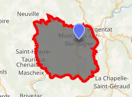
| |
 Monceaux-sur-Dordogne  Monceaux-sur-Dordogne | |
| Coordinates: 45°04′58″N 1°54′30″E | |
| Country | France |
| Region | Nouvelle-Aquitaine |
| Department | Corrèze |
| Arrondissement | Tulle |
| Canton | Argentat-sur-Dordogne |
| Government | |
| • Mayor (2014–2020) | Hubert Arrestier |
| Area 1 | 36.93 km2 (14.26 sq mi) |
| Population (2017-01-01)[1] | 636 |
| • Density | 17/km2 (45/sq mi) |
| Time zone | UTC+01:00 (CET) |
| • Summer (DST) | UTC+02:00 (CEST) |
| INSEE/Postal code | 19140 /19400 |
| Elevation | 147–508 m (482–1,667 ft) (avg. 185 m or 607 ft) |
| 1 French Land Register data, which excludes lakes, ponds, glaciers > 1 km2 (0.386 sq mi or 247 acres) and river estuaries. | |
Geography
Before joining the Dordogne River, the Maronne river forms part of the commune's eastern boundary. The Dordogne forms part of its eastern border and most of its southern boundary.
Population
| Year | Pop. | ±% |
|---|---|---|
| 1962 | 837 | — |
| 1968 | 948 | +13.3% |
| 1975 | 812 | −14.3% |
| 1982 | 722 | −11.1% |
| 1990 | 703 | −2.6% |
| 1999 | 665 | −5.4% |
| 2008 | 679 | +2.1% |
See also
References
- "Populations légales 2017". INSEE. Retrieved 6 January 2020.
| Wikimedia Commons has media related to Monceaux-sur-Dordogne. |
| Authority control |
|---|
This article is issued from Wikipedia. The text is licensed under Creative Commons - Attribution - Sharealike. Additional terms may apply for the media files.