Mooselookmeguntic Lake
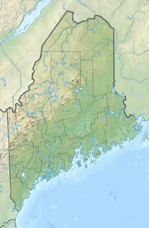
Mooselookmeguntic Lake is located in Franklin County and Oxford County, Maine, in the United States. It is part of the Androscoggin River watershed. It is located in the western part of Maine, near the border with the state of New Hampshire and the Canadian province of Quebec. The lake is just a few miles from the Appalachian Trail.
| Mooselookmeguntic Lake | |
|---|---|
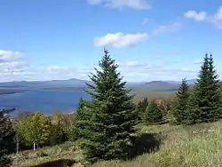 from a scenic overlook on Maine State Route 17 | |
 Mooselookmeguntic Lake  Mooselookmeguntic Lake | |
| Location | Franklin / Oxford counties, Maine, United States |
| Coordinates | 44°54′18″N 70°48′32″W |
| Type | mesotrophic |
| Catchment area | 389 sq mi (1,010 km2) |
| Basin countries | United States |
| Surface area | 16,300 acres (6,600 ha) |
| Average depth | 60 ft (18 m) |
| Max. depth | 132 ft (40 m) |
| Water volume | 562,121 acre⋅ft (693,366,000 m3) |
| Residence time | 1.1 years |
| Shore length1 | 57.5 mi (92.5 km) |
| Surface elevation | 1,467 ft (447 m) |
| Islands | Toothaker Island, Students Island |
| 1 Shore length is not a well-defined measure. | |
Mooselookmeguntic Lake receives water from several sources. The Cupsuptic River flows into Cupsuptic Lake, which is directly connected with the northern part of Mooselookmeguntic Lake. The Rangeley River and Kennebago River both flow into northeastern Mooselookmeguntic Lake.
The lake's waters flow out to the southeast, into Upper Richardson Lake. There is a dam between the two lakes called "Upper Dam". The dam raised the level of Mooselookmeguntic Lake about 14 feet, causing it to become joined to Cupsuptic Lake forming a reservoir. The two lakes had been separate before the dam was built.
Mooselookmeguntic Lake's maximum depth is 132 feet (40 m) and its surface area is 25.5 square miles (66 km2).[1] It is the fourth largest lake in Maine. Mooselookmeguntic Lake's elevation is 1,467 feet (447 meters) above sea level.
There are two islands in the southern portion of Mooselookmeguntic Lake called "Toothaker Island" and "Students Island".
River name
The name "Mooselookmeguntic" is an Abnaki word for "moose feeding place"; although a humorous legend states that a Native American was hunting moose in the area, and spotted one. The native had forgotten to load his rifle but took the shot anyway. Thinking his rifle was damaged, he began yelling to his companion.[2]
Variant names listed by the USGS include "Mooselocmaguntic Lake" and "Mooselookmeguntick Lake".
Mooselookmeguntic Lake is tied for the longest place name in the United States. It has seventeen letters, along with Kleinfeltersville, Pennsylvania.[3][4]
In literature
Lake Mooselookmeguntic is the location of the action in the book "Magic Thinks Big", an illustrated children's book by Elisha Cooper. The book features paintings of one of the islands in the lake, as well as a panorama of the lake.
References
- Maine Fishing Depth Maps: Lakes & Ponds by County. DeLorme. 2007. ISBN 978-0-89933-350-2.
- Nile, LeRoy (15 August 1948). Tales of the Rangeley Lakes (1st ed.). Knowlton & McLeary Co., Farmington, Maine. p. 128.
- "Domestic Names - Frequently Asked Questions (FAQs)". U.S. Board on Geographic Names. Retrieved February 12, 2016.
- Ash, Russell (10 November 2011). Boring, Botty and Spong. RHCP. p. 69. ISBN 978-1-4090-9739-6. Retrieved February 12, 2016.
- "Fishes of Mooselookguntic and Cupsuptic Lakes" (PDF). Maine Department of Inland Fisheries and WIldlife (Maine gov). 1992. Retrieved 26 July 2015.
- David P. Boucher (March 2008). "Mooselookmeguntic Lake Fishery Management". Maine Department of Inland Fisheries and Wildlife. Retrieved 26 July 2015.
External links
| Authority control |
|
|---|