National Register of Historic Places listings in Adams County, Illinois
This is a list of the National Register of Historic Places listings in Adams County, Illinois.
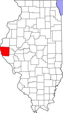
Location of Adams County in Illinois
This is intended to be a complete list of the properties and districts on the National Register of Historic Places in Adams County, Illinois, United States. Latitude and longitude coordinates are provided for many National Register properties and districts; these locations may be seen together in a map.[1]
There are 27 properties and districts listed on the National Register in the county.
- This National Park Service list is complete through NPS recent listings posted January 29, 2021.[2]
Current listings
| [3] | Name on the Register | Image | Date listed[4] | Location | City or town | Description |
|---|---|---|---|---|---|---|
| 1 | Coca-Cola Bottling Company Building |  Coca-Cola Bottling Company Building |
February 7, 1997 (#97000032) |
616 N. 24th St. 39°56′18″N 91°22′37″W |
Quincy | |
| 2 | Downtown Quincy Historic District |  Downtown Quincy Historic District |
April 7, 1983 (#83000298) |
Roughly bounded by Hampshire, Jersey, 4th and 8th Sts. 39°55′57″N 91°24′28″W |
Quincy | |
| 3 | Ebenezer Methodist Episcopal Chapel and Cemetery | 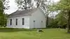 Ebenezer Methodist Episcopal Chapel and Cemetery |
June 4, 1984 (#84000921) |
Northwest of Golden 40°09′32″N 91°06′10″W |
Golden | |
| 4 | Exchange Bank | 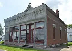 Exchange Bank |
February 12, 1987 (#86003714) |
Quincy St. 40°06′26″N 91°04′15″W |
Golden | |
| 5 | Fall Creek Stone Arch Bridge | 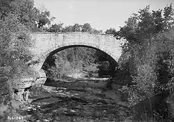 Fall Creek Stone Arch Bridge |
November 7, 1996 (#96001282) |
1.2 miles northeast of Fall Creek-Payson Rd., across Fall Creek 39°47′28″N 91°17′30″W |
Payson | |
| 6 | Robert W. Gardner House | 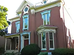 Robert W. Gardner House |
June 20, 1979 (#79000812) |
613 Broadway St. 39°56′09″N 91°24′21″W |
Quincy | |
| 7 | S.J. Lesem Building | 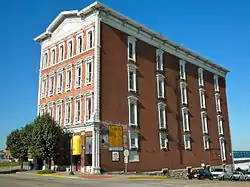 S.J. Lesem Building |
November 22, 1999 (#99001377) |
135-137 N. 3rd St. 39°56′06″N 91°24′43″W |
Quincy | |
| 8 | Lewis Round Barn | 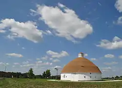 Lewis Round Barn |
January 29, 2003 (#02001750) |
2007 E. 1250th St. 40°03′06″N 91°16′19″W |
Mendon | Originally listed in 1984 at its original site NW of Clayton, Iowa, reference #84000916. Was removed from the Register in March 2002 due to a pending relocation. The site was recertified with a new reference number in 2003 after successful relocation. |
| 9 | Lock and Dam No. 20 Historic District |  Lock and Dam No. 20 Historic District |
March 10, 2004 (#04000180) |
Mississippi River southwest of Meyer 40°08′38″N 91°30′41″W |
Meyer | Extends into Lewis County, Missouri |
| 10 | Lock and Dam No. 21 Historic District |  Lock and Dam No. 21 Historic District |
March 10, 2004 (#04000181) |
0.5 miles west of Illinois Route 57 39°54′22″N 91°25′56″W |
Quincy | Extends into Marion County, Missouri |
| 11 | Morgan-Wells House | 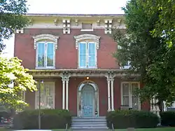 Morgan-Wells House |
November 16, 1977 (#77000471) |
421 Jersey St. 39°55′52″N 91°24′32″W |
Quincy | Demolished by the local newspaper for office expansion in 2017. |
| 12 | Richard F. Newcomb House |  Richard F. Newcomb House |
June 3, 1982 (#82002516) |
1601 Maine St. 39°55′56″N 91°23′24″W |
Quincy | |
| 13 | One Thirty North Eighth Building | 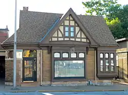 One Thirty North Eighth Building |
February 9, 1984 (#84000918) |
130 N. 8th St. 39°55′58″N 91°24′10″W |
Quincy | |
| 14 | Quincy East End Historic District | 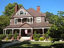 Quincy East End Historic District |
November 14, 1985 (#85002791) |
Roughly bounded by Hampshire, 24th, State, and 12th Sts. 39°55′51″N 91°23′11″W |
Quincy | |
| 15 | Quincy National Cemetery | 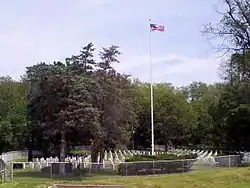 Quincy National Cemetery |
May 6, 2011 (#11000242) |
36th and Maine Sts. 39°55′58″N 91°21′25″W |
Quincy | Civil War Era National Cemeteries MPS |
| 16 | Quincy Northwest Historic District | 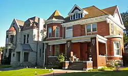 Quincy Northwest Historic District |
May 11, 2000 (#00000414) |
Roughly bounded by Broadway, N. 2nd, Locust, and N. 12th Sts. 39°56′43″N 91°24′18″W |
Quincy | |
| 17 | John Roy Site | 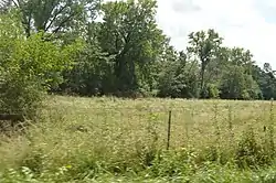 John Roy Site |
May 22, 1978 (#78001109) |
Southwest of the junction of 1700th Ave. and 2950th St.[5] 39°59′56″N 90°56′59″W |
Clayton | |
| 18 | South Side German Historic District | 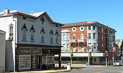 South Side German Historic District |
May 22, 1992 (#92000484) |
Roughly bounded by 6th, 12th, Washington, Jersey and York Sts.; also roughly bounded by Jefferson, S. 12th, Jackson and S. 5th Sts. 39°55′33″N 91°24′07″W |
Quincy | Second set of boundaries represents a boundary increase of April 20, 1995 |
| 19 | State Savings Loan and Trust | 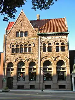 State Savings Loan and Trust |
March 23, 1979 (#79000813) |
428 Maine St. 39°55′55″N 91°24′32″W |
Quincy | |
| 20 | F. D. Thomas House | 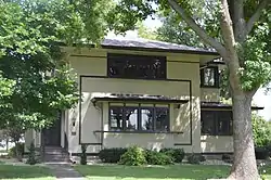 F. D. Thomas House |
July 28, 1983 (#83000299) |
331 N. Ohio St. 40°02′50″N 91°03′51″W |
Camp Point | |
| 21 | U.S. Post Office and Courthouse | 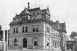 U.S. Post Office and Courthouse |
December 2, 1977 (#77000472) |
200 N. 8th St. 39°56′01″N 91°24′10″W |
Quincy | |
| 22 | Ursa Town Hall | 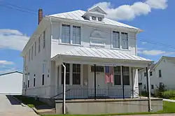 Ursa Town Hall |
March 1, 2002 (#02000095) |
109 S. Warsaw St. 40°04′25″N 91°22′00″W |
Ursa | |
| 23 | Villa Kathrine | 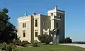 Villa Kathrine |
December 8, 1978 (#78001110) |
532 S. 3rd 39°55′33″N 91°24′46″W |
Quincy | |
| 24 | William S. Warfield House | 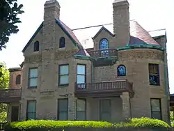 William S. Warfield House |
March 21, 1979 (#79000814) |
1624 Maine St. 39°55′53″N 91°23′23″W |
Quincy | |
| 25 | Ernest M. Wood Office and Studio |  Ernest M. Wood Office and Studio |
August 12, 1982 (#82002517) |
126 N. 8th St. 39°55′57″N 91°24′10″W |
Quincy | |
| 26 | John Wood Mansion |  John Wood Mansion |
April 17, 1970 (#70000228) |
425 S. 12th St. 39°55′39″N 91°23′45″W |
Quincy | |
| 27 | Woodland Cemetery | 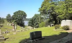 Woodland Cemetery |
March 1, 2002 (#02000096) |
1020 S. 5th St. 39°55′01″N 91°12′55″W |
Quincy |
See also
| Wikimedia Commons has media related to National Register of Historic Places in Adams County, Illinois. |
References
- The latitude and longitude information provided in this table was derived originally from the National Register Information System, which has been found to be fairly accurate for about 99% of listings. Some locations in this table may have been corrected to current GPS standards.
- "National Register of Historic Places: Weekly List Actions". National Park Service, United States Department of the Interior. Retrieved on January 29, 2021.
- Numbers represent an alphabetical ordering by significant words. Various colorings, defined here, differentiate National Historic Landmarks and historic districts from other NRHP buildings, structures, sites or objects.
- The eight-digit number below each date is the number assigned to each location in the National Register Information System database, which can be viewed by clicking the number.
- Maruszak, Kathleen. National Register of Historic Places Inventory/Nomination: John Roy Site. National Park Service, 1977-02, 3.
| Topics | |
|---|---|
| Lists by state |
|
| Lists by insular areas | |
| Lists by associated state | |
| Other areas | |
| Related | |
| |
This article is issued from Wikipedia. The text is licensed under Creative Commons - Attribution - Sharealike. Additional terms may apply for the media files.
