National Register of Historic Places listings in Apostle Islands National Lakeshore
This is a list of the National Register of Historic Places listings in Apostle Islands National Lakeshore.
This is intended to be a complete list of the properties and districts on the National Register of Historic Places in Apostle Islands National Lakeshore, Wisconsin, United States. The locations of National Register properties and districts for which the latitude and longitude coordinates are included below, may be seen in a Google map.[1]
There are thirteen properties and districts listed on the National Register in the park.
- This National Park Service list is complete through NPS recent listings posted January 29, 2021.[2]
Current listings
| [3] | Name on the Register | Image | Date listed[4] | Location | City or town | Description |
|---|---|---|---|---|---|---|
| 1 | Apostle Islands Lighthouses | 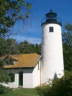 Apostle Islands Lighthouses |
March 8, 1977 (#77000145) |
N and E of Bayfield on Michigan, raspberry, Outer, Sand and Devils Islands 46°59′38″N 90°36′06″W |
Bayfield | |
| 2 | Bass Island Brownstone Company Quarry | 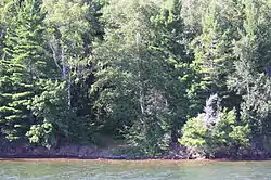 Bass Island Brownstone Company Quarry |
March 29, 1978 (#78000075) |
N of La Pointe on Basswood Island 46°49′56″N 90°45′20″W |
La Pointe | |
| 3 | Hadland Fishing Camp | 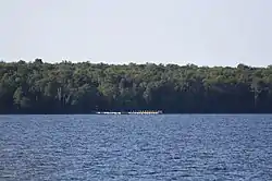 Hadland Fishing Camp |
August 18, 1977 (#77000146) |
N of La Pointe on Rocky Island 47°02′38″N 90°39′57″W |
La Pointe | |
| 4 | Hokenson Fishing Dock | 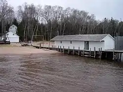 Hokenson Fishing Dock |
June 18, 1976 (#76000050) |
N of Bayfield at Little Sand Bay 46°56′48″N 90°53′29″W |
Bayfield | |
| 5 | La Pointe Light Station | 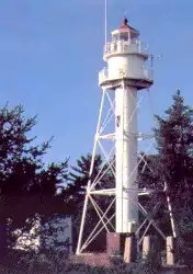 La Pointe Light Station |
August 4, 1983 (#83003366) |
Long Island in Chequamagon Bay 46°43′43″N 90°47′06″W |
Bayfield | Light on 65 foot skeletal tower, started in 1895 to guide ore freighters between the islands. The WPA added the lightkeeper's house in 1939.[5] |
| 6 | Manitou Camp | 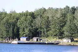 Manitou Camp |
January 19, 1983 (#83003367) |
Manitou Island 46°57′20″N 90°40′35″W |
Apostle Islands National Lakeshore | |
| 7 | Morty Site (47AS40) |  Morty Site (47AS40) |
June 13, 1988 (#88000145) |
Address Restricted |
Bayfield | |
| 8 | P-Flat Site (47AS47) | P-Flat Site (47AS47) |
September 19, 1988 (#88000144) |
Address Restricted |
Bayfield | |
| 9 | Rocky Island Historic District | 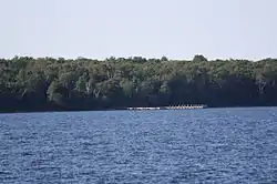 Rocky Island Historic District |
July 3, 2008 (#08000016) |
Rocky Island, Apostle Islands National Lakeshore 47°02′45″N 90°39′58″W |
La Pointe vicinity | |
| 10 | Sevona Cabin | September 29, 1976 (#76000051) |
N of Bayfield on Sand Island 46°57′49″N 90°56′14″W |
Bayfield | ||
| 11 | Shaw Farm | June 18, 1976 (#76000052) |
Sand Island 46°57′47″N 90°56′03″W |
Bayfield | ||
| 12 | Trout Point Logging Camp | Trout Point Logging Camp |
December 16, 1988 (#88002756) |
Address Restricted |
Bayfield | |
| 13 | West Bay Club | July 28, 2015 (#14000385) |
Sand Island 46°58′19″N 90°58′35″E |
Bayfield |
See also
References
- The latitude and longitude information provided in this table was derived originally from the National Register Information System, which has been found to be fairly accurate for about 99% of listings. Some locations in this table may have been corrected to current GPS standards.
- "National Register of Historic Places: Weekly List Actions". National Park Service, United States Department of the Interior. Retrieved on January 29, 2021.
- Numbers represent an alphabetical ordering by significant words. Various colorings, defined here, differentiate National Historic Landmarks and historic districts from other NRHP buildings, structures, sites or objects.
- The eight-digit number below each date is the number assigned to each location in the National Register Information System database, which can be viewed by clicking the number.
- Pepper, Terry. "New La Pointe Light Station". Seeing the LIght. Terry Pepper. Retrieved 2013-02-21.
| Topics | |
|---|---|
| Lists by state |
|
| Lists by insular areas | |
| Lists by associated state | |
| Other areas | |
| Related | |
| |
| Wikimedia Commons has media related to National Register of Historic Places in Apostle Islands National Lakeshore. |
This article is issued from Wikipedia. The text is licensed under Creative Commons - Attribution - Sharealike. Additional terms may apply for the media files.