National Register of Historic Places listings in Carbon County, Montana
This is a list of the National Register of Historic Places listings in Carbon County, Montana.
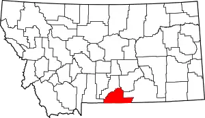
Location of Carbon County in Montana
This is intended to be a complete list of the properties and districts on the National Register of Historic Places in Carbon County, Montana, United States. The locations of National Register properties and districts for which the latitude and longitude coordinates are included below, may be seen in a map.[1]
There are 65 properties and districts listed on the National Register in the county.
- This National Park Service list is complete through NPS recent listings posted January 29, 2021.[2]
Current listings
| [3] | Name on the Register | Image | Date listed[4] | Location | City or town | Description |
|---|---|---|---|---|---|---|
| 1 | Bad Pass Trail | 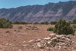 Bad Pass Trail |
October 29, 1975 (#75000215) |
East of Warren along the Big Horn River in the Bighorn Canyon National Recreation Area 45°03′07″N 108°15′44″W |
Warren | |
| 2 | Baker and Lovering Store | May 2, 1986 (#86000885) |
Main St. 45°29′06″N 108°58′10″W |
Joliet | ||
| 3 | Baldwin Building | January 28, 1993 (#92001777) |
Junction of W. River St. and Harley Ave. 45°23′31″N 108°54′25″W |
Fromberg | Demolished | |
| 4 | Bearcreek Bank | 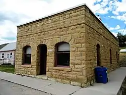 Bearcreek Bank |
March 31, 2004 (#04000251) |
Main and 2nd Sts. 45°09′40″N 109°09′30″W |
Bearcreek | |
| 5 | Bearcreek Cemetery | January 18, 2011 (#11000017) |
1 mile west of Bearcreek 45°09′30″N 109°08′21″W |
Bearcreek | ||
| 6 | Dr. Theodore J. Benson House |  Dr. Theodore J. Benson House |
January 28, 1993 (#92001780) |
10 N. Montana 45°23′33″N 108°54′32″W |
Fromberg | |
| 7 | John Blewett House | 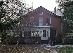 John Blewett House |
January 28, 1993 (#92001789) |
2411 E. River St. 45°23′30″N 108°54′05″W |
Fromberg | |
| 8 | Bluewater Creek Bridge | 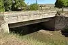 Bluewater Creek Bridge |
April 28, 2011 (#11000223) |
Milepost 8 on Bluewater Creek Rd. 45°22′10″N 108°52′56″W |
Fromberg | |
| 9 | Bridger Coal Company House |  Bridger Coal Company House |
September 15, 1987 (#87001215) |
307 W. Broadway 45°17′46″N 108°55′00″W |
Bridger | |
| 10 | Bridger Opera House | September 15, 1987 (#87001217) |
E. Broadway 45°17′44″N 108°54′39″W |
Bridger | ||
| 11 | Frank Brooder House | 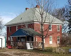 Frank Brooder House |
January 28, 1993 (#92001787) |
303 North St. 45°23′38″N 108°54′37″W |
Fromberg | |
| 12 | Calvary Episcopal Church | 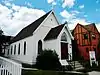 Calvary Episcopal Church |
October 23, 1986 (#86002928) |
9 N. Villard Ave. 45°11′16″N 109°14′56″W |
Red Lodge | |
| 13 | Camp Senia Historic District | April 14, 1988 (#88000441) |
Custer National Forest 45°10′15″N 109°28′34″W |
Red Lodge | Boundary increased 2015-08-10 | |
| 14 | Cedarvale |  Cedarvale |
August 19, 1975 (#75000161) |
Present town of Hillsboro and its environs in the Bighorn Canyon National Recreation Area 45°05′53″N 108°13′26″W |
Hillsboro | |
| 15 | Corey House | 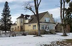 Corey House |
July 21, 1987 (#87001219) |
106 N. E St. 45°17′46″N 108°54′21″W |
Bridger | |
| 16 | Demijohn Flat Archeological District | November 20, 1974 (#74001092) |
Address Restricted |
Bridger | ||
| 17 | Ewing-Snell Ranch | 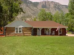 Ewing-Snell Ranch |
May 12, 1977 (#77000114) |
South of Dryhead 45°05′02″N 108°15′49″W |
Dryhead | |
| 18 | Fire Hall |  Fire Hall |
May 2, 1986 (#86000884) |
Main St. 45°29′05″N 108°58′10″W |
Joliet | |
| 19 | Forsman House | 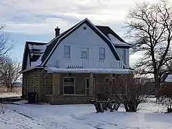 Forsman House |
July 21, 1987 (#87001233) |
406 E. Carbon Ave. 45°17′35″N 108°54′29″W |
Bridger | |
| 20 | Fromberg Concrete Arch Bridge | 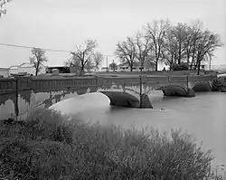 Fromberg Concrete Arch Bridge |
January 28, 1993 (#92001790) |
River St. over the Clarks Fork of the Yellowstone River 45°23′31″N 108°53′39″W |
Fromberg | |
| 21 | Fromberg High School |  Fromberg High School |
January 28, 1993 (#92001788) |
Kids Ct. 45°23′35″N 108°54′41″W |
Fromberg | |
| 22 | Fromberg Methodist-Episcopal Church | 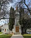 Fromberg Methodist-Episcopal Church |
January 28, 1993 (#92001781) |
Junction of N. Montana Ave. and School St. 45°23′34″N 108°54′32″W |
Fromberg | |
| 23 | Fromberg Opera House | 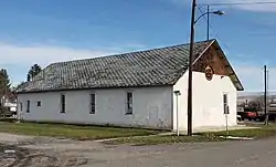 Fromberg Opera House |
January 28, 1993 (#92001779) |
Junction of Harley Ave. and C St. 45°23′35″N 108°54′24″W |
Fromberg | |
| 24 | Gebo Barn | 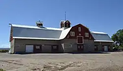 Gebo Barn |
June 1, 2005 (#05000512) |
2.5 miles south of Fromberg on River Rd. 45°21′15″N 108°54′22″W |
Fromberg | Large concrete gambrel-roofed barn on Gebo Ranch, of coal mine developer Samuel Gebo. |
| 25 | Gebo Cemetery | 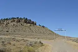 Gebo Cemetery |
April 8, 1993 (#93000291) |
County road linking Gebo and Fromberg 45°24′12″N 108°55′23″W |
Fromberg | |
| 26 | Henry Gebo House | July 21, 1987 (#87001234) |
East of Bridger 45°17′56″N 108°53′57″W |
Bridger | Queen Anne-style house, largest house in area | |
| 27 | John Gibson House |  John Gibson House |
January 28, 1993 (#92001785) |
219 W. River St. 45°23′31″N 108°54′36″W |
Fromberg | |
| 28 | Glidden House |  Glidden House |
July 21, 1987 (#87001236) |
112 N. E St. 45°17′47″N 108°54′22″W |
Bridger | |
| 29 | Glidden Mercantile | 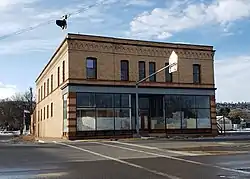 Glidden Mercantile |
September 15, 1987 (#87001237) |
102 N. Main 45°17′46″N 108°54′49″W |
Bridger | |
| 30 | Samuel Greenblatt House | 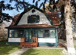 Samuel Greenblatt House |
January 28, 1993 (#92001784) |
215 W. River St. 45°23′31″N 108°54′34″W |
Fromberg | |
| 31 | Heatherington Boarding House |  Heatherington Boarding House |
September 15, 1987 (#87001240) |
209 E. Broadway 45°17′46″N 108°54′41″W |
Bridger | |
| 32 | Hi Bug Historic District |  Hi Bug Historic District |
July 23, 1986 (#86001932) |
Roughly bounded by W. 3rd St., N. Villard Ave., W. 8th St., and N. Word Ave. 45°11′35″N 109°14′58″W |
Red Lodge | |
| 33 | Raymond Hough House | 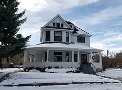 Raymond Hough House |
September 15, 1987 (#87001242) |
312 S. 2nd 45°17′35″N 108°54′54″W |
Bridger | |
| 34 | House on Railroad Avenue | 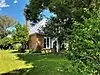 House on Railroad Avenue |
May 2, 1986 (#86000889) |
Railroad Ave. 45°29′10″N 108°58′12″W |
Joliet | |
| 35 | IOOF Hall and Fromberg Co-operative Mercantile Building | 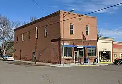 IOOF Hall and Fromberg Co-operative Mercantile Building |
January 28, 1993 (#92001778) |
123 W. River St. 45°23′31″N 108°54′31″W |
Fromberg | |
| 36 | Joliet Bridge |  Joliet Bridge |
May 2, 1986 (#86000888) |
US 212 east of Joliet 45°29′15″N 108°57′51″W |
Joliet | Formerly crossed Rock Creek south of Joliet. Now sitting near US212 east of Joliet. |
| 37 | Joliet High School | May 2, 1986 (#86000887) |
Main St. 45°29′15″N 108°58′23″W |
Joliet | ||
| 38 | Joliet Residential Historic District | 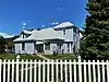 Joliet Residential Historic District |
May 2, 1986 (#86000892) |
Roughly bounded by the Northern Pacific railroad line and U.S. Route 12, State St., Carbon Ave., and 2nd St. 45°29′04″N 108°58′11″W |
Joliet | |
| 39 | Kent Dairy Round Barn | April 7, 1995 (#95000381) |
Along U.S. Route 212, 2 miles north of Red Lodge 45°13′09″N 109°14′29″W |
Red Lodge | ||
| 40 | Kero Farmstead Historic District | August 16, 2007 (#07000815) |
223 W. Bench Rd. 45°17′32″N 109°13′05″W |
Roberts | ||
| 41 | Kose Hall | 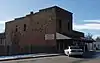 Kose Hall |
April 9, 2013 (#13000152) |
216 Broadway Ave. 45°08′34″N 109°00′29″W |
Belfry | |
| 42 | Caroline Lockhart Ranch |  Caroline Lockhart Ranch |
November 3, 1989 (#89000155) |
Davis Creek, 70 miles south of Hardin 45°08′17″N 108°14′24″W |
Dead Hill | |
| 43 | Dr. Carl Marcus House | 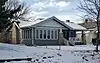 Dr. Carl Marcus House |
September 15, 1987 (#87001243) |
210 S. 2nd 45°17′41″N 108°54′54″W |
Bridger | |
| 44 | Tracy McCall House | 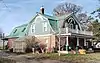 Tracy McCall House |
January 28, 1993 (#92001782) |
110 N. Montana Ave. 45°23′36″N 108°54′32″W |
Fromberg | |
| 45 | Methodist Episcopal Church and Parsonage | 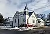 Methodist Episcopal Church and Parsonage |
September 15, 1987 (#87001244) |
220 W. Broadway 45°17′45″N 108°54′58″W |
Bridger | |
| 46 | Montana, Wyoming and Southern Railroad Depot | 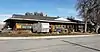 Montana, Wyoming and Southern Railroad Depot |
October 3, 2012 (#12000828) |
403 Broadway Ave. 45°08′34″N 109°00′36″W |
Belfry | |
| 47 | Northern Pacific Railroad Depot-Fromberg |  Northern Pacific Railroad Depot-Fromberg |
January 28, 1993 (#92001776) |
Junction of U.S. Route 310 and River St. 45°23′31″N 108°54′20″W |
Fromberg | |
| 48 | Nutting Rental | September 15, 1987 (#87001245) |
Carbon Ave. 45°17′39″N 108°54′55″W |
Bridger | ||
| 49 | Petroglyph Canyon | November 20, 1975 (#75001079) |
Southern half of Section 35, Township 9 South, Range 26 East[5] 45°00′20″N 108°30′14″W |
Warren | ||
| 50 | Pretty Creek Archeological Site | January 17, 1975 (#75000162) |
Address Restricted |
Hardin | ||
| 51 | Francis Rahrer House | January 28, 1993 (#92001786) |
309 School St. 45°23′36″N 108°54′40″W |
Fromberg | Demolished | |
| 52 | Red Lodge Brewing Company-Red Lodge Canning Company | 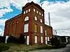 Red Lodge Brewing Company-Red Lodge Canning Company |
September 5, 2007 (#07000947) |
904 N. Bonner St. 45°11′46″N 109°14′40″W |
Red Lodge | |
| 53 | Red Lodge Commercial Historic District |  Red Lodge Commercial Historic District |
April 14, 1983 (#83001057) |
Roughly Broadway from 8th to 13th Sts.; also S. Broadway between 8th and 15th Sts. 45°11′32″N 109°14′48″W |
Red Lodge | Second set of boundaries represents a boundary increase, added on August 28, 1986 |
| 54 | Red Lodge Communal Mausoleum | March 21, 2011 (#11000114) |
Montana Highway 78 45°11′41″N 109°15′41″W |
Red Lodge | ||
| 55 | Red Lodge-Cooke City Approach Road Historic District |  Red Lodge-Cooke City Approach Road Historic District |
May 8, 2014 (#14000219) |
US 212 45°10′14″N 109°15′26″W |
Red Lodge | Extends into Park County, Montana and Park County, Wyoming |
| 56 | Rock Creek State Bank | 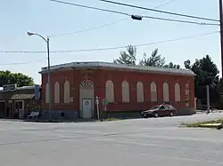 Rock Creek State Bank |
May 2, 1986 (#86000890) |
Main St. 45°29′04″N 108°58′12″W |
Joliet | |
| 57 | Rock Creek Ranger Station Historic District | October 17, 2016 (#16000729) |
6811 US 212 45°09′24″N 109°18′07″W |
Red Lodge vicinity | ||
| 58 | Sage Creek Ranger Station | August 17, 2020 (#100005456) |
Custer Gallatin NF, Sage Creek Guard Station Rd. 2223, Pryor Mts. 45°12′31″N 108°33′28″W |
Bridger vicinity | ||
| 59 | T.W. Smith House | May 2, 1986 (#86000886) |
Front St. 45°29′20″N 108°57′46″W |
Joliet | ||
| 60 | Smith Mine Historic District | 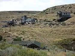 Smith Mine Historic District |
September 30, 2009 (#09000788) |
Montana Highway 308 45°09′25″N 109°10′58″W |
Bearcreek | |
| 61 | Southern Hotel | 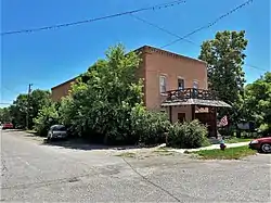 Southern Hotel |
May 2, 1986 (#86000891) |
Main St. 45°29′05″N 108°58′09″W |
Joliet | |
| 62 | Hester E. Suydam Boarding House | 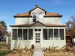 Hester E. Suydam Boarding House |
January 28, 1993 (#92001783) |
209 W. River St. 45°23′31″N 108°54′33″W |
Fromberg | |
| 63 | Warila Boarding House and Sauna | 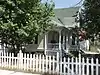 Warila Boarding House and Sauna |
October 24, 1985 (#85003382) |
20 N. Haggin 45°11′16″N 109°14′38″W |
Red Lodge | |
| 64 | Wool Warehouse | July 21, 1987 (#87001246) |
E. Bridger 45°17′44″N 108°54′32″W |
Bridger | Demolished | |
| 65 | Yodeler Motel | 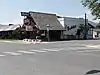 Yodeler Motel |
March 26, 2014 (#14000078) |
601 S. Broadway Ave. 45°10′51″N 109°14′50″W |
Red Lodge |
See also
| Wikimedia Commons has media related to National Register of Historic Places in Carbon County, Montana. |
References
- The latitude and longitude information provided in this table was derived originally from the National Register Information System, which has been found to be fairly accurate for about 99% of listings. Some locations in this table may have been corrected to current GPS standards.
- "National Register of Historic Places: Weekly List Actions". National Park Service, United States Department of the Interior. Retrieved on January 29, 2021.
- Numbers represent an alphabetical ordering by significant words. Various colorings, defined here, differentiate National Historic Landmarks and historic districts from other NRHP buildings, structures, sites or objects.
- The eight-digit number below each date is the number assigned to each location in the National Register Information System database, which can be viewed by clicking the number.
- Vincent, William B. National Register of Historic Places Inventory/Nomination: Petroglyph Canyon. National Park Service, 1974-09-04, 1.
| Topics | |
|---|---|
| Lists by state |
|
| Lists by insular areas | |
| Lists by associated state | |
| Other areas | |
| Related | |
| |
Municipalities and communities of Carbon County, Montana, United States | ||
|---|---|---|
| City | Carbon County map | |
| Towns | ||
| CDPs | ||
| Other unincorporated communities | ||
| ||
This article is issued from Wikipedia. The text is licensed under Creative Commons - Attribution - Sharealike. Additional terms may apply for the media files.