National Register of Historic Places listings in Clark County, Nevada
List of Registered Historic Places in Clark County, Nevada, USA:
The locations of National Register properties and districts (at least for all showing latitude and longitude coordinates below), may be seen in an online map by clicking on "Map of all coordinates".[1]
- This National Park Service list is complete through NPS recent listings posted January 29, 2021.[2]
Current listings
| [3] | Name on the Register | Image | Date listed[4] | Location | City or town | Description |
|---|---|---|---|---|---|---|
| 1 | B-29 Serial No. 45-21847 (Heavy Bomber) | .jpg.webp) B-29 Serial No. 45-21847 (Heavy Bomber) |
April 20, 2011 (#11000212) |
Lake Mead National Recreation Area |
Overton | |
| 2 | Berkley Square | 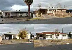 Berkley Square |
October 23, 2009 (#09000846) |
Area bounded by Byrnes Ave., D St., Leonard Ave., and G St. 36°11′26″N 115°08′57″W |
Las Vegas | |
| 3 | Boulder City Historic District | Boulder City Historic District |
August 19, 1983 (#83001107) |
Roughly bounded by Nevada Highway, Avenue L, Date, and 5th Sts. 35°58′40″N 114°50′03″W |
Boulder City | |
| 4 | Boulder Dam Hotel | 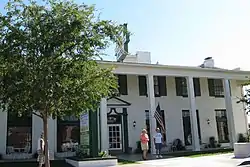 Boulder Dam Hotel |
July 13, 1982 (#82003210) |
1305 Arizona St. 35°58′45″N 114°49′48″W |
Boulder City | |
| 5 | Boulder Dam Park Museum |  Boulder Dam Park Museum |
February 22, 1996 (#96000126) |
Western side of State Route 169 36°31′53″N 114°26′24″W |
Overton | Now the Lost City Museum |
| 6 | Brownstone Canyon Archeological District | 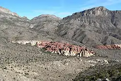 Brownstone Canyon Archeological District |
September 22, 1982 (#82003212) |
West of Las Vegas[5] 36°11′01″N 115°25′28″W |
Las Vegas | |
| 7 | Camp Lee Canyon | January 16, 1997 (#96001561) |
State Route 156 approximately 50 miles northwest of Las Vegas in the Spring Mountains National Recreation Area 36°18′32″N 115°40′22″W |
Las Vegas | ||
| 8 | Clark Avenue Railroad Underpass |  Clark Avenue Railroad Underpass |
January 28, 2004 (#03001509) |
Junction of Bonanza Rd. and Union Pacific railroad line 36°10′38″N 115°08′40″W |
Las Vegas | Also known as the Bonanza Underpass |
| 9 | Corn Creek Campsite | 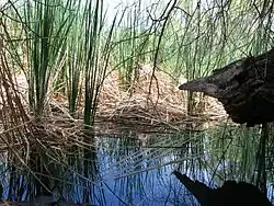 Corn Creek Campsite |
March 4, 1975 (#75001105) |
Address Restricted |
Las Vegas | |
| 10 | Desert Valley Museum | 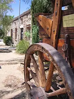 Desert Valley Museum |
October 24, 1991 (#91001527) |
31 W. Mesquite Boulevard 36°48′15″N 114°04′05″W |
Mesquite | Now the Virgin Valley Heritage Museum |
| 11 | El Cortez Hotel and Casino | 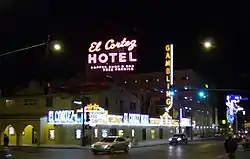 El Cortez Hotel and Casino |
February 22, 2013 (#13000010) |
600 East Fremont Street 36°10′10″N 115°08′19″W |
Las Vegas | |
| 12 | Eureka Locomotive | 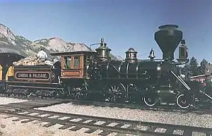 Eureka Locomotive |
January 12, 1995 (#94001575) |
Address Restricted 36°13′40″N 115°12′29″W |
Las Vegas | |
| 13 | Gold Strike Canyon-Sugarloaf Mountain Traditional Cultural Property | September 4, 2004 (#04000935) |
Address Restricted |
Boulder City | ||
| 14 | Goodsprings Schoolhouse | 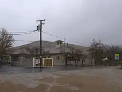 Goodsprings Schoolhouse |
March 10, 1992 (#92000121) |
San Pedro Ave. east of its junction with Esmeralda St. 35°49′54″N 115°26′08″W |
Goodsprings | |
| 15 | Grapevine Canyon Petroglyphs (AZ:F:14:98 ASM) | 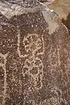 Grapevine Canyon Petroglyphs (AZ:F:14:98 ASM) |
December 15, 1984 (#84000799) |
Address Restricted |
Laughlin | |
| 16 | Green Shack |  Green Shack |
June 3, 1994 (#94000552) |
2504 E. Fremont 36°09′28″N 115°06′53″W |
Las Vegas | Demolished in the 2000s |
| 17 | Gypsum Cave | July 8, 2010 (#10000443) |
Sunrise Mountain[6] 36°13′28″N 114°58′37″W |
Las Vegas | ||
| 18 | Harrison's Guest House |  Harrison's Guest House |
May 3, 2016 (#15000009) |
1001 F St. 36°10′55″N 115°08′58″W |
Las Vegas | |
| 19 | Hidden Forest Cabin | February 20, 1975 (#75001106) |
About 20 miles north of Las Vegas on Hidden Forest Rd. 36°37′54″N 115°13′05″W |
Las Vegas | ||
| 20 | Homestake Mine | 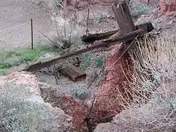 Homestake Mine |
July 17, 1985 (#85001601) |
Address Restricted |
Searchlight | |
| 21 | Hoover Dam | 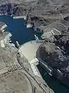 Hoover Dam |
April 8, 1981 (#81000382) |
East of Las Vegas on U.S. Route 93 36°00′58″N 114°44′12″W |
Boulder City | National Historic Landmark |
| 22 | Parley Hunt House | 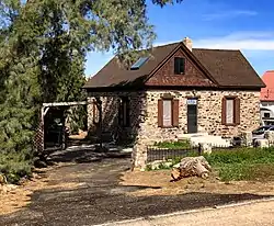 Parley Hunt House |
November 14, 1991 (#91001652) |
Canal St. near its junction with Virgin St. 36°46′32″N 114°06′59″W |
Bunkerville | |
| 23 | Huntridge Theater |  Huntridge Theater |
July 22, 1993 (#93000686) |
1208 E. Charleston Boulevard 36°09′29″N 115°08′07″W |
Las Vegas | |
| 24 | Kyle Ranch | 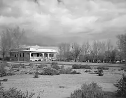 Kyle Ranch |
October 6, 1975 (#75001107) |
Losee St. and Carey Ave. 36°12′16″N 115°08′21″W |
North Las Vegas | |
| 25 | Las Vegas Grammar School | 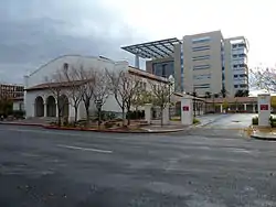 Las Vegas Grammar School |
May 20, 1988 (#88000549) |
400 Las Vegas Boulevard, S. 36°09′53″N 115°08′48″W |
Las Vegas | Also known as the Fifth Street School |
| 26 | Las Vegas Grammar School | 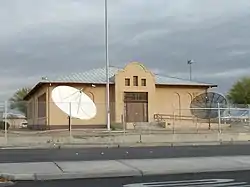 Las Vegas Grammar School |
April 2, 1979 (#79001460) |
Washington and D Sts. 36°10′53″N 115°08′43″W |
Las Vegas | Also known as Westside School |
| 27 | Las Vegas High School Academic Building and Gymnasium |  Las Vegas High School Academic Building and Gymnasium |
September 24, 1986 (#86002293) |
315 S. 7th St. 36°09′55″N 115°08′20″W |
Las Vegas | |
| 28 | Las Vegas High School Neighborhood Historic District | 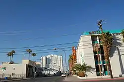 Las Vegas High School Neighborhood Historic District |
January 30, 1991 (#90002204) |
Roughly bounded by E. Bridger, S. 9th, E. Gass, and S. 6th Sts. 36°09′44″N 115°08′23″W |
Las Vegas | |
| 29 | Las Vegas Mormon Fort | 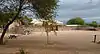 Las Vegas Mormon Fort |
February 1, 1972 (#72000764) |
900 Las Vegas Boulevard, N. 36°10′49″N 115°07′57″W |
Las Vegas | There was a boundary increase on December 12, 1978 (refnum 78003379) |
| 30 | Las Vegas Springs | 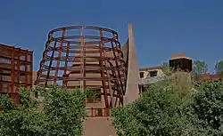 Las Vegas Springs |
December 14, 1978 (#78001719) |
Address Restricted |
Las Vegas | |
| 31 | LDS Moapa Stake Office Building | 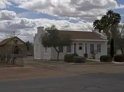 LDS Moapa Stake Office Building |
July 25, 2002 (#02000819) |
161 W. Virginia St. 36°32′25″N 114°26′40″W |
Overton | |
| 32 | Thomas Leavitt House | 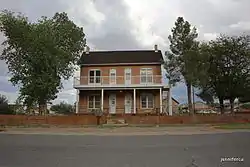 Thomas Leavitt House |
November 14, 1991 (#91001653) |
160 S. 1st W. St. 36°46′15″N 114°07′37″W |
Bunkerville | |
| 33 | Little Church of the West |  Little Church of the West |
September 14, 1992 (#92001161) |
4617 Las Vegas Boulevard, S. 36°05′10″N 115°10′19″W |
Paradise | Wedding chapel on Las Vegas strip |
| 34 | Mesquite High School Gymnasium | 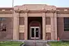 Mesquite High School Gymnasium |
March 10, 1992 (#92000119) |
144 E. N. 1st St. 36°48′18″N 114°03′18″W |
Mesquite | |
| 35 | Morelli House | 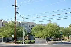 Morelli House |
June 3, 2012 (#11001086) |
861 E. Bridger Ave. 36°09′55″N 115°08′16″W |
Las Vegas | |
| 36 | Mormon Well Spring | December 24, 1974 (#74001143) |
North of Las Vegas on Mormon Spring 36°38′39″N 115°05′45″W |
Las Vegas | ||
| 37 | Moulin Rouge Hotel | 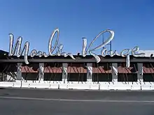 Moulin Rouge Hotel |
December 22, 1992 (#92001701) |
900 W. Bonanza Rd. 36°10′40″N 115°09′06″W |
Las Vegas | Historic non-segregated hotel which was burned after listing; only the neon sign and facade remain |
| 38 | Old Boulder City Hospital |  Old Boulder City Hospital |
April 1, 1982 (#82003211) |
701 Park Pl. 35°58′45″N 114°49′48″W |
Boulder City | |
| 39 | Old Spanish Trail – Mormon Road Historic District | August 22, 2001 (#01000863) |
From the California border to Arizona across southern Nevada, through Las Vegas; also specifically near the junction of Interstate 15 and State Route 169 36°15′11″N 115°09′43″W |
Las Vegas and Moapa | Junction address represents a boundary increase, added on March 21, 2008 | |
| 40 | Overton Gymnasium | 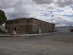 Overton Gymnasium |
March 10, 1992 (#92000118) |
N. W. Thomas St. west of its junction with S. Anderson St. 36°32′32″N 114°26′53″W |
Overton | |
| 41 | John S. Park Historic District | 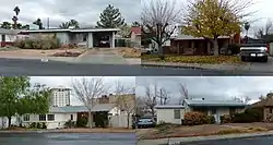 John S. Park Historic District |
May 16, 2003 (#03000412) |
Roughly bounded by Charleston Boulevard, Las Vegas Boulevard, Franklin Ave., and S. 9th St. 36°09′24″N 115°08′40″W |
Las Vegas | |
| 42 | Potosi | 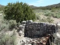 Potosi |
November 13, 1974 (#74001144) |
South of Las Vegas off Interstate 15 near Potosi Pass 35°58′00″N 115°32′37″W |
Las Vegas | |
| 43 | Pueblo Grande de Nevada | October 8, 1982 (#82000612) |
Southeast of Overton 36°29′27″N 114°22′21″W |
Overton | ||
| 44 | Railroad Cottage Historic District | 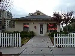 Railroad Cottage Historic District |
December 22, 1987 (#87001622) |
601-629 S. Casino Center 36°09′50″N 115°08′50″W |
Las Vegas | All but one cottage destroyed or moved. |
| 45 | St. Thomas Memorial Cemetery | January 20, 2005 (#04001529) |
Magnasite Rd. off Moapa Valley Boulevard 36°31′14″N 114°26′06″W |
Overton | ||
| 46 | Sandstone Ranch | 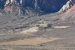 Sandstone Ranch |
April 2, 1976 (#76001141) |
20 miles southwest of Las Vegas 36°04′04″N 115°27′30″W |
Las Vegas | Boundary increase approved April 25, 2019 |
| 47 | Sheep Mountain Range Archeological District | December 31, 1974 (#74001145) |
Address Restricted |
Las Vegas | ||
| 48 | Sloan Petroglyph Site | 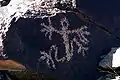 Sloan Petroglyph Site |
December 19, 1978 (#78001720) |
Address Restricted[7] 35°55′53″N 115°11′27″W |
Henderson | There was a boundary increase on February 5, 2004 (refnum 02000114) |
| 49 | Jay Dayton Smith House | 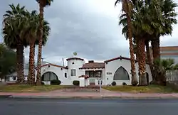 Jay Dayton Smith House |
February 20, 1987 (#87000077) |
624 S. 6th St. 36°09′40″N 115°08′39″W |
Las Vegas | |
| 50 | Spirit Mountain |  Spirit Mountain |
September 8, 1999 (#99001083) |
North of Laughlin in the Lake Mead National Recreation Area[8] 35°16′30″N 114°43′26″W |
Laughlin | |
| 51 | Tim Springs Petroglyphs | December 16, 1974 (#74001142) |
Address Restricted |
Indian Springs | ||
| 52 | Tule Springs Archeological Site | April 20, 1979 (#79001461) |
Address Restricted |
Las Vegas | ||
| 53 | Tule Springs Ranch | 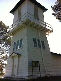 Tule Springs Ranch |
September 23, 1981 (#81000383) |
9200 Tule Springs Rd. 36°19′14″N 115°16′01″W |
Las Vegas | |
| 54 | U.S. Post Office and Courthouse | 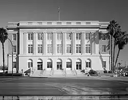 U.S. Post Office and Courthouse |
February 10, 1983 (#83001108) |
300 E. Stewart Ave. 36°10′22″N 115°08′25″W |
Las Vegas | |
| 55 | Walking Box Ranch | Walking Box Ranch |
January 30, 2009 (#08001392) |
6333 W. State Route 164 35°29′22″N 115°02′25″W |
Searchlight | |
| 56 | Washington School | 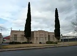 Washington School |
March 10, 1992 (#92000120) |
1901 N. White St. 36°11′43″N 115°07′52″W |
North Las Vegas | |
| 57 | The "Welcome to Fabulous Las Vegas" Sign |  The "Welcome to Fabulous Las Vegas" Sign |
May 1, 2009 (#09000284) |
Las Vegas Boulevard, in public right of way, approximately .5 miles (0.8 km) south of intersection with Russell Road 36°04′55″N 115°10′22″W |
Paradise | |
| 58 | Willow Beach Gauging Station |  Willow Beach Gauging Station |
March 21, 1986 (#86000587) |
Lake Mead National Recreation Area 35°53′17″N 114°40′57″W |
Boulder City | |
| 59 | Woodlawn Cemetery | 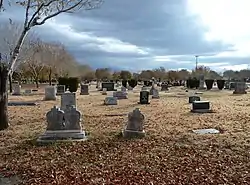 Woodlawn Cemetery |
November 21, 2006 (#06001060) |
1500 Las Vegas Boulevard, N. 36°11′15″N 115°07′43″W |
Las Vegas |
Former listings
| [3] | Name on the Register | Image | Date listed | Date removed | Location | City or town | Summary |
|---|---|---|---|---|---|---|---|
| 1 | Las Vegas Hospital | October 13, 1987 (#87001340) | October 13, 2000 | 201 N. Eight St. |
Las Vegas | Destroyed by fire in 1988.[9] | |
| 2 | Steven R. Whitehead House | August 6, 1987 (#87001341) | October 13, 2000 | 333 N. Seventh St. |
Las Vegas | Destroyed by fire in 2000.[10] |
See also
| Wikimedia Commons has media related to National Register of Historic Places in Clark County, Nevada. |
References
- The latitude and longitude information provided in this table was derived originally from the National Register Information System, which has been found to be fairly accurate for about 99% of listings. Some locations in this table may have been corrected to current GPS standards.
- "National Register of Historic Places: Weekly List Actions". National Park Service, United States Department of the Interior. Retrieved on January 29, 2021.
- Numbers represent an alphabetical ordering by significant words. Various colorings, defined here, differentiate National Historic Landmarks and historic districts from other NRHP buildings, structures, sites or objects.
- The eight-digit number below each date is the number assigned to each location in the National Register Information System database, which can be viewed by clicking the number.
- Location derived from the canyon's GNIS feature record; the NRIS lists the site as "Address Restricted".
- http://nvshpo.org/dmdocuments/RESEARCH-pdf.pdf
- Coordinates represent the beginning of the entrance road depicted on this Bureau of Land Management map
- Location derived from its GNIS feature record; the NRIS lists the site as "Address Restricted"
| Topics | |
|---|---|
| Lists by state |
|
| Lists by insular areas | |
| Lists by associated state | |
| Other areas | |
| Related | |
| |
This article is issued from Wikipedia. The text is licensed under Creative Commons - Attribution - Sharealike. Additional terms may apply for the media files.