National Register of Historic Places listings in Custer County, South Dakota
This is a list of the National Register of Historic Places listings in Custer County, South Dakota.
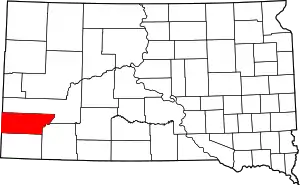
Location of Custer County in South Dakota
This is intended to be a complete list of the properties and districts on the National Register of Historic Places in Custer County, South Dakota, United States. The locations of National Register properties and districts for which the latitude and longitude coordinates are included below, may be seen in a map.[1]
There are 50 properties and districts listed on the National Register in the county.
- This National Park Service list is complete through NPS recent listings posted January 29, 2021.[2]
Current listings
| [3] | Name on the Register[4] | Image | Date listed[5] | Location | City or town | Description |
|---|---|---|---|---|---|---|
| 1 | Archeological Site No. 39CU70 |  Archeological Site No. 39CU70 |
October 20, 1993 (#93001039) |
Address Restricted |
Custer | |
| 2 | Archeological Site No. 39CU890 | Archeological Site No. 39CU890 |
August 6, 1993 (#93000803) |
Address Restricted |
Hermosa | |
| 3 | Archeological Site No. 39CU1619 | Archeological Site No. 39CU1619 |
June 3, 1999 (#99000679) |
Address Restricted |
Custer | |
| 4 | Archeological Site No. 39CU2565 | Archeological Site No. 39CU2565 |
February 23, 2016 (#16000047) |
Address Restricted |
Dewey vicinity | |
| 5 | Archeological Site No. 39CU3178 | Archeological Site No. 39CU3178 |
February 23, 2016 (#16000048) |
Address Restricted |
Dewey vicinity | |
| 6 | Archeological Site No. 39CU3393 | Archeological Site No. 39CU3393 |
February 23, 2016 (#16000049) |
Address Restricted |
Dewey vicinity | |
| 7 | Archeological Site No. 39CU4164 | Archeological Site No. 39CU4164 |
February 23, 2016 (#16000050) |
Address Restricted |
Dewey vicinity | |
| 8 | Lonnie and Francis Ayres Ranch | January 25, 1991 (#90002209) |
2 miles southeast of Fourmile Junction on U.S. Route 16 43°43′01″N 103°39′01″W |
Custer | ||
| 9 | Badger Hole | 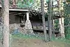 Badger Hole |
March 7, 1973 (#73001740) |
1 mile east of Legion Lake on U.S. Route 16A 43°45′27″N 103°27′28″W |
Custer | |
| 10 | Maria Bauer Homestead Ranch |  Maria Bauer Homestead Ranch |
June 9, 1992 (#92000683) |
3 miles southeast of Jewel Cave National Monument 43°42′43″N 103°46′43″W |
Custer | |
| 11 | Beaver Creek Bridge | 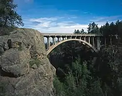 Beaver Creek Bridge |
August 8, 1984 (#84003254) |
Wind Cave National Park, Highway 87, 0.5 miles north of U.S. Route 385 43°35′04″N 103°29′19″W |
Hot Springs | |
| 12 | Beaver Creek Rockshelter |  Beaver Creek Rockshelter |
October 25, 1993 (#93001130) |
Southern side of Beaver Creek, northeast of Wind Cave[6] 43°34′54″N 103°28′14″W |
Pringle | |
| 13 | Buffalo Gap Cheyenne River Bridge | February 8, 1988 (#88000024) |
County Road 656 43°30′07″N 103°04′29″W |
Buffalo Gap | Replaced in 2014 | |
| 14 | Buffalo Gap Historic Commercial District | 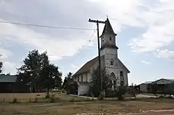 Buffalo Gap Historic Commercial District |
June 30, 1995 (#95000774) |
Roughly the area surrounding Main, 2nd, and Walnut Sts. 43°29′31″N 103°18′43″W |
Buffalo Gap | |
| 15 | CCC Camp Custer Officers' Cabin |  CCC Camp Custer Officers' Cabin |
June 9, 1992 (#92000684) |
8 miles northwest of Custer on County Road 292 43°48′26″N 103°42′59″W |
Custer | |
| 16 | Cold Springs Schoolhouse | 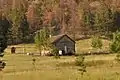 Cold Springs Schoolhouse |
March 7, 1973 (#73001741) |
Southeast of Custer off Highway 336 in the Black Hills National Forest 43°37′24″N 103°30′24″W |
Custer | |
| 17 | Custer County Courthouse | 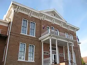 Custer County Courthouse |
November 27, 1972 (#72001226) |
411 Mt. Rushmore Rd. 43°45′59″N 103°36′04″W |
Custer | |
| 18 | Custer State Game Lodge | 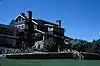 Custer State Game Lodge |
March 30, 1983 (#83003007) |
East of Custer on U.S. Route 16A 43°45′49″N 103°22′51″W |
Custer | |
| 19 | Custer State Park Museum | 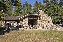 Custer State Park Museum |
March 30, 1983 (#83003008) |
West of Hermosa on U.S. Route 16A 43°45′56″N 103°23′02″W |
Hermosa | |
| 20 | Fairburn Historic Commercial District | June 30, 1995 (#95000772) |
Roughly the area surrounding Main St. between 1st and 2nd Sts.; also Blk. 7, Lots 3-10 43°41′08″N 103°12′39″W |
Fairburn | The district's boundaries were decreased on 2018-12-28 | |
| 21 | First National Bank Building |  First National Bank Building |
March 5, 1982 (#82003924) |
6th St. and Mt. Rushmore Rd. 43°46′04″N 103°36′02″W |
Custer | |
| 22 | Fourmile School No. 21 | January 25, 1991 (#90002208) |
¼ mile south of Fourmile Junction on U.S. Route 16 43°43′42″N 103°40′30″W |
Custer | Possibly demolished or moved. | |
| 23 | Garlock Building | 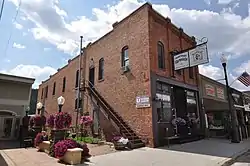 Garlock Building |
January 28, 2004 (#03001524) |
522 Mount Rushmore Rd. 43°46′07″N 103°35′59″W |
Custer | |
| 24 | Grace Coolidge Memorial Log Building |  Grace Coolidge Memorial Log Building |
June 21, 2001 (#01000680) |
644 Crook St. 43°46′04″N 103°35′52″W |
Custer | |
| 25 | Hermosa Masonic Lodge | 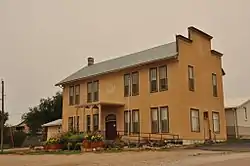 Hermosa Masonic Lodge |
February 17, 2009 (#09000043) |
Western side of 2nd St., between Folsom St. and Highway 40 43°50′25″N 103°11′29″W |
Hermosa | |
| 26 | Historic Trail and Cave Entrance |  Historic Trail and Cave Entrance |
April 19, 1995 (#95000337) |
From old ranger station HS-1 to the old cave entrance at Jewel Cave National Monument 43°44′00″N 103°50′31″W |
Custer | |
| 27 | Charles and Ollie Lampert Ranch | July 5, 1990 (#90000951) |
South of the Elk Mountains north of Dewey 43°37′33″N 104°00′48″W |
Custer | ||
| 28 | Irene and Walter Mann Ranch | July 5, 1990 (#90000953) |
Schenk Canyon area, just off County Road 270 43°39′00″N 103°56′00″W |
Custer | ||
| 29 | Peter Norbeck Summer House | 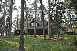 Peter Norbeck Summer House |
September 13, 1977 (#77001241) |
Custer State Park 43°48′07″N 103°27′03″W |
Custer | |
| 30 | Pig Tail Bridge |  Pig Tail Bridge |
April 7, 1995 (#95000344) |
Highway 87 loop over Highway 87, north of Norbeck Lake at Wind Cave National Park 43°36′04″N 103°29′38″W |
Hot Springs | |
| 31 | Ranger Station | 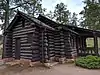 Ranger Station |
April 5, 1995 (#95000336) |
Old administration area at Jewel Cave National Monument 43°44′00″N 103°50′29″W |
Custer | |
| 32 | Red Shirt Bridge | 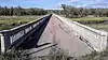 Red Shirt Bridge |
December 9, 1993 (#93001281) |
Highway 40 over the Cheyenne River 43°40′03″N 102°52′13″W |
Red Shirt | |
| 33 | Ferdinand and Elizabeth Roetzel Ranch | January 25, 1991 (#90002210) |
1 mile northwest of junction of Saginaw and Roetzel Rds. 43°50′38″N 103°42′39″W |
Custer | ||
| 34 | Site No. 39 Cu 91 | Site No. 39 Cu 91 |
May 20, 1982 (#82004759) |
Address Restricted |
City Restricted | |
| 35 | Site No. 39 Cu 510 | Site No. 39 Cu 510 |
May 20, 1982 (#82004752) |
Address Restricted |
City Restricted | |
| 36 | Site No. 39 Cu 511 | Site No. 39 Cu 511 |
May 20, 1982 (#82004754) |
Address Restricted |
City Restricted | |
| 37 | Site No. 39 Cu 512 | Site No. 39 Cu 512 |
May 20, 1982 (#82004753) |
Address Restricted |
City Restricted | |
| 38 | Site No. 39 Cu 513 | Site No. 39 Cu 513 |
May 20, 1982 (#82004755) |
Address Restricted |
City Restricted | |
| 39 | Site No. 39 Cu 514 | Site No. 39 Cu 514 |
May 20, 1982 (#82004756) |
Address Restricted |
City Restricted | |
| 40 | Site No. 39 Cu 515 | Site No. 39 Cu 515 |
May 20, 1982 (#82004757) |
Address Restricted |
City Restricted | |
| 41 | Site No. 39 Cu 516 | Site No. 39 Cu 516 |
May 20, 1982 (#82004758) |
Address Restricted |
City Restricted | |
| 42 | South Dakota Dept. of Transportation Bridge No. 17-289-107 |  South Dakota Dept. of Transportation Bridge No. 17-289-107 |
December 9, 1993 (#93001280) |
Highway 87 over French Creek at Custer State Park 43°42′56″N 103°28′47″W |
Custer | Aka the French Creek Bridge. |
| 43 | William Stearns Ranch | July 5, 1990 (#90000952) |
East of Elk Mountain, off County Highway 769 43°39′00″N 103°56′00″W |
Custer | ||
| 44 | Norman B. Streeter Homestead | 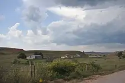 Norman B. Streeter Homestead |
June 30, 1995 (#95000765) |
Streeter Ranch, near Beaver Creek 43°32′13″N 103°22′57″W |
Buffalo Gap | |
| 45 | Francis Averill (T.A.) and Janet Leach Towner House |  Francis Averill (T.A.) and Janet Leach Towner House |
June 21, 1990 (#90000959) |
218 Crook St. 43°46′30″N 103°36′15″W |
Custer | |
| 46 | Newton Seymour Tubbs House |  Newton Seymour Tubbs House |
December 9, 1993 (#93001341) |
35 Centennial Dr. 43°45′47″N 103°36′46″W |
Custer | |
| 47 | Elbert and Harriet Ward Ranch | July 5, 1990 (#90000950) |
East of Elk Mountain, south of U.S. Route 16 43°39′38″N 103°58′13″W |
Custer | ||
| 48 | Way Park Museum |  Way Park Museum |
March 7, 1973 (#73001739) |
4th St. and Rushmore Rd. 43°45′36″N 103°36′03″W |
Custer | |
| 49 | Wind Cave National Park Administrative and Utility Area Historic District |  Wind Cave National Park Administrative and Utility Area Historic District |
July 11, 1984 (#84003259) |
East of Custer off U.S. Route 385 43°33′23″N 103°28′26″W |
Custer | |
| 50 | Edna and Ernest Young Ranch | July 5, 1990 (#90000949) |
Approximately 3 miles south of Dewey, south of Beaver Creek 43°29′11″N 104°02′40″W |
Custer |
See also
| Wikimedia Commons has media related to National Register of Historic Places in Custer County, South Dakota. |
References
- The latitude and longitude information provided in this table was derived originally from the National Register Information System, which has been found to be fairly accurate for about 99% of listings. Some locations in this table may have been corrected to current GPS standards.
- "National Register of Historic Places: Weekly List Actions". National Park Service, United States Department of the Interior. Retrieved on January 29, 2021.
- Numbers represent an alphabetical ordering by significant words. Various colorings, defined here, differentiate National Historic Landmarks and historic districts from other NRHP buildings, structures, sites or objects.
- "National Register Information System". National Register of Historic Places. National Park Service. April 24, 2008.
- The eight-digit number below each date is the number assigned to each location in the National Register Information System database, which can be viewed by clicking the number.
- Martin, James E., et al. "The Beaver Creek Shelter (39CU779): A Holocene Succession in the Black Hills of South Dakota". Plains Anthropologist 38.145: 17-36: 18, 22.
| Topics | |
|---|---|
| Lists by state |
|
| Lists by insular areas | |
| Lists by associated state | |
| Other areas | |
| Related | |
| |
Municipalities and communities of Custer County, South Dakota, United States | ||
|---|---|---|
| City | | |
| Towns | ||
| Unincorporated communities | ||
| Ghost towns | ||
| ||
This article is issued from Wikipedia. The text is licensed under Creative Commons - Attribution - Sharealike. Additional terms may apply for the media files.