National Register of Historic Places listings in Dewey County, South Dakota
This is a list of the National Register of Historic Places listings in Dewey County, South Dakota.
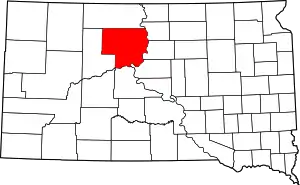
Location of Dewey County in South Dakota
This is intended to be a complete list of the properties and districts on the National Register of Historic Places in Dewey County, South Dakota, United States. The locations of National Register properties and districts for which the latitude and longitude coordinates are included below, may be seen in a map.[1]
There are 5 properties and districts listed on the National Register in the county, including 1 National Historic Landmark.
- This National Park Service list is complete through NPS recent listings posted January 29, 2021.[2]
Current listings
| [3] | Name on the Register[4] | Image | Date listed[5] | Location | City or town | Description |
|---|---|---|---|---|---|---|
| 1 | Dakota Club Library | 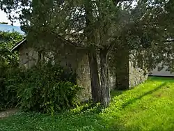 Dakota Club Library |
May 19, 2004 (#04000474) |
Lot 4 Block 3 Main St. 44°59′55″N 101°14′07″W |
Eagle Butte | |
| 2 | Drees Brothers General Merchandise | May 8, 1998 (#98000445) |
812 Main St. 45°25′48″N 101°04′24″W |
Timber Lake | ||
| 3 | Forest City Bridge | 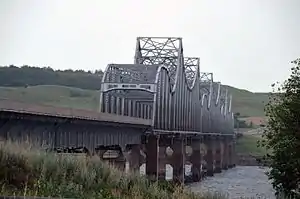 Forest City Bridge |
November 8, 2001 (#01001217) |
U.S. Trunk Route 212 45°00′53″N 100°17′39″W |
La Plant | |
| 4 | Laurens Polygonal Hog House | 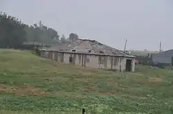 Laurens Polygonal Hog House |
December 14, 1995 (#95001468) |
Highway 63, 1 mile north of U.S. Route 212 45°01′43″N 101°09′19″W |
Eagle Butte | |
| 5 | Molstad Village | 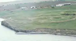 Molstad Village |
October 15, 1966 (#66000713) |
Western side of the Missouri River, 6 miles (9.7 km) southeast of Mobridge[6] 45°27′25″N 100°21′15″W |
Mobridge |
See also
| Wikimedia Commons has media related to National Register of Historic Places in Dewey County, South Dakota. |
References
- The latitude and longitude information provided in this table was derived originally from the National Register Information System, which has been found to be fairly accurate for about 99% of listings. Some locations in this table may have been corrected to current GPS standards.
- "National Register of Historic Places: Weekly List Actions". National Park Service, United States Department of the Interior. Retrieved on January 29, 2021.
- Numbers represent an alphabetical ordering by significant words. Various colorings, defined here, differentiate National Historic Landmarks and historic districts from other NRHP buildings, structures, sites or objects.
- "National Register Information System". National Register of Historic Places. National Park Service. April 24, 2008.
- The eight-digit number below each date is the number assigned to each location in the National Register Information System database, which can be viewed by clicking the number.
- Stephenson, Robert L. "The Potts Village Site (39CO19) Oahe Reservoir, North Central South Dakota". Missouri Archaeologist 33 Whole Volume (1971): 2.
| Topics | |
|---|---|
| Lists by state |
|
| Lists by insular areas | |
| Lists by associated state | |
| Other areas | |
| Related | |
| |
Municipalities and communities of Dewey County, South Dakota, United States | ||
|---|---|---|
| Cities | | |
| Town | ||
| CDPs | ||
| Unincorporated communities | ||
| Indian reservations | ||
| Footnotes | ‡This populated place also has portions in an adjacent county or counties | |
| ||
This article is issued from Wikipedia. The text is licensed under Creative Commons - Attribution - Sharealike. Additional terms may apply for the media files.