National Register of Historic Places listings in Gallatin County, Montana
This is a list of the National Register of Historic Places listings in Gallatin County, Montana.
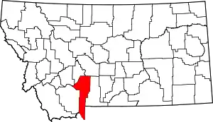
Location of Gallatin County in Montana
This is intended to be a complete list of the properties and districts on the National Register of Historic Places in Gallatin County, Montana, United States. The locations of National Register properties and districts for which the latitude and longitude coordinates are included below, may be seen in a map.[1]
There are 106 properties and districts listed on the National Register in the county, including 1 National Historic Landmark.
- This National Park Service list is complete through NPS recent listings posted January 29, 2021.[2]
Current listings
| [3] | Name on the Register | Image | Date listed[4] | Location | City or town | Description |
|---|---|---|---|---|---|---|
| 1 | Adams Block | 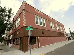 Adams Block |
May 20, 1999 (#99000597) |
123 Main St. 45°53′36″N 111°33′05″W |
Three Forks | |
| 2 | Airway Radio Station | 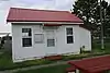 Airway Radio Station |
November 5, 1998 (#98001340) |
Three Forks Airport 45°53′05″N 111°33′45″W |
Three Forks | |
| 3 | Anderson School | July 21, 1981 (#81000354) |
East of Gallatin Gateway 45°35′53″N 111°06′14″W |
Gallatin Gateway | ||
| 4 | B Bar K Ranch | December 28, 2006 (#06001185) |
750 Lone Mountain Ranch Rd. 45°16′38″N 111°19′32″W |
Big Sky | Also called the Lone Mountain Ranch | |
| 5 | R.T. Barnett and Company Building | 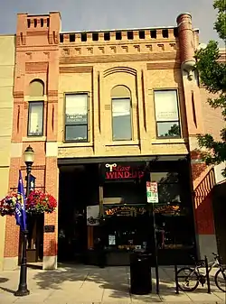 R.T. Barnett and Company Building |
December 1, 1980 (#80002416) |
13 E. Main St. 45°40′43″N 111°02′12″W |
Bozeman | |
| 6 | Jack Bartlett House | 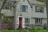 Jack Bartlett House |
February 4, 2000 (#00000046) |
8 W. Harrison 45°40′08″N 111°02′59″W |
Bozeman | |
| 7 | Beall Park Community Center | 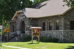 Beall Park Community Center |
October 23, 1987 (#87001807) |
409 N. Bozeman 45°41′02″N 111°02′03″W |
Bozeman | |
| 8 | Belgrade City Hall and Jail | _-_Gallatin_County%252C_Montana.png.webp) Belgrade City Hall and Jail |
October 25, 1982 (#82000592) |
Broadway at Northern Pacific Boulevard 45°46′33″N 111°10′33″W |
Belgrade | |
| 9 | Blackmore Apartments | 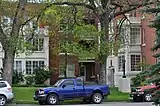 Blackmore Apartments |
July 7, 1983 (#83001062) |
120 S. Black St. 45°40′41″N 111°02′00″W |
Bozeman | |
| 10 | Bohart House | 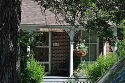 Bohart House |
October 23, 1987 (#87001810) |
510 N. Church 45°41′07″N 111°01′42″W |
Bozeman | |
| 11 | Bon Ton Historic District | 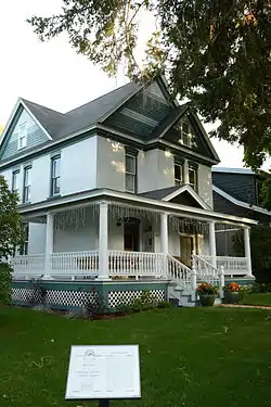 Bon Ton Historic District |
October 23, 1987 (#87001816) |
Roughly bounded by Olive St., Willson Ave., Cleveland St., and 4th Ave. 45°40′38″N 111°02′36″W |
Bozeman | |
| 12 | Bozeman Armory | _-_Gallatin_County%252C_Montana.png.webp) Bozeman Armory |
October 22, 1987 (#87001800) |
24 W. Mendenhall 45°40′49″N 111°02′14″W |
Bozeman | |
| 13 | Bozeman Brewery Historic District | 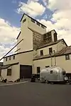 Bozeman Brewery Historic District |
October 23, 1987 (#87001844) |
700-800 N. Wallace Ave. 45°41′17″N 111°01′39″W |
Bozeman | |
| 14 | Bozeman Carnegie Library | 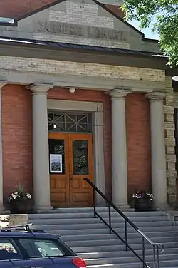 Bozeman Carnegie Library |
February 2, 1979 (#79001402) |
35 N. Bozeman Ave. 45°40′49″N 111°02′04″W |
Bozeman | |
| 15 | Bozeman National Fish Hatchery | Bozeman National Fish Hatchery |
January 6, 1983 (#83001063) |
4050 Bridger Canyon Rd. 45°41′55″N 110°58′41″W |
Bozeman | |
| 16 | Bozeman Sheet Metal Works | 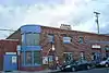 Bozeman Sheet Metal Works |
October 23, 1987 (#87001836) |
26 S. Grand 45°40′44″N 111°02′20″W |
Bozeman | |
| 17 | Bozeman YMCA | _-_Gallatin_County%252C_Montana.png.webp) Bozeman YMCA |
October 23, 1987 (#87001819) |
6 W. Babcock 45°40′42″N 111°02′14″W |
Bozeman | |
| 18 | Brandenburg House | 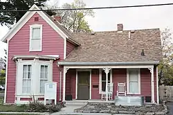 Brandenburg House |
October 23, 1987 (#87001804) |
122 W. Lamme 45°40′51″N 111°02′20″W |
Bozeman | |
| 19 | Bridger Arms Apartments | 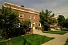 Bridger Arms Apartments |
October 23, 1987 (#87001799) |
103-111 S. 4th Ave. 45°40′41″N 111°02′30″W |
Bozeman | |
| 20 | Busch House | 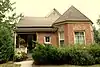 Busch House |
October 23, 1987 (#87001805) |
224 N. Church 45°41′02″N 111°01′44″W |
Bozeman | |
| 21 | Buttelman Ranch | April 19, 1993 (#93000309) |
Address Restricted |
Willow Creek | ||
| 22 | Colburn House | 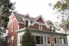 Colburn House |
October 23, 1987 (#87001813) |
607 W. Lamme 45°40′51″N 111°02′39″W |
Bozeman | |
| 23 | Cooper Park Historic District | 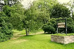 Cooper Park Historic District |
October 23, 1987 (#87001845) |
200-700 blocks of S. 5th, 6th, 7th, 8th, and Cross Sts. 45°40′31″N 111°02′40″W |
Bozeman | |
| 24 | Cottonwood School | July 21, 1981 (#81000356) |
Southeast of Gallatin Gateway 45°38′00″N 111°07′35″W |
Gallatin Gateway | ||
| 25 | Crail Ranch Buildings | 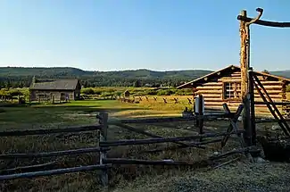 Crail Ranch Buildings |
April 15, 1982 (#82003167) |
Meadow Village 45°16′07″N 111°19′11″W |
Gallatin Gateway | |
| 26 | Dokken-Nelson Funeral Home | 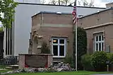 Dokken-Nelson Funeral Home |
December 21, 1987 (#87001833) |
113 S. Willson 45°40′42″N 111°02′19″W |
Bozeman | |
| 27 | Dry Creek School | 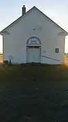 Dry Creek School |
July 21, 1981 (#81000360) |
East of Manhattan 45°52′28″N 111°13′27″W |
Manhattan | |
| 28 | Eagle's Store | 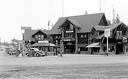 Eagle's Store |
November 6, 1986 (#86002957) |
3 Canyon St. 44°39′34″N 111°05′53″W |
West Yellowstone | |
| 29 | Elkhorn Ranch Historic District | April 5, 2016 (#16000142) |
33133 Gallatin Rd. 45°04′04″N 111°11′22″W |
Gallatin Gateway vicinity | ||
| 30 | Emerson School | 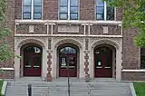 Emerson School |
August 10, 1990 (#90001212) |
111 S. Grand Ave. 45°40′42″N 111°02′22″W |
Bozeman | |
| 31 | Federal Building and US Post Office-Bozeman | 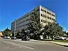 Federal Building and US Post Office-Bozeman |
April 26, 2018 (#100002362) |
10 E. Babcock St. 45°40′41″N 111°02′10″W |
Bozeman | |
| 32 | First Baptist Church | 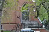 First Baptist Church |
October 23, 1987 (#87001803) |
120 S. Grand 45°40′40″N 111°02′21″W |
Bozeman | |
| 33 | First Presbyterian Church | 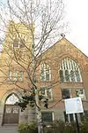 First Presbyterian Church |
December 21, 1987 (#87001820) |
26 W. Babcock 45°40′41″N 111°02′16″W |
Bozeman | |
| 34 | Burr Fisher House | 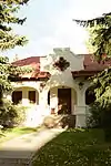 Burr Fisher House |
March 28, 1985 (#85000643) |
712 S. Willson Ave. 45°40′18″N 111°02′16″W |
Bozeman | |
| 35 | Flaming Arrow Lodge | July 29, 1994 (#94000784) |
15521 Bridger Canyon Rd. 45°48′34″N 110°53′03″W |
Bozeman | ||
| 36 | Flaming Arrow Ranch House and Office | March 12, 1998 (#98000229) |
15325 Bridger Canyon Rd. 45°48′31″N 110°52′58″W |
Bozeman | ||
| 37 | Gallatin County Courthouse | 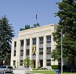 Gallatin County Courthouse |
December 21, 1987 (#87001794) |
301 W. Main 45°40′47″N 111°02′28″W |
Bozeman | |
| 38 | Gallatin County High School | 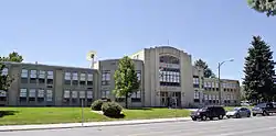 Gallatin County High School |
January 22, 1988 (#87002309) |
404 W. Main 45°40′44″N 111°02′30″W |
Bozeman | |
| 39 | Gallatin County Jail | 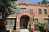 Gallatin County Jail |
January 19, 1983 (#83001064) |
317 W. Main St. 45°40′47″N 111°02′30″W |
Bozeman | |
| 40 | Gallatin Gateway Inn | 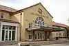 Gallatin Gateway Inn |
January 24, 1980 (#80002417) |
U.S. Route 191 45°35′37″N 111°11′54″W |
Gallatin Gateway | |
| 41 | Gallatin Valley Seed Company | _-_Gallatin_County%252C_Montana.png.webp) Gallatin Valley Seed Company |
October 23, 1987 (#87001830) |
209 S. Wallace 45°40′38″N 111°01′42″W |
Bozeman | |
| 42 | Gifford House | October 23, 1987 (#87001802) |
112 S. Grand 45°40′41″N 111°02′21″W |
Bozeman | ||
| 43 | Graf Building | 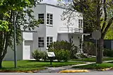 Graf Building |
October 22, 1987 (#87001811) |
219-221 W. Arthur 45°40′08″N 111°02′25″W |
Bozeman | |
| 44 | Green Ranch | April 19, 1993 (#93000310) |
Address Restricted |
Willow Creek | ||
| 45 | Jesse R. Green Homestead | January 21, 1992 (#91001939) |
6 miles northeast of Trident 45°59′05″N 111°22′09″W |
Trident | ||
| 46 | Hamill Apartments | 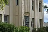 Hamill Apartments |
October 23, 1987 (#87001817) |
427 E. Main 45°40′46″N 111°01′51″W |
Bozeman | |
| 47 | Hamill House | 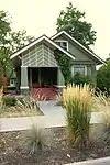 Hamill House |
October 23, 1987 (#87001814) |
205 S. Church 45°40′38″N 111°01′49″W |
Bozeman | |
| 48 | Harris House | 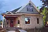 Harris House |
January 22, 1988 (#87002310) |
502 W. Mendenhall 45°40′49″N 111°02′35″W |
Bozeman | |
| 49 | Hines House | 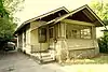 Hines House |
January 22, 1988 (#87002311) |
420 W. College 45°40′16″N 111°02′33″W |
Bozeman | |
| 50 | Holy Rosary Church Rectory | 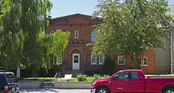 Holy Rosary Church Rectory |
October 23, 1987 (#87001801) |
220 W. Main 45°40′44″N 111°02′23″W |
Bozeman | |
| 51 | Hotel Baxter | 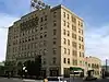 Hotel Baxter |
April 19, 1984 (#84002469) |
105 W. Main St. 45°40′46″N 111°04′37″W |
Bozeman | |
| 52 | House at 22 West Lamme | 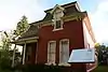 House at 22 West Lamme |
October 23, 1987 (#87001806) |
22 W. Lamme 45°40′51″N 111°02′14″W |
Bozeman | |
| 53 | House at 714 North Tracy | 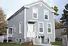 House at 714 North Tracy |
January 22, 1988 (#87002315) |
714 N. Tracy 45°41′18″N 111°02′09″W |
Bozeman | |
| 54 | House at 818 South Eighth | 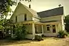 House at 818 South Eighth |
January 22, 1988 (#87002318) |
818 S. 8th 45°40′15″N 111°02′02″W |
Bozeman | |
| 55 | Johnson House |  Johnson House |
January 22, 1988 (#87002321) |
506 N. Bozeman 45°41′02″N 111°15′51″W |
Bozeman | |
| 56 | Kennedy Building |  Kennedy Building |
May 13, 1983 (#83001065) |
127 Yellowstone Ave. 44°39′34″N 111°05′59″W |
West Yellowstone | |
| 57 | Emil Ketterer House |  Emil Ketterer House |
March 31, 1983 (#83001066) |
35 N. Grand Ave. 45°40′49″N 111°02′21″W |
Bozeman | |
| 58 | Kolble House |  Kolble House |
October 23, 1987 (#87001812) |
716 S. Black 45°40′22″N 111°02′05″W |
Bozeman | |
| 59 | Samuel Lewis House |  Samuel Lewis House |
March 18, 1999 (#99000342) |
308 S. Bozeman Ave. 45°40′33″N 111°01′59″W |
Bozeman | |
| 60 | Lindley Place Historic District | 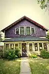 Lindley Place Historic District |
October 23, 1987 (#87001842) |
200-300 Lindley Pl. 45°40′36″N 111°01′57″W |
Bozeman | |
| 61 | Litening Gas |  Litening Gas |
October 22, 1987 (#87001843) |
424 E. Main 45°40′45″N 111°01′50″W |
Bozeman | |
| 62 | Little Bear School | 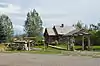 Little Bear School |
April 15, 1982 (#82003168) |
Bear Creek Rd. 45°32′46″N 111°09′55″W |
Gallatin Gateway | |
| 63 | Lonesomehurst Cabin | 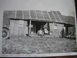 Lonesomehurst Cabin |
August 18, 2011 (#11000541) |
Lonesomehurst Residential Residence Blk. A., Lot 1. 44°44′12″N 111°13′59″W |
West Yellowstone | |
| 64 | Lower Bridger School | July 21, 1981 (#81000347) |
East of Bozeman 45°42′11″N 110°55′44″W |
Bozeman | ||
| 65 | Lower Willow Creek Rural Historic Landscape District | April 19, 1993 (#93000311) |
Address Restricted |
Willow Creek | ||
| 66 | Charles Lundwall Building | 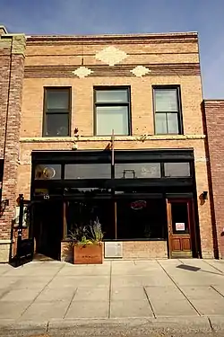 Charles Lundwall Building |
January 4, 2001 (#00001611) |
123-125 W. Main St. 45°40′53″N 111°02′22″W |
Bozeman | |
| 67 | Madison Buffalo Jump State Monument | _-_Jefferson_County%252C_Montana.png.webp) Madison Buffalo Jump State Monument |
April 28, 1970 (#70000356) |
7 miles south of Logan 45°47′39″N 111°27′42″W |
Logan | |
| 68 | Madison Hotel and Cafe | 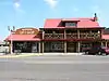 Madison Hotel and Cafe |
May 13, 1983 (#83001067) |
137 Yellowstone Ave. 44°39′30″N 111°06′00″W |
West Yellowstone | |
| 69 | Main Street Historic District | 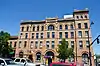 Main Street Historic District |
December 21, 1987 (#87001848) |
100 block of W. Main through the 300 block of E. Main 45°40′47″N 111°02′05″W |
Bozeman | |
| 70 | Malmborg School |  Malmborg School |
July 21, 1981 (#81000349) |
East of Bozeman 45°40′20″N 110°50′06″W |
Bozeman | |
| 71 | Maudlow School | August 23, 1982 (#82003164) |
Milwaukee Rd. 46°06′27″N 111°10′17″W |
Belgrade | ||
| 72 | Methodist Episcopal Church |  Methodist Episcopal Church |
October 23, 1987 (#87001839) |
121 S. Willson 45°40′41″N 111°02′19″W |
Bozeman | |
| 73 | Methodist Episcopal Church | 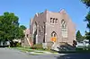 Methodist Episcopal Church |
December 28, 2000 (#00001566) |
116 Cedar St. 45°53′43″N 111°33′00″W |
Three Forks | |
| 74 | MISCO Grain Elevator | 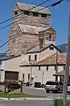 MISCO Grain Elevator |
October 23, 1987 (#87001831) |
700 N. Wallace 45°41′15″N 111°01′37″W |
Bozeman | |
| 75 | Montana State University Historic District | 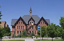 Montana State University Historic District |
December 24, 2013 (#13000972) |
Roughly bounded by W. College & W. Grant Sts., S. 11th & S. 6th Aves. 45°40′03″N 111°02′58″W |
Bozeman | |
| 76 | Newman House | 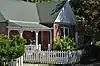 Newman House |
October 23, 1987 (#87001835) |
216 N. Church 45°41′01″N 111°01′44″W |
Bozeman | |
| 77 | North Tracy Avenue Historic District | 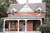 North Tracy Avenue Historic District |
October 23, 1987 (#87001846) |
300-500 blocks of N. Tracy Ave., Bozeman, and Montana 45°41′04″N 111°02′12″W |
Bozeman | |
| 78 | Northern Pacific-Story Mill Historic District | May 10, 1996 (#96000479) |
Roughly bounded by the Northern Pacific right-of-way and the Story Mill spur line from Wye to Bridger Canyon Rd. 45°41′30″N 111°01′16″W |
Bozeman | ||
| 79 | Panton House | 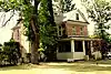 Panton House |
October 23, 1987 (#87001828) |
801 S. 7th 45°40′17″N 111°02′00″W |
Bozeman | |
| 80 | Pass Creek School | 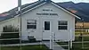 Pass Creek School |
July 21, 1981 (#81000341) |
Northeast of Belgrade 45°58′40″N 111°05′52″W |
Belgrade | |
| 81 | Peterson House | _-_Gallatin_County%252C_Montana.png.webp) Peterson House |
January 22, 1988 (#87002350) |
216 N. Wallace 45°41′00″N 111°01′42″W |
Bozeman | |
| 82 | Peterson Place | April 19, 1993 (#93000308) |
Address Restricted |
Willow Creek | ||
| 83 | Pine Butte School | 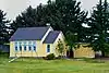 Pine Butte School |
July 21, 1981 (#81000351) |
West of Bozeman 45°40′14″N 111°14′54″W |
Bozeman | |
| 84 | Thomas Quaw House | March 4, 1991 (#91000217) |
5 Central Ave. 45°46′36″N 111°10′27″W |
Belgrade | ||
| 85 | Rea School | July 21, 1981 (#81000346) |
West of Bozeman 45°40′19″N 111°07′27″W |
Bozeman | ||
| 86 | Reese Creek School | July 21, 1981 (#81000342) |
Northeast of Belgrade 45°52′33″N 111°04′48″W |
Belgrade | One-room schoolhouse with a cupola, built in 1906. | |
| 87 | Rouse House |  Rouse House |
October 23, 1987 (#87001832) |
506 E. Babcock 45°40′41″N 111°01′44″W |
Bozeman | |
| 88 | Ruby Theatre | 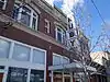 Ruby Theatre |
April 30, 1982 (#82003169) |
212 Main St. 45°53′35″N 111°33′06″W |
Three Forks | |
| 89 | Sacajawea Hotel | 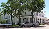 Sacajawea Hotel |
January 24, 1980 (#80002418) |
5 Main St. 45°53′44″N 111°33′03″W |
Three Forks | |
| 90 | Sedan School | July 21, 1981 (#81000344) |
Northeast of Belgrade 45°57′30″N 110°51′03″W |
Belgrade | ||
| 91 | South Tracy Avenue Historic District | 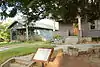 South Tracy Avenue Historic District |
October 23, 1987 (#87001847) |
802-824 S. Tracy Ave. 45°40′16″N 111°02′14″W |
Bozeman | |
| 92 | South Tracy-South Black Historic District | 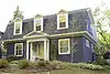 South Tracy-South Black Historic District |
December 21, 1987 (#87001840) |
200-600 blocks of S. Tracy and S. Black Aves. 45°40′31″N 111°02′11″W |
Bozeman | |
| 93 | South Willson Historic District | 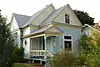 South Willson Historic District |
December 18, 1978 (#78001687) |
Willson Ave. between Curtiss and Arthur Sts. 45°40′21″N 111°02′19″W |
Bozeman | |
| 94 | Spanish Creek School | July 21, 1981 (#81000358) |
Northwest of Gallatin Gateway 45°29′27″N 111°19′50″W |
Gallatin Gateway | ||
| 95 | Spieth and Krug Brewery | 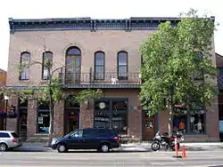 Spieth and Krug Brewery |
April 19, 1984 (#84002473) |
238-246 E. Main St. 45°40′54″N 111°01′53″W |
Bozeman | |
| 96 | Spieth Houses | 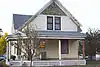 Spieth Houses |
October 23, 1987 (#87001838) |
204 N. Bozeman and 209 E. Lamme 45°40′55″N 111°01′59″W |
Bozeman | |
| 97 | Springhill School | July 21, 1981 (#81000345) |
Northeast of Belgrade 45°50′21″N 111°02′04″W |
Belgrade | ||
| 98 | St. James Episcopal Church and Rectory | _-_Galltin_County%252C_Montana.png.webp) St. James Episcopal Church and Rectory |
October 23, 1987 (#87001841) |
9 W. Olive 45°40′40″N 111°02′12″W |
Bozeman | |
| 99 | Stateler Memorial Methodist Church | July 29, 2008 (#08000757) |
303 Main St. 45°49′32″N 111°38′42″W |
Willow Creek | ||
| 100 | Story Motor Company | October 23, 1987 (#87001837) |
202 W. Main 45°40′47″N 111°02′21″W |
Bozeman | ||
| 101 | Three Forks of the Missouri | 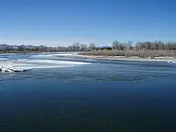 Three Forks of the Missouri |
October 15, 1966 (#66000433) |
Northeast of Three Forks on the Missouri River, at Missouri Headwaters State Monument 45°55′48″N 111°30′00″W |
Three Forks | |
| 102 | Three Valleys State Bank | 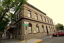 Three Valleys State Bank |
April 11, 2005 (#05000256) |
202 Main St. 45°53′35″N 111°33′07″W |
Three Forks | |
| 103 | Trident School | July 21, 1981 (#81000364) |
South of Trident 45°56′58″N 111°28′24″W |
Trident | ||
| 104 | Upper Madison School | 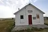 Upper Madison School |
January 19, 1983 (#83001068) |
Buffalo Jump Rd. 45°44′38″N 111°28′07″W |
Three Forks | |
| 105 | Watkins Creek Ranch | December 27, 2006 (#06001180) |
1207 Firehole Ranch Rd. 44°48′49″N 111°17′20″W |
West Yellowstone | ||
| 106 | West Yellowstone Oregon Shortline Terminus Historic District | 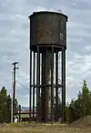 West Yellowstone Oregon Shortline Terminus Historic District |
April 13, 1983 (#83001069) |
Yellowstone Ave. 44°39′30″N 111°06′06″W |
West Yellowstone |
See also
| Wikimedia Commons has media related to National Register of Historic Places in Gallatin County, Montana. |
References
- The latitude and longitude information provided in this table was derived originally from the National Register Information System, which has been found to be fairly accurate for about 99% of listings. Some locations in this table may have been corrected to current GPS standards.
- "National Register of Historic Places: Weekly List Actions". National Park Service, United States Department of the Interior. Retrieved on January 29, 2021.
- Numbers represent an alphabetical ordering by significant words. Various colorings, defined here, differentiate National Historic Landmarks and historic districts from other NRHP buildings, structures, sites or objects.
- The eight-digit number below each date is the number assigned to each location in the National Register Information System database, which can be viewed by clicking the number.
Municipalities and communities of Gallatin County, Montana, United States | ||
|---|---|---|
| Cities | Gallatin County map | |
| Towns | ||
| CDPs | ||
| Other unincorporated communities | ||
| Footnotes | ‡This populated place also has portions in an adjacent county or counties | |
| ||
| Topics | |
|---|---|
| Lists by state |
|
| Lists by insular areas | |
| Lists by associated state | |
| Other areas | |
| Related | |
| |
This article is issued from Wikipedia. The text is licensed under Creative Commons - Attribution - Sharealike. Additional terms may apply for the media files.