National Register of Historic Places listings in Jo Daviess County, Illinois
This is a list of the National Register of Historic Places listings in Jo Daviess County, Illinois.
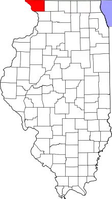
Location of Jo Daviess County in Illinois
This is intended to be a complete list of the properties and districts on the National Register of Historic Places in Jo Daviess County, Illinois, United States. Latitude and longitude coordinates are provided for many National Register properties and districts; these locations may be seen together in a map.[1]
There are 17 properties and districts listed on the National Register in the county.
- This National Park Service list is complete through NPS recent listings posted February 5, 2021.[2]
Current listings
| [3] | Name on the Register | Image | Date listed[4] | Location | City or town | Description |
|---|---|---|---|---|---|---|
| 1 | Apple River Fort Site | 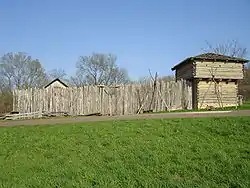 Apple River Fort Site |
November 7, 1997 (#97001332) |
0.25 miles east-southeast of the junction of Mrytle and Illinois Sts. 42°19′05″N 90°12′51″W |
Elizabeth | |
| 2 | John Chapman Village Site | 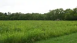 John Chapman Village Site |
December 10, 2009 (#09001058) |
Western side of Illinois Route 84, south of Hanover[5] 42°14′33″N 90°16′03″W |
Hanover | |
| 3 | Chicago Great Western Railroad Depot | 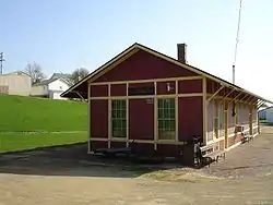 Chicago Great Western Railroad Depot |
February 16, 1996 (#96000098) |
Myrtle St. between N. Madison and Vine Sts. 42°19′01″N 90°13′21″W |
Elizabeth | |
| 4 | East Dubuque School | 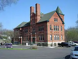 East Dubuque School |
November 12, 1982 (#82000396) |
Montgomery Ave. 42°29′38″N 90°38′29″W |
East Dubuque | |
| 5 | Henry N. Frentess Farmstead | 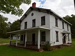 Henry N. Frentess Farmstead |
February 4, 2011 (#10001202) |
19140 U.S. Route 20 W. 42°28′20″N 90°36′30″W |
East Dubuque | |
| 6 | Galena Historic District | 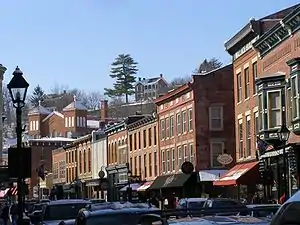 Galena Historic District |
October 18, 1969 (#69000056) |
Roughly bounded by Davis Creek and 4th, 5th, Adams, Field, Wann, N. Dodge, Fulton, N. Hickory, Hill, Ridge, and Spring Sts. 42°25′06″N 90°25′40″W |
Galena | Boundary increase and decrease October 23, 2013. |
| 7 | Ulysses S. Grant House | 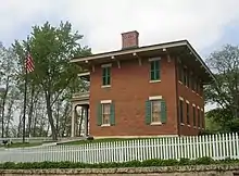 Ulysses S. Grant House |
October 15, 1966 (#66000322) |
511 Bouthillier St. 42°24′40″N 90°25′27″W |
Galena | |
| 8 | Henry W. Miller House | 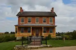 Henry W. Miller House |
October 13, 2010 (#10000836) |
11672 W. Norris Ln. 42°26′48″N 90°27′36″W |
Galena | |
| 9 | Millville Town Site | 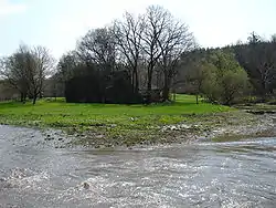 Millville Town Site |
March 3, 2003 (#03000066) |
Apple River Canyon State Park, 8663 E. Canyon Rd. 42°26′36″N 90°03′07″W |
Apple River | |
| 10 | Old Market House | 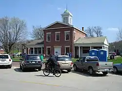 Old Market House |
July 16, 1973 (#73000707) |
Market Square-Commerce St. 42°24′56″N 90°25′38″W |
Galena | |
| 11 | Old Stone Hotel | 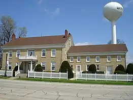 Old Stone Hotel |
April 16, 1975 (#75000665) |
110 W. Main St. 42°29′50″N 89°59′28″W |
Warren | |
| 12 | Scales Mound Historic District | 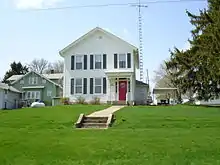 Scales Mound Historic District |
September 5, 1990 (#90001199) |
Roughly bounded by the village limits 42°28′55″N 90°15′10″W |
Scales Mound | |
| 13 | Townsend House | 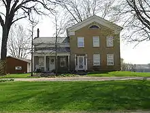 Townsend House |
May 17, 2005 (#05000111) |
117 N. Canyon Park Rd. 42°22′26″N 90°03′03″W |
Stockton | |
| 14 | Warren Commercial Historic District | 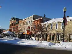 Warren Commercial Historic District |
November 7, 1995 (#95001241) |
102-165 E. Main St., 204-210 E. Bunett, 102-108 S. Railroad 42°29′45″N 89°59′15″W |
Warren | |
| 15 | Elihu Benjamin Washburne House | 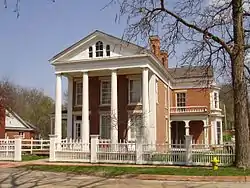 Elihu Benjamin Washburne House |
July 5, 1973 (#73000708) |
908 3rd St. 42°24′50″N 90°25′54″W |
Galena | |
| 16 | Charles Wenner House | 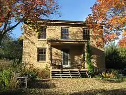 Charles Wenner House |
August 22, 1984 (#84001073) |
Rocky Rd. 42°27′40″N 90°24′39″W |
Galena | |
| 17 | W.E. White Building | 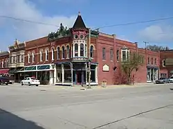 W.E. White Building |
November 7, 1997 (#97001339) |
100 N. Main St. 42°21′00″N 90°00′24″W |
Stockton |
See also
| Wikimedia Commons has media related to National Register of Historic Places in Jo Daviess County, Illinois. |
References
- The latitude and longitude information provided in this table was derived originally from the National Register Information System, which has been found to be fairly accurate for about 99% of listings. Some locations in this table may have been corrected to current GPS standards.
- "National Register of Historic Places: Weekly List Actions". National Park Service, United States Department of the Interior. Retrieved on February 5, 2021.
- Numbers represent an alphabetical ordering by significant words. Various colorings, defined here, differentiate National Historic Landmarks and historic districts from other NRHP buildings, structures, sites or objects.
- The eight-digit number below each date is the number assigned to each location in the National Register Information System database, which can be viewed by clicking the number.
- "Grant Propoosal: Wapello Land & Water Reserve Habitat Restoration Project Archived 2008-04-23 at the Wayback Machine". Illinois Department of Natural Resources, 2006, 2/18.
| Topics | |
|---|---|
| Lists by state |
|
| Lists by insular areas | |
| Lists by associated state | |
| Other areas | |
| Related | |
| |
Municipalities and communities of Jo Daviess County, Illinois, United States | ||
|---|---|---|
| Cities | Map of Illinois highlighting Jo Daviess County | |
| Villages | ||
| Townships | ||
| CDPs | ||
| Other unincorporated communities | ||
| Ghost town | ||
| ||
This article is issued from Wikipedia. The text is licensed under Creative Commons - Attribution - Sharealike. Additional terms may apply for the media files.