National Register of Historic Places listings in Lake County, Montana
This is a list of the National Register of Historic Places listings in Lake County, Montana. It is intended to be a complete list of the properties and districts on the National Register of Historic Places in Lake County, Montana, United States. The locations of National Register properties and districts for which the latitude and longitude coordinates are included below, may be seen in a map.[1]
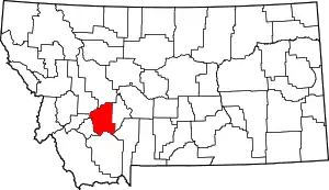
Location of Lake County in Montana
There are 10 properties and districts listed on the National Register in the county.
- This National Park Service list is complete through NPS recent listings posted January 29, 2021.[2]
Listings county-wide
| [3] | Name on the Register | Image | Date listed[4] | Location | City or town | Description |
|---|---|---|---|---|---|---|
| 1 | Big Arm School | 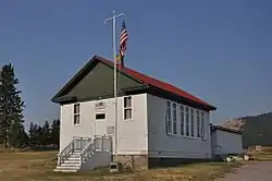 Big Arm School |
August 16, 2007 (#07000816) |
7th and D Sts. 47°47′48″N 114°17′41″W |
Big Arm | |
| 2 | Dayton State Bank | 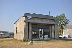 Dayton State Bank |
October 3, 2012 (#12000829) |
133 C St. 47°51′52″N 114°16′40″W |
Dayton | |
| 3 | Fort Connah Site | 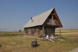 Fort Connah Site |
April 28, 1982 (#82003173) |
U.S. Route 93 47°24′20″N 114°05′14″W |
Post Creek | |
| 4 | Kootenai Lodge Historic District | January 17, 1984 (#84002476) |
Sunburst Dr. 48°01′16″N 113°58′33″W |
Bigfork | ||
| 5 | Frank Bird Linderman House | February 22, 1984 (#84002479) |
Address Restricted |
Lakeside | Lodge of writer and politician Frank Bird Linderman. | |
| 6 | Don E. Olsson House and Garage | 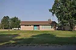 Don E. Olsson House and Garage |
January 15, 2009 (#08001325) |
503 4th Ave. SW. 47°31′29″N 114°06′11″W |
Ronan | |
| 7 | Polson Feed Mill | _NRHP_80002423_Lake_County%252C_MT.jpg.webp) Polson Feed Mill |
April 29, 1980 (#80002423) |
501 Main St. 47°41′28″N 114°09′44″W |
Polson | Demolished. |
| 8 | St. Ignatius Mission | _2002-05.jpg.webp) St. Ignatius Mission |
June 19, 1973 (#73001053) |
About 0.1 miles (0.16 km) southeast of U.S. Route 93 in St. Ignatius 47°18′54″N 114°06′07″W |
St. Ignatius | |
| 9 | St. Joseph's Catholic Church | _2.jpg.webp) St. Joseph's Catholic Church |
March 18, 1999 (#99000345) |
D'Aste Townsite 47°23′07″N 114°11′47″W |
Moiese | |
| 10 | Swan Lake Rock House Historic District | August 1, 1984 (#84002485) |
Off Montana Highway 83 47°57′18″N 113°53′33″W |
Swan Lake |
See also
References
- The latitude and longitude information provided in this table was derived originally from the National Register Information System, which has been found to be fairly accurate for about 99% of listings. Some locations in this table may have been corrected to current GPS standards.
- "National Register of Historic Places: Weekly List Actions". National Park Service, United States Department of the Interior. Retrieved on January 29, 2021.
- Numbers represent an alphabetical ordering by significant words. Various colorings, defined here, differentiate National Historic Landmarks and historic districts from other NRHP buildings, structures, sites or objects.
- The eight-digit number below each date is the number assigned to each location in the National Register Information System database, which can be viewed by clicking the number.
| Topics | |
|---|---|
| Lists by state |
|
| Lists by insular areas | |
| Lists by associated state | |
| Other areas | |
| Related | |
| |
Municipalities and communities of Lake County, Montana, United States | ||
|---|---|---|
| Cities | 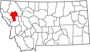 Lake County map | |
| Town | ||
| CDPs | ||
| Unincorporated community | ||
| Indian reservation | ||
| Footnotes | ‡This populated place also has portions in an adjacent county or counties | |
| ||
This article is issued from Wikipedia. The text is licensed under Creative Commons - Attribution - Sharealike. Additional terms may apply for the media files.