National Register of Historic Places listings in Lawrence County, South Dakota
This is a list of the National Register of Historic Places listings in Lawrence County, South Dakota.
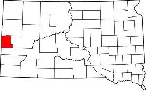
Location of Lawrence County in South Dakota
This is intended to be a complete list of the properties and districts on the National Register of Historic Places in Lawrence County, South Dakota, United States. The locations of National Register properties and districts for which the latitude and longitude coordinates are included below, may be seen in a map.[1]
There are 55 properties and districts listed on the National Register in the county, including 2 National Historic Landmarks.
- This National Park Service list is complete through NPS recent listings posted January 29, 2021.[2]
Current listings
| [3] | Name on the Register[4] | Image | Date listed[5] | Location | City or town | Description |
|---|---|---|---|---|---|---|
| 1 | Oliver N. Ainsworth House | 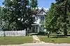 Oliver N. Ainsworth House |
October 25, 1990 (#90001646) |
340 Kansas 44°29′35″N 103°51′18″W |
Spearfish | part of the Architecture of Finnish Settlement Thematic Resource (TR) |
| 2 | Rasmus and Elemine Anderson Homestead Ranch | January 16, 2015 (#14001179) |
11753 Anderson Rd. 44°30′39″N 103°41′45″W |
St. Onge vicinity | ||
| 3 | Baker Bungalow | 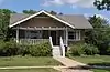 Baker Bungalow |
October 24, 1996 (#96001231) |
740 8th St. 44°29′29″N 103°51′19″W |
Spearfish | |
| 4 | Henry Buskala Ranch | November 13, 1985 (#85003488) |
FDR 206 44°12′27″N 103°48′11″W |
Dumont | part of the Architecture of Finnish Settlement TR | |
| 5 | Fayette Cook House | 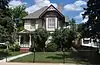 Fayette Cook House |
July 13, 1988 (#88000573) |
840 8th Ave. 44°29′33″N 103°51′20″W |
Spearfish | |
| 6 | James A. Corbin House | 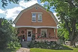 James A. Corbin House |
October 25, 1990 (#90001651) |
345 Main St. 44°29′11″N 103°51′28″W |
Spearfish | |
| 7 | Henry Court House |  Henry Court House |
October 25, 1990 (#90001652) |
329 Main St. 44°29′10″N 103°51′28″W |
Spearfish | |
| 8 | Dakota Tin and Gold Mine | June 8, 2005 (#05000592) |
20896 Fillmore Mine Ln. 44°22′23″N 104°02′02″W |
Spearfish | ||
| 9 | Deadwood Historic District | Deadwood Historic District |
October 15, 1966 (#66000716) |
Bounded by the city limits 44°22′19″N 103°44′00″W |
Deadwood | |
| 10 | Eleazer C. and Gwinnie Dickey House |  Eleazer C. and Gwinnie Dickey House |
July 13, 1989 (#89000824) |
735 8th St. 44°29′28″N 103°51′21″W |
Spearfish | |
| 11 | Walter Dickey House |  Walter Dickey House |
May 16, 1988 (#88000568) |
815 State St. 44°29′31″N 103°51′17″W |
Spearfish | |
| 12 | William D. Driskill House |  William D. Driskill House |
July 13, 1989 (#89000822) |
335 Canyon St. 44°29′10″N 103°51′39″W |
Spearfish | |
| 13 | Episcopal Church of All Angels | 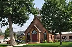 Episcopal Church of All Angels |
April 22, 1976 (#76001743) |
129 W. Michigan 44°29′38″N 103°51′38″W |
Spearfish | |
| 14 | Frawley Historic Ranch | 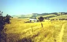 Frawley Historic Ranch |
December 31, 1974 (#74001893) |
6 miles (9.7 km) east of Spearfish on U.S. Route 14 44°28′30″N 103°42′38″W |
Spearfish | |
| 15 | Galena School | November 30, 1999 (#99001435) |
Block 13, Lots 1-5 Bryan Placer No. 913 44°19′42″N 103°38′47″W |
Galena | part of the Schools in South Dakota Multiple Property Submission (MPS) | |
| 16 | Halloran-Matthews-Brady House |  Halloran-Matthews-Brady House |
December 12, 1976 (#76001744) |
214 E. Jackson St. 44°29′30″N 103°51′26″W |
Spearfish | |
| 17 | Solomon and Martha Hann Homestead | March 14, 2019 (#100003444) |
21732 Hann Pl. 44°15′07″N 103°39′44″W |
Nemo vicinity | ||
| 18 | Hardy Guard Station | October 18, 2011 (#11000746) |
22107 US 85 44°11′54″N 104°02′14″W |
Lead | ||
| 19 | Jerome and Jonetta Harvey Homestead Cabin | September 12, 2008 (#08000885) |
Township 3, Range 2, Track A of Homestead Entry Survey 71 44°11′59″N 103°49′10″W |
Lead | ||
| 20 | Arthur Hewes House | 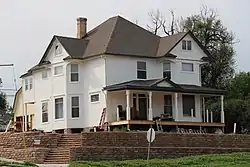 Arthur Hewes House |
October 25, 1990 (#90001650) |
811 St. Joe 44°29′29″N 103°52′07″W |
Spearfish | |
| 21 | John Hill Ranch-Keltomaki | November 13, 1985 (#85003489) |
Northeast of Brownsville 44°17′11″N 103°39′11″W |
Brownsville | part of the Architecture of Finnish Settlement TR | |
| 22 | Homestake Workers House |  Homestake Workers House |
November 1, 1991 (#91001620) |
830 State St. 44°29′32″N 103°51′15″W |
Spearfish | |
| 23 | Jackson Boulevard Historic District | March 11, 2019 (#100003440) |
Several blks. around E. Jackson Blvd., generally bounded by N. 7th, N. 10th, E. Kansas & E. Hudson Sts. 44°29′30″N 103°51′20″W |
Spearfish | ||
| 24 | Henry Keets House |  Henry Keets House |
July 13, 1988 (#88000572) |
344 E. Illinois 44°29′27″N 103°51′16″W |
Spearfish | |
| 25 | Webb S. Knight House | 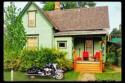 Webb S. Knight House |
July 13, 1989 (#89000823) |
514 7th St. 44°29′19″N 103°51′22″W |
Spearfish | |
| 26 | Kroll Meat Market and Slaughterhouse |  Kroll Meat Market and Slaughterhouse |
May 20, 1988 (#88000576) |
Spearfish city park 44°29′06″N 103°51′38″W |
Spearfish | |
| 27 | Lead Historic District | 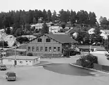 Lead Historic District |
December 31, 1974 (#74001892) |
Roughly bounded by the city limits 44°21′06″N 103°45′45″W |
Lead | |
| 28 | William Ernest Lown House |  William Ernest Lown House |
May 28, 1976 (#76001745) |
745 5th St. 44°29′26″N 103°51′38″W |
Spearfish | |
| 29 | The Mail Building |  The Mail Building |
May 16, 1988 (#88000574) |
731 Main St. 44°29′26″N 103°51′32″W |
Spearfish | |
| 30 | McLaughlin Ranch Barn | February 14, 2002 (#02000025) |
410 N. Rainbow Rd. 44°28′46″N 103°46′06″W |
Spearfish | ||
| 31 | Mount Theodore Roosevelt Monument | 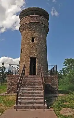 Mount Theodore Roosevelt Monument |
December 22, 2005 (#05001457) |
Black Hills National Forest 44°23′53″N 103°45′33″W |
Deadwood | |
| 32 | Nemo School House |  Nemo School House |
July 17, 1996 (#96000747) |
12743 Nemo Rd.[6] 44°13′29″N 103°34′38″W |
Nemo | |
| 33 | Old Finnish Lutheran Church | 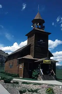 Old Finnish Lutheran Church |
November 13, 1985 (#85003487) |
Sinking Gardens, E. Main St. 44°21′09″N 103°45′50″W |
Lead | part of the Architecture of Finnish Settlement TR |
| 34 | Thomas Quillian House | 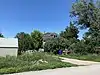 Thomas Quillian House |
November 1, 1991 (#91001618) |
W. Center St. 44°32′49″N 103°43′23″W |
Saint Onge | |
| 35 | Old Redwater Bridge | December 9, 1993 (#93001300) |
Local road over the Redwater River 44°35′24″N 103°51′22″W |
Spearfish | part of the Historic Bridges in South Dakota MPS | |
| 36 | Pearson Cabin | August 14, 2012 (#12000514) |
0.33 miles (0.53 km) southeast of the junction of Radio Rd. & US 14 44°23′00″N 103°39′43″W |
Deadwood vicinity | ||
| 37 | Almira Riley House | 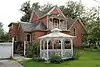 Almira Riley House |
July 13, 1989 (#89000825) |
938 Ames 44°29′35″N 103°52′04″W |
Spearfish | |
| 38 | St. Lawrence O'Toole Catholic Church | 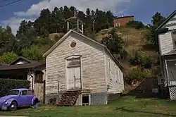 St. Lawrence O'Toole Catholic Church |
February 5, 2003 (#02001764) |
618 Main 44°22′10″N 103°45′58″W |
Central City | |
| 39 | St. Onge Schoolhouse | 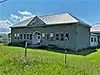 St. Onge Schoolhouse |
May 7, 1980 (#80003727) |
Off Highway 24 44°32′47″N 103°43′26″W |
Saint Onge | |
| 40 | Saint Onge State Bank | 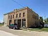 Saint Onge State Bank |
October 26, 2005 (#05001190) |
214 Center St. 44°32′56″N 103°43′14″W |
Saint Onge | |
| 41 | Spearfish City Hall |  Spearfish City Hall |
October 25, 1990 (#90001649) |
722 Main St. 44°29′27″N 103°51′31″W |
Spearfish | |
| 42 | Spearfish Filling Station | 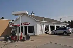 Spearfish Filling Station |
May 16, 1988 (#88000567) |
706 Main St. 44°29′25″N 103°51′30″W |
Spearfish | |
| 43 | Spearfish Fisheries Center | 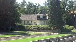 Spearfish Fisheries Center |
May 19, 1978 (#78003438) |
South of Spearfish off U.S. Route 14 44°28′52″N 103°51′36″W |
Spearfish | |
| 44 | Spearfish Historic Commercial District | 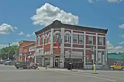 Spearfish Historic Commercial District |
June 5, 1975 (#75001718) |
544, 545, 603-645 Main St., 114-136 W. Illinois St., and 701-703 5th St. 44°29′22″N 103°51′32″W |
Spearfish | Boundary decrease approved November 2, 2017. |
| 45 | Spearfish Rest Stop Tipi | 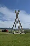 Spearfish Rest Stop Tipi |
January 20, 2015 (#14001180) |
Mi. 1, I-90 44°32′42″N 104°02′03″W |
Spearfish vicinity | |
| 46 | Old Spearfish Post Office |  Old Spearfish Post Office |
February 12, 1999 (#99000205) |
526 Main St. 44°28′13″N 103°51′30″W |
Spearfish | part of the Federal Relief Construction in South Dakota MPS |
| 47 | Tomahawk Lake Country Club | 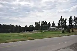 Tomahawk Lake Country Club |
October 26, 2005 (#05001191) |
U.S. Route 385 44°17′27″N 103°41′07″W |
Deadwood | |
| 48 | Toomey House |  Toomey House |
November 7, 1997 (#97001390) |
1011 Main St. 44°29′36″N 103°51′35″W |
Spearfish | |
| 49 | Otto L. Uhlig House |  Otto L. Uhlig House |
July 13, 1989 (#89000827) |
230 Jackson 44°29′30″N 103°51′23″W |
Spearfish | |
| 50 | Walsh Barn | May 30, 2003 (#03000500) |
0.5 miles (0.80 km) west of the junction of Upper Redwater Rd. and 104th Ave. 44°34′47″N 103°59′19″W |
Spearfish | ||
| 51 | Walton Ranch | 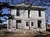 Walton Ranch |
May 30, 2005 (#05000036) |
221 Upper Valley Rd. 44°30′38″N 103°52′50″W |
Spearfish | |
| 52 | Whitewood Historic District | June 8, 2007 (#07000529) |
1005-1021 Meade St. 44°27′46″N 103°38′23″W |
Whitewood | ||
| 53 | Mary Whitney House |  Mary Whitney House |
October 25, 1990 (#90001647) |
704 8th St. 44°29′27″N 103°51′19″W |
Spearfish | |
| 54 | John Wolzmuth House |  John Wolzmuth House |
July 13, 1988 (#88000562) |
814 8th Ave. 44°29′31″N 103°51′20″W |
Spearfish | |
| 55 | Woodmen Hall | 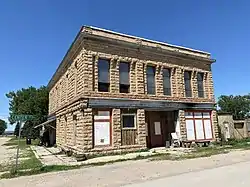 Woodmen Hall |
November 14, 1991 (#91001619) |
Junction of Center and 2nd Sts. 44°32′49″N 103°43′12″W |
Saint Onge |
Former listings
| [3] | Name on the Register | Image | Date listed | Date removed | Location | City or town | Summary |
|---|---|---|---|---|---|---|---|
| 1 | Robert H. Evans House | November 1, 1991 (#91001621) | February 25, 2009 | 258 Evans Ln. 44°30′25″N 103°52′06″W |
Spearfish | ||
| 2 | Selbie Building | November 6, 1986 (#86003013) | November 9, 2001 | 1101 Meade |
Whitewood | ||
| 3 | James Sunderland House | 1990 (#90001648) | June 1, 2006 | 711 Canyon |
Spearfish | ||
| 4 | Benjamin F. Walters House | July 13, 1989 (#89000826) | March 27, 1997 | 740 Seventh St. 44°29′26″N 103°51′27″W |
Spearfish |
See also
| Wikimedia Commons has media related to National Register of Historic Places in Lawrence County, South Dakota. |
References
- The latitude and longitude information provided in this table was derived originally from the National Register Information System, which has been found to be fairly accurate for about 99% of listings. Some locations in this table may have been corrected to current GPS standards.
- "National Register of Historic Places: Weekly List Actions". National Park Service, United States Department of the Interior. Retrieved on January 29, 2021.
- Numbers represent an alphabetical ordering by significant words. Various colorings, defined here, differentiate National Historic Landmarks and historic districts from other NRHP buildings, structures, sites or objects.
- "National Register Information System". National Register of Historic Places. National Park Service. April 24, 2008.
- The eight-digit number below each date is the number assigned to each location in the National Register Information System database, which can be viewed by clicking the number.
- Address from Nemo School House web site
| Topics | |
|---|---|
| Lists by state |
|
| Lists by insular areas | |
| Lists by associated state | |
| Other areas | |
| Related | |
| |
Municipalities and communities of Lawrence County, South Dakota, United States | ||
|---|---|---|
| Cities | | |
| Township | ||
| CDPs | ||
| Other unincorporated communities | ||
| Ghost towns | ||
| ||
This article is issued from Wikipedia. The text is licensed under Creative Commons - Attribution - Sharealike. Additional terms may apply for the media files.