National Register of Historic Places listings in Lincoln County, Nebraska
This is a list of the National Register of Historic Places listings in Lincoln County, Nebraska. It is intended to be a complete list of the properties and districts on the National Register of Historic Places in Lincoln County, Nebraska, United States. The locations of National Register properties and districts for which the latitude and longitude coordinates are included below, may be seen in a map.[1]
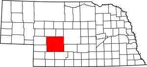
Location of Lincoln County in Nebraska
There are 10 properties and districts listed on the National Register in the county, one of which is a National Historic Landmark.
- This National Park Service list is complete through NPS recent listings posted January 29, 2021.[2]
Current listings
| [3] | Name on the Register[4] | Image | Date listed[5] | Location | City or town | Description |
|---|---|---|---|---|---|---|
| 1 | Fort McPherson National Cemetery | 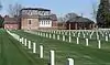 Fort McPherson National Cemetery |
March 7, 2012 (#12000075) |
12004 S. Spur 56A 41°01′33″N 100°31′30″W |
Maxwell vicinity | |
| 2 | Fox Theatre | 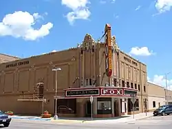 Fox Theatre |
May 9, 1985 (#85000957) |
301 E. 5th 41°08′14″N 100°45′36″W |
North Platte | |
| 3 | Hotel Yancey | 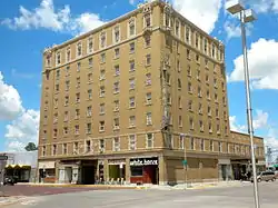 Hotel Yancey |
May 9, 1985 (#85000956) |
221 E. 5th St. 41°08′15″N 100°45′37″W |
North Platte | |
| 4 | Johnston Memorial Building | 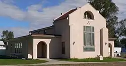 Johnston Memorial Building |
March 20, 1986 (#86000473) |
Off Nebraska Highway 25 40°50′22″N 101°09′52″W |
Wallace | |
| 5 | Lincoln County Courthouse | 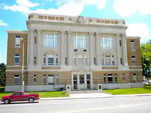 Lincoln County Courthouse |
January 10, 1990 (#89002224) |
301 N. Jeffers St. 41°08′10″N 100°45′45″W |
North Platte | |
| 6 | North Platte Commercial Historic District | July 1, 2020 (#100005338) |
South: 4th St. to Front St., Vine St. to Chestnut St. North: 7th St. to 9th St., Vine St. to Dewey St. 41°08′15″N 100°45′42″W |
North Platte | ||
| 7 | North Platte US Post Office and Federal Building | 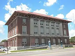 North Platte US Post Office and Federal Building |
March 4, 2009 (#09000071) |
416 North Jeffers Street 41°08′12″N 100°45′48″W |
North Platte | |
| 8 | O'Fallons Bluff | 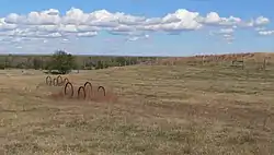 O'Fallons Bluff |
July 12, 1974 (#74001127) |
Southeast of Sutherland 41°08′11″N 101°05′41″W |
Sutherland | |
| 9 | Scout's Rest Ranch | 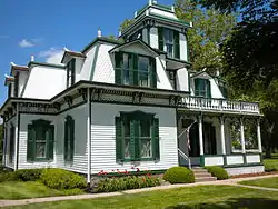 Scout's Rest Ranch |
January 30, 1978 (#78001705) |
Northwest of North Platte off U.S. Route 30 41°09′48″N 100°47′42″W |
North Platte | Designated a National Historic Landmark in 2021. |
| 10 | Sutherland State Aid Bridge | 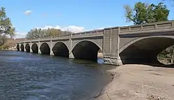 Sutherland State Aid Bridge |
June 29, 1992 (#92000705) |
County road over the North Platte River, 4.2 miles (6.8 km) north of Sutherland 41°12′36″N 101°07′02″W |
Sutherland |
See also
| Wikimedia Commons has media related to National Register of Historic Places in Lincoln County, Nebraska. |
References
- The latitude and longitude information provided in this table was derived originally from the National Register Information System, which has been found to be fairly accurate for about 99% of listings. Some locations in this table may have been corrected to current GPS standards.
- "National Register of Historic Places: Weekly List Actions". National Park Service, United States Department of the Interior. Retrieved on January 29, 2021.
- Numbers represent an alphabetical ordering by significant words. Various colorings, defined here, differentiate National Historic Landmarks and historic districts from other NRHP buildings, structures, sites or objects.
- "National Register Information System". National Register of Historic Places. National Park Service. March 13, 2009.
- The eight-digit number below each date is the number assigned to each location in the National Register Information System database, which can be viewed by clicking the number.
| Topics | |
|---|---|
| Lists by state |
|
| Lists by insular areas | |
| Lists by associated state | |
| Other areas | |
| Related | |
| |
Municipalities and communities of Lincoln County, Nebraska, United States | ||
|---|---|---|
| City | Map of Nebraska highlighting Lincoln County | |
| Villages | ||
| Unincorporated communities | ||
| ||
This article is issued from Wikipedia. The text is licensed under Creative Commons - Attribution - Sharealike. Additional terms may apply for the media files.