National Register of Historic Places listings in Lyman County, South Dakota
This is a list of the National Register of Historic Places listings in Lyman County, South Dakota.
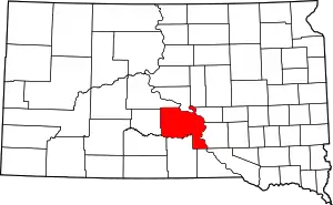
Location of Lyman County in South Dakota
This is intended to be a complete list of the properties and districts on the National Register of Historic Places in Lyman County, South Dakota, United States. The locations of National Register properties and districts for which the latitude and longitude coordinates are included below, may be seen in a map.[1]
There are 9 properties and districts listed on the National Register in the county, including 1 National Historic Landmark.
- This National Park Service list is complete through NPS recent listings posted January 29, 2021.[2]
Current listings
| [3] | Name on the Register[4] | Image | Date listed[5] | Location | City or town | Description |
|---|---|---|---|---|---|---|
| 1 | Burnt Prairie Site (39LM207) |  Burnt Prairie Site (39LM207) |
August 14, 1986 (#86002735) |
Address Restricted |
Lower Brule | |
| 2 | Dinehart Village Archeological Site | Dinehart Village Archeological Site |
June 2, 2003 (#03000501) |
Address Restricted |
Oacoma | |
| 3 | Fort Lookout IV | Fort Lookout IV |
December 31, 1990 (#90001940) |
Address Restricted |
Oacoma | |
| 4 | Iron Nation's Gravesite | February 24, 2014 (#14000032) |
Messiah Cemetery, Iron Nation District, Lower Brule Sioux Reservation 44°06′03″N 99°44′15″W |
Lower Brule | ||
| 5 | Jiggs Thompson Site (39LM208) | Jiggs Thompson Site (39LM208) |
August 14, 1986 (#86002734) |
Address Restricted |
Lower Brule | |
| 6 | King Archeological Site | King Archeological Site |
June 2, 2003 (#03000502) |
Address Restricted |
Oacoma | |
| 7 | Langdeau Site | Langdeau Site |
October 15, 1966 (#66000717) |
Address Restricted |
Lower Brule | |
| 8 | Medicine Creek Archeological District | Medicine Creek Archeological District |
August 14, 1986 (#86002740) |
Address Restricted |
Lower Brule | Extends into Hughes County |
| 9 | Edgar Vernon House | March 30, 1978 (#78002562) |
Off U.S. Route 16 43°54′29″N 100°03′02″W |
Presho |
Former listings
| [3] | Name on the Register | Image | Date listed | Date removed | Location | City or town | Summary |
|---|---|---|---|---|---|---|---|
| 1 | Lower Brule Agency House | November 21, 1980 (#80003728) | September 17, 2008 | 1st St. and Lichtenstien Ave. |
Oacoma |
See also
References
- The latitude and longitude information provided in this table was derived originally from the National Register Information System, which has been found to be fairly accurate for about 99% of listings. Some locations in this table may have been corrected to current GPS standards.
- "National Register of Historic Places: Weekly List Actions". National Park Service, United States Department of the Interior. Retrieved on January 29, 2021.
- Numbers represent an alphabetical ordering by significant words. Various colorings, defined here, differentiate National Historic Landmarks and historic districts from other NRHP buildings, structures, sites or objects.
- "National Register Information System". National Register of Historic Places. National Park Service. April 24, 2008.
- The eight-digit number below each date is the number assigned to each location in the National Register Information System database, which can be viewed by clicking the number.
| Topics | |
|---|---|
| Lists by state |
|
| Lists by insular areas | |
| Lists by associated state | |
| Other areas | |
| Related | |
| |
Municipalities and communities of Lyman County, South Dakota, United States | ||
|---|---|---|
| City | | |
| Towns | ||
| CDPs | ||
| Unincorporated communities | ||
| Indian reservations | ||
| Ghost town | ||
| Footnotes | ‡This populated place also has portions in an adjacent county or counties | |
| ||
This article is issued from Wikipedia. The text is licensed under Creative Commons - Attribution - Sharealike. Additional terms may apply for the media files.