National Register of Historic Places listings in Macon County, Illinois
This is a list of the National Register of Historic Places listings in Macon County, Illinois.
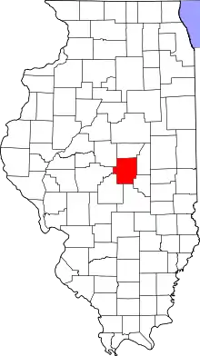
Location of Macon County in Illinois
This is intended to be a complete list of the properties and districts on the National Register of Historic Places in Macon County, Illinois, United States. Latitude and longitude coordinates are provided for many National Register properties and districts; these locations may be seen together in a map.[1]
There are 10 properties and districts listed on the National Register in the county. Another property was once listed but has been removed.
- This National Park Service list is complete through NPS recent listings posted February 5, 2021.[2]
Current listings
| [3] | Name on the Register | Image | Date listed[4] | Location | City or town | Description |
|---|---|---|---|---|---|---|
| 1 | Decatur Downtown Historic District | 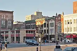 Decatur Downtown Historic District |
May 9, 1985 (#85001011) |
Merchant St. roughly bounded by North, Water, Wood, and Church Sts. 39°50′32″N 88°57′20″W |
Decatur | |
| 2 | Decatur Historic District | 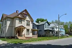 Decatur Historic District |
November 7, 1976 (#76000719) |
Roughly bounded by Hayward, Eldorado, Church, and Lincoln Park Dr. 39°50′32″N 88°57′48″W |
Decatur | |
| 3 | James Millikin House |  James Millikin House |
December 3, 1974 (#74000765) |
125 N. Pine St. 39°50′31″N 88°58′01″W |
Decatur | |
| 4 | Roosevelt Junior High School |  Roosevelt Junior High School |
May 9, 2002 (#02000462) |
701 W. Grand Ave. 39°51′16″N 88°57′55″W |
Decatur | |
| 5 | Transfer House | Transfer House |
December 3, 2002 (#02000843) |
1 Central Park East 39°50′33″N 88°57′12″W |
Decatur | |
| 6 | Trobaugh-Good House | 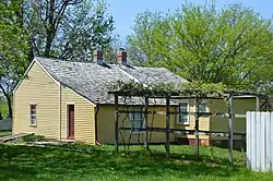 Trobaugh-Good House |
August 1, 1996 (#96000858) |
1495 Brozio Ln. 39°49′24″N 89°00′42″W |
Decatur | |
| 7 | Eli Ulery House |  Eli Ulery House |
October 1, 1979 (#79000854) |
Southeast of Mount Zion on County Route 60 39°45′49″N 88°50′06″W |
Mount Zion | |
| 8 | Union Church | 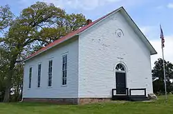 Union Church |
September 23, 1999 (#99000588) |
2.5 miles southeast of Oreana, on Kirby Rd. 39°55′13″N 88°50′53″W |
Oreana | |
| 9 | Wabash Railroad Station and Railway Express Agency | 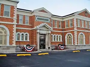 Wabash Railroad Station and Railway Express Agency |
February 4, 1994 (#94000029) |
780 E. Cerro Gordo St. 39°50′50″N 88°56′47″W |
Decatur | |
| 10 | West End Historic District | 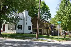 West End Historic District |
November 27, 2002 (#02001444) |
Roughly bounded by S. Fairview Ave., Park Place, Fairview Park, Westdale Ave., W. Main St., Glencoe Ave., Sunset Ave. 39°50′24″N 88°59′04″W |
Decatur |
Former listing
| [3] | Name on the Register | Image | Date listed | Date removed | Location | City or town | Summary |
|---|---|---|---|---|---|---|---|
| 1 | Decatur and Macon County Welfare Home for Girls | August 12, 1999 (#990000982) | August 14, 2004 | 736 S. Martin Luther King Jr. Dr. |
Decatur | Also known as Webster Hall. Demolished December 10, 2003.[5] | |
| 2 | Millikin Building | July 24, 1979 (#79000853) | July 24, 1980 | 100 N. Water St. |
Decatur |
See also
| Wikimedia Commons has media related to National Register of Historic Places in Macon County, Illinois. |
References
- The latitude and longitude information provided in this table was derived originally from the National Register Information System, which has been found to be fairly accurate for about 99% of listings. Some locations in this table may have been corrected to current GPS standards.
- "National Register of Historic Places: Weekly List Actions". National Park Service, United States Department of the Interior. Retrieved on February 5, 2021.
- Numbers represent an alphabetical ordering by significant words. Various colorings, defined here, differentiate National Historic Landmarks and historic districts from other NRHP buildings, structures, sites or objects.
- The eight-digit number below each date is the number assigned to each location in the National Register Information System database, which can be viewed by clicking the number.
| Topics | |
|---|---|
| Lists by state |
|
| Lists by insular areas | |
| Lists by associated state | |
| Other areas | |
| Related | |
| |
Municipalities and communities of Macon County, Illinois, United States | ||
|---|---|---|
| Cities | Map of Illinois highlighting Macon County | |
| Villages | ||
| Townships | ||
| CDP | ||
| Other unincorporated communities |
| |
| Ghost towns |
| |
| ||
This article is issued from Wikipedia. The text is licensed under Creative Commons - Attribution - Sharealike. Additional terms may apply for the media files.