National Register of Historic Places listings in Minnehaha County, South Dakota
This is a list of the National Register of Historic Places listings in Minnehaha County, South Dakota.
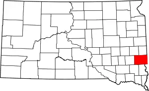
Location of Minnehaha County in South Dakota
This is intended to be a complete list of the properties and districts on the National Register of Historic Places in Minnehaha County, South Dakota, United States. The locations of National Register properties and districts for which the latitude and longitude coordinates are included below, may be seen in a map.[1]
There are 103 properties and districts listed on the National Register in the county. Five other properties were once listed but have been removed.
- This National Park Service list is complete through NPS recent listings posted January 29, 2021.[2]
Current listings
| [3] | Name on the Register[4] | Image | Date listed[5] | Location | City or town | Description |
|---|---|---|---|---|---|---|
| 1 | All Saints Historic District | 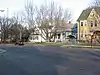 All Saints Historic District |
February 23, 1984 (#84003349) |
Roughly Main to 2nd Ave. from 14th to 23rd Sts., and 18th to 21st Sts. to 5th Ave. 43°32′11″N 96°43′30″W |
Sioux Falls | |
| 2 | All Saints School Main Building | 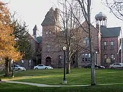 All Saints School Main Building |
March 14, 1973 (#73001748) |
101 W. 17th St. 43°32′14″N 96°43′40″W |
Sioux Falls | |
| 3 | Augustana College Historic Buildings | 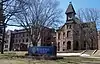 Augustana College Historic Buildings |
March 25, 1977 (#77001250) |
29th and S. Summit Sts. 43°31′34″N 96°44′12″W |
Sioux Falls | |
| 4 | Austin-Olson Farm | December 14, 1995 (#95001474) |
24993 465th Ave. 43°45′46″N 96°54′42″W |
Colton | ||
| 5 | Berdahl-Rolvaag House |  Berdahl-Rolvaag House |
January 23, 1979 (#79002405) |
1009 W. 33rd St. 43°31′14″N 96°44′21″W |
Sioux Falls | |
| 6 | Berg and Estensen Store |  Berg and Estensen Store |
November 8, 2001 (#01001224) |
110 Zeliff Ave. 43°45′29″N 96°28′33″W |
Sherman | |
| 7 | Marion E. Bowen House |  Marion E. Bowen House |
May 28, 1976 (#76001748) |
840 W. 9th St. 43°32′50″N 96°44′16″W |
Sioux Falls | |
| 8 | Brandon Village | June 14, 2001 (#01000664) |
Address Restricted |
Brandon | ||
| 9 | Bridge at Iverson Crossing |  Bridge at Iverson Crossing |
July 17, 1996 (#96000746) |
48054 266th St. 43°31′44″N 96°36′02″W |
Brandon | |
| 10 | Brooks Brothers Home | 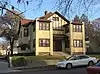 Brooks Brothers Home |
October 24, 1996 (#96001225) |
1006-1008 South Dakota Ave. 43°32′10″N 96°43′45″W |
Sioux Falls | |
| 11 | Margaret Burger Apartment House | January 4, 2021 (#100005893) |
619 South Main Ave. 43°32′26″N 96°43′42″W |
Sioux Falls | ||
| 12 | Building at 330 South 1st Avenue | 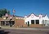 Building at 330 South 1st Avenue |
January 23, 2013 (#12001217) |
330 S. 1st Avenue[6] 43°32′38″N 96°43′30″W |
Sioux Falls | |
| 13 | Building at 529 North Main | 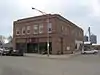 Building at 529 North Main |
January 14, 2005 (#04001489) |
529 N. Main Ave. 43°43′04″N 96°30′11″W |
Garretson | |
| 14 | Gina Smith Campbell Bathhouse | 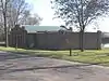 Gina Smith Campbell Bathhouse |
February 13, 1986 (#86000246) |
City Park, Beach Ave. extension 43°49′12″N 96°42′06″W |
Dell Rapids | |
| 15 | Carnegie Free Public Library | 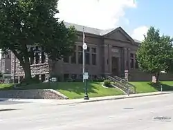 Carnegie Free Public Library |
March 14, 1973 (#73001750) |
235 W. 10th St. 43°32′45″N 96°43′46″W |
Sioux Falls | |
| 16 | Carnegie Public Library | 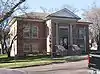 Carnegie Public Library |
February 13, 1986 (#86000247) |
513 N. Orleans 43°49′30″N 96°42′36″W |
Dell Rapids | |
| 17 | Carpenter Hotel | 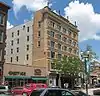 Carpenter Hotel |
August 13, 1986 (#86001499) |
221 S. Phillips Ave. 43°32′43″N 96°43′36″W |
Sioux Falls | |
| 18 | Cathedral Historic District | 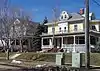 Cathedral Historic District |
June 5, 1974 (#74001896) |
Bounded by W. 4th and 10th Sts., Spring, Prairie, and Summit Aves. 43°33′00″N 96°44′06″W |
Sioux Falls | Known as the Sioux Falls Historic District until 2011 |
| 19 | Central Fire Station | 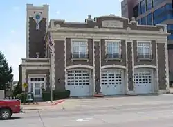 Central Fire Station |
May 27, 1980 (#80003730) |
100 S. Minnesota Ave. 43°32′49″N 96°43′51″W |
Sioux Falls | |
| 20 | Cherry Rock Park Bridge | 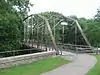 Cherry Rock Park Bridge |
May 30, 2003 (#03000499) |
Cherry Rock Park 43°32′16″N 96°42′17″W |
Sioux Falls | |
| 21 | Edward Coughran House | 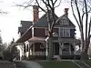 Edward Coughran House |
May 28, 1976 (#76001749) |
1203 S. 1st Ave. 43°32′04″N 96°43′31″W |
Sioux Falls | |
| 22 | E.J. and Alice Daniels House | 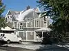 E.J. and Alice Daniels House |
October 19, 1989 (#89001724) |
3901 S. Hawthorne 43°30′34″N 96°44′56″W |
Sioux Falls | |
| 23 | Dell Rapids Amphitheater | 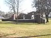 Dell Rapids Amphitheater |
February 15, 2002 (#02000020) |
City park 43°49′15″N 96°42′11″W |
Dell Rapids | |
| 24 | Dell Rapids Bridge | 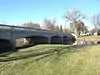 Dell Rapids Bridge |
August 5, 1999 (#99000952) |
Local road over the Big Sioux River 43°49′12″N 96°42′35″W |
Dell Rapids | Also known as the South Dakota Department of Transportation Bridge 50-210-018. Bridge was added again in January 2000 under a separate duplicate NRHP listing, ID#00000021. Entire bridge replaced in 2014. |
| 25 | Dell Rapids Historic District | 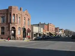 Dell Rapids Historic District |
February 23, 1978 (#78002563) |
335-536 E. 4th St. 43°49′24″N 96°42′36″W |
Dell Rapids | |
| 26 | Dell Rapids Residential Historic District | 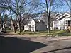 Dell Rapids Residential Historic District |
October 12, 2000 (#00001224) |
Roughly bounded by Orleans Ave., 4th St., and 7th St. 43°49′30″N 96°42′17″W |
Dell Rapids | |
| 27 | Dell Rapids Warming House | February 27, 2017 (#100000691) |
State Ave. 43°49′16″N 96°42′30″W |
Dell Rapids | Warming hut used by ice skaters on the Big Sioux River | |
| 28 | Dell Rapids Water Tower | 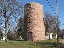 Dell Rapids Water Tower |
February 23, 1984 (#84003356) |
10th and Orleans 43°49′47″N 96°42′32″W |
Dell Rapids | |
| 29 | Harrison DeLong House | 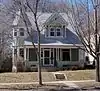 Harrison DeLong House |
October 12, 2000 (#00001221) |
621 S. Main 43°32′27″N 96°43′41″W |
Sioux Falls | |
| 30 | East Site Fire Station and Branch Library | 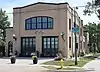 East Site Fire Station and Branch Library |
June 26, 2019 (#100004124) |
600 E. 7th St. 43°33′00″N 96°43′10″W |
Sioux Falls | |
| 31 | Eighth Street Bridge | Eighth Street Bridge |
December 9, 1993 (#93001308) |
S. 8th St. over the Big Sioux River 43°32′55″N 96°43′31″W |
Sioux Falls | |
| 32 | Farley-Loetscher Company Building | 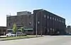 Farley-Loetscher Company Building |
January 26, 2001 (#01000020) |
701-705 E. 8th St. 43°32′54″N 96°43′05″W |
Sioux Falls | |
| 33 | Farley-Loetscher Company Building I | 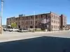 Farley-Loetscher Company Building I |
February 5, 2003 (#02001766) |
322 and 324 E. 8th St. 43°32′55″N 96°43′51″W |
Sioux Falls | |
| 34 | Federal Building and U.S. Courthouse | 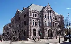 Federal Building and U.S. Courthouse |
May 2, 1974 (#74001894) |
400 S. Phillips Ave. 43°32′36″N 96°43′33″W |
Sioux Falls | |
| 35 | First Congregational Church | 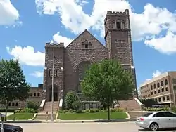 First Congregational Church |
August 18, 1983 (#83003012) |
303 S. Dakota Ave. 43°32′40″N 96°43′48″W |
Sioux Falls | |
| 36 | First National Bank of Garretson | November 2, 2011 (#11000787) |
605 Main St. 43°42′59″N 96°30′10″W |
Garretson | ||
| 37 | Josephine Martin Glidden Memorial Chapel | 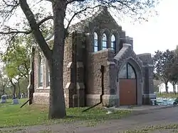 Josephine Martin Glidden Memorial Chapel |
September 25, 1987 (#87001732) |
2121 E. 12th St. 43°32′37″N 96°41′58″W |
Sioux Falls | |
| 38 | Glidden-Martin Hall | 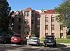 Glidden-Martin Hall |
November 8, 2000 (#00001350) |
1101 W. 22nd Ave. 43°31′58″N 96°44′19″W |
Sioux Falls | |
| 39 | The Gloria House | 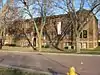 The Gloria House |
July 20, 2000 (#00000828) |
1216 S. Center Ave. 43°32′03″N 96°43′42″W |
Sioux Falls | |
| 40 | Grand Lodge and Library of the Ancient Free and Accepted Masons | 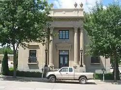 Grand Lodge and Library of the Ancient Free and Accepted Masons |
May 28, 1976 (#76001750) |
415 S. Main Ave. 43°32′34″N 96°43′42″W |
Sioux Falls | |
| 41 | Hayes Historic District |  Hayes Historic District |
February 14, 2006 (#06000049) |
Roughly bounded by W. 22nd St. to W. 26th St. and by South Dakota Ave. to S. Phillips Ave. 43°32′04″N 96°43′43″W |
Sioux Falls | |
| 42 | Orlan A. Hayward House | 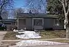 Orlan A. Hayward House |
December 2, 1998 (#98001406) |
1509 S. Glendale 43°32′27″N 96°44′42″W |
Sioux Falls | |
| 43 | Hans J. Hilmoe Barn | June 28, 2010 (#10000410) |
47170 Homestead St. 43°46′06″N 96°46′35″W |
Baltic vicinity | Built in 1911 by Norwegian immigrants[7] | |
| 44 | Andrew O. Huseboe House | 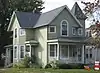 Andrew O. Huseboe House |
July 13, 1988 (#88000569) |
223 S. Prairie Ave. 43°32′44″N 96°44′14″W |
Sioux Falls | |
| 45 | Illinois Central Passenger Depot | 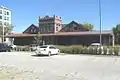 Illinois Central Passenger Depot |
August 18, 1983 (#83003013) |
Big Sioux River at 8th St. 43°32′58″N 96°43′24″W |
Sioux Falls | |
| 46 | Jorden Hall | 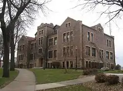 Jorden Hall |
November 8, 2000 (#00001349) |
1101 W. 22nd St. 43°31′56″N 96°44′19″W |
Sioux Falls | |
| 47 | Andrew Kuehn Warehouse | 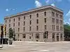 Andrew Kuehn Warehouse |
February 25, 1982 (#82003933) |
401 N. Phillips Ave. 43°33′05″N 96°43′37″W |
Sioux Falls | |
| 48 | L & A Baking Company | 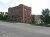 L & A Baking Company |
November 20, 2007 (#07001214) |
910 N. Main Ave. 43°33′29″N 96°43′39″W |
Sioux Falls | |
| 49 | LaSalle Apartments | 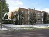 LaSalle Apartments |
September 14, 1998 (#98001125) |
703 S. Summit 43°32′38″N 96°44′09″W |
Sioux Falls | |
| 50 | Daniel Lund House | 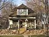 Daniel Lund House |
February 18, 2000 (#00000123) |
628 W. 20th 43°32′07″N 96°43′59″W |
Sioux Falls | |
| 51 | McKennan Park Historic District | 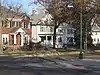 McKennan Park Historic District |
June 6, 1984 (#84003359) |
McKennan Park, 2nd and 4th Aves. from 21st to 26th Sts., and 21st St. from Phillips to 7th Aves.; also roughly bounded by 1st Ave., S., Phillips Ave., 24th St., E., and 26th St. 43°31′56″N 96°43′17″W |
Sioux Falls | Second set of boundaries represents a boundary increase |
| 52 | L.D. Miller Funeral Home | 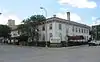 L.D. Miller Funeral Home |
August 18, 1983 (#83003014) |
507 S. Main Ave. 43°32′33″N 96°43′42″W |
Sioux Falls | |
| 53 | William G. Milne House | 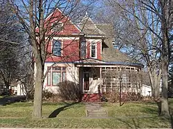 William G. Milne House |
December 1, 1994 (#94001391) |
508 E. 9th St. 43°49′42″N 96°42′30″W |
Dell Rapids | |
| 54 | John Mundt Building | 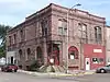 John Mundt Building |
February 17, 1981 (#81000575) |
103 N. Main Ave. 43°37′20″N 96°56′44″W |
Hartford | |
| 55 | Odd Fellows Home of Dell Rapids |  Odd Fellows Home of Dell Rapids |
February 21, 2012 (#12000037) |
100 W. 10th St. 43°49′45″N 96°43′06″W |
Dell Rapids | |
| 56 | Old Courthouse and Warehouse Historic District |  Old Courthouse and Warehouse Historic District |
August 18, 1983 (#83003015) |
Roughly bounded by the Big Sioux River, 4th and 6th Sts., and Dakota Ave.; also roughly bounded by North Dakota Ave., 4th St., the Big Sioux River, and 7th St. 43°33′06″N 96°43′37″W |
Sioux Falls | Second set of boundaries represents a boundary increase |
| 57 | Old Minnehaha County Courthouse |  Old Minnehaha County Courthouse |
May 10, 1973 (#73001749) |
Main Ave. at 6th St. 43°33′06″N 96°43′43″W |
Sioux Falls | |
| 58 | Old Yankton Bridge |  Old Yankton Bridge |
August 5, 1999 (#99000955) |
Old Yankton Rd. over the Big Sioux River 43°30′05″N 96°45′03″W |
Sioux Falls | |
| 59 | Orpheum Theatre |  Orpheum Theatre |
June 23, 1983 (#83003016) |
315 N. Phillips Ave. 43°33′03″N 96°43′37″W |
Sioux Falls | |
| 60 | Palisades Bridge | 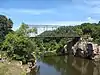 Palisades Bridge |
June 3, 1999 (#99000687) |
25495 485th Ave. 43°41′20″N 96°31′05″W |
Garretson | |
| 61 | Parmley-Pankow House | 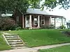 Parmley-Pankow House |
January 28, 2004 (#03001528) |
613 S. Main 43°32′27″N 96°43′41″W |
Sioux Falls | |
| 62 | R.F. Pettigrew and S.L. Tate Building | 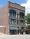 R.F. Pettigrew and S.L. Tate Building |
November 6, 1986 (#86002991) |
121-123 S. Main Ave. 43°33′01″N 96°43′39″W |
Sioux Falls | |
| 63 | Phillips Block | 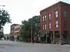 Phillips Block |
January 18, 1978 (#78002564) |
333-335 N. Main Ave. 43°33′03″N 96°43′43″W |
Sioux Falls | |
| 64 | Plumbing Supply Company | 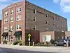 Plumbing Supply Company |
January 14, 2005 (#04001488) |
326 E. 8th St. 43°33′03″N 96°43′24″W |
Sioux Falls | |
| 65 | Presentation Children's Home | 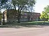 Presentation Children's Home |
February 10, 1993 (#92001852) |
701 S. Western Ave. 43°32′23″N 96°45′04″W |
Sioux Falls | |
| 66 | Queen Bee Mill | 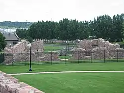 Queen Bee Mill |
August 1, 1984 (#84003362) |
N. Weber Ave., Falls Park 43°33′25″N 96°43′19″W |
Sioux Falls | |
| 67 | Dr. Fredrich A. Randolph Block | 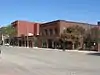 Dr. Fredrich A. Randolph Block |
March 17, 1994 (#94000195) |
320 N. Main 43°33′11″N 96°43′59″W |
Sioux Falls | |
| 68 | Renner Ball Park | 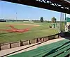 Renner Ball Park |
November 8, 2006 (#06001007) |
0.75 miles (1.21 km) west of the intersection of 258th St. and Highway 115 43°38′49″N 96°43′38″W |
Renner | |
| 69 | Renner Lutheran Sanctuary | 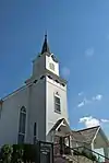 Renner Lutheran Sanctuary |
May 7, 1980 (#80003729) |
West of South Dakota Highway 115 43°38′44″N 96°42′58″W |
Renner | |
| 70 | Grant J. Reynolds House | 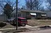 Grant J. Reynolds House |
December 2, 1998 (#98001400) |
800 S. Hawthorne St. 43°32′10″N 96°44′47″W |
Sioux Falls | |
| 71 | Rock Island Depot | 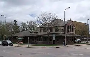 Rock Island Depot |
February 15, 1974 (#74001895) |
201 E. 10th St. 43°32′45″N 96°43′29″W |
Sioux Falls | |
| 72 | Security Bank Building | 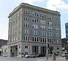 Security Bank Building |
February 23, 1984 (#84003366) |
101 S. Main Ave. 43°32′50″N 96°43′42″W |
Sioux Falls | |
| 73 | Shafer Round Barn | 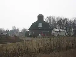 Shafer Round Barn |
December 14, 1995 (#95001470) |
1600 S. Powder House Rd. 43°32′31″N 96°38′58″W |
Sioux Falls | |
| 74 | Sherman Historic District | 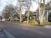 Sherman Historic District |
January 28, 2004 (#03001529) |
Roughly bounded by W. 18th St. to W. 22nd St., and S. Dakota Ave. to S. Main St. 43°32′05″N 96°43′43″W |
Sioux Falls | |
| 75 | Shriver-Johnson Building | 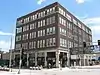 Shriver-Johnson Building |
June 17, 1982 (#82003934) |
230 S. Phillips Ave. 43°32′41″N 96°43′34″W |
Sioux Falls | |
| 76 | Sioux Falls Downtown Historic District | 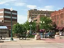 Sioux Falls Downtown Historic District |
December 1, 1994 (#94001393) |
Roughly bounded by S. Dakota and S. 1st Aves., W. 9th and W. 14th Sts. 43°32′49″N 96°43′43″W |
Sioux Falls | |
| 77 | Sioux Falls Light and Power Hydro Electric Plant | 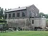 Sioux Falls Light and Power Hydro Electric Plant |
February 3, 1993 (#92001854) |
N. Weber Ave. on the eastern bank of the Big Sioux River 43°33′25″N 96°43′15″W |
Sioux Falls | |
| 78 | Sioux Falls National Bank Building | 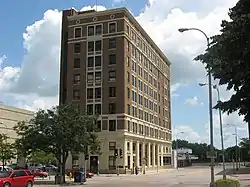 Sioux Falls National Bank Building |
March 26, 1979 (#79002406) |
100 N. Phillips Ave. 43°32′51″N 96°43′35″W |
Sioux Falls | |
| 79 | Slip Up Creek Homestead | August 15, 2003 (#03000761) |
25359 478th Ave. 43°42′42″N 96°39′10″W |
Garretson | ||
| 80 | South Dakota Department of Transportation Bridge No. 50-122-155 | January 28, 2000 (#00000022) |
Local road over Skunk Creek 43°37′25″N 96°53′08″W |
Brandon Township | Replaced in 2000[8] | |
| 81 | South Dakota Department of Transportation Bridge No. 50-193-086 | January 14, 2000 (#99001695) |
Local road over the Big Sioux River near Midway 43°43′12″N 96°44′54″W |
Sverdrup Township | Bridge removed in 2013 | |
| 82 | South Dakota Dept. of Trans. Bridge No. 50-196-104 | February 10, 2000 (#00000098) |
Local road over the Big Sioux River 43°41′45″N 96°44′15″W |
Sverdrup Township | ||
| 83 | South Dakota School for the Deaf | 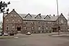 South Dakota School for the Deaf |
June 14, 1981 (#81000576) |
1800 E. 10th St. 43°32′51″N 96°42′10″W |
Sioux Falls | |
| 84 | South Dakota State Penitentiary Historic Buildings | 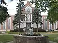 South Dakota State Penitentiary Historic Buildings |
April 20, 1978 (#78002565) |
1600 North Dr. 43°34′03″N 96°43′29″W |
Sioux Falls | |
| 85 | South Side Fire Station No. 3 | 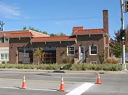 South Side Fire Station No. 3 |
February 23, 1984 (#84003369) |
1324 S. Minnesota Ave. 43°32′00″N 96°43′51″W |
Sioux Falls | |
| 86 | Split Rock Creek Park Historic District | 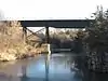 Split Rock Creek Park Historic District |
July 20, 2000 (#00000827) |
Roughly 1 mile (1.6 km) north of Garretson in Split Rock Park 43°43′14″N 96°30′07″W |
Garretson | |
| 87 | Split Rock Park Bridge | 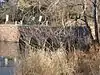 Split Rock Park Bridge |
December 9, 1993 (#93001309) |
Split Rock Park Rd. over Devils Creek Gulch 43°43′20″N 96°30′02″W |
Garretson | |
| 88 | R.D. and Mary Springer House | 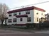 R.D. and Mary Springer House |
December 13, 1995 (#95001436) |
201 W. 19th St. 43°32′09″N 96°43′37″W |
Sioux Falls | |
| 89 | St. Peter's Lutheran Church (Dell Rapids, South Dakota) | 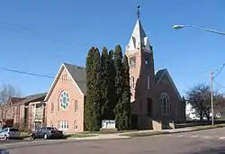 St. Peter's Lutheran Church (Dell Rapids, South Dakota) |
February 15, 2002 (#02000018) |
701 North Orleans 43°49′34″N 96°42′37″W |
Dell Rapids | |
| 90 | Stadum-Green House | 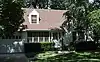 Stadum-Green House |
July 31, 2017 (#100001401) |
2101 S. Pendar Ln. 43°31′34″N 96°43′24″W |
Sioux Falls | |
| 91 | Dr. Steven's House | 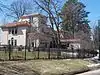 Dr. Steven's House |
October 31, 2002 (#02001286) |
21 S. Riverview Heights 43°31′59″N 96°45′27″W |
Sioux Falls | |
| 92 | Stock Yards State Bank and Tri-State Wholesale Grocery Co. | 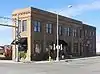 Stock Yards State Bank and Tri-State Wholesale Grocery Co. |
January 28, 2004 (#03001530) |
201/207/211 N. Weber Ave. 43°32′55″N 96°43′11″W |
Sioux Falls | |
| 93 | Terrace Park and Japanese Gardens |  Terrace Park and Japanese Gardens |
September 1, 2015 (#15000566) |
1100 W. 4th St. 43°33′15″N 96°44′30″W |
Sioux Falls | |
| 94 | Texaco Super Service Station | 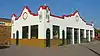 Texaco Super Service Station |
January 23, 2013 (#12001218) |
330 S. 1st Avenue[6] 43°32′37″N 96°43′30″W |
Sioux Falls | |
| 95 | Charles A. Thomas House | 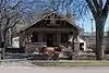 Charles A. Thomas House |
October 31, 1985 (#85003450) |
620 S. Dakota Ave. 43°32′27″N 96°43′43″W |
Sioux Falls | |
| 96 | Thompson Farmstead | February 18, 1999 (#99000239) |
47339 248th St. 43°47′03″N 96°44′27″W |
Dell Rapids | ||
| 97 | Tolefsons Beef Stock Farm | February 14, 2002 (#02000019) |
24450 458th Ave. 43°50′36″N 97°02′39″W |
Colton | ||
| 98 | John W. Tuthill Lumber Company | 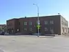 John W. Tuthill Lumber Company |
August 24, 2006 (#06000459) |
311 E. 8th St. 43°33′01″N 96°43′24″W |
Sioux Falls | |
| 99 | Valley Springs Rest Stop Tipi |  Valley Springs Rest Stop Tipi |
January 20, 2015 (#14001183) |
Mi. 412.1 on I-90 West 43°36′37″N 96°27′37″W |
Valley Springs vicinity | |
| 100 | Washington High School | 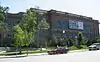 Washington High School |
February 13, 1986 (#86000248) |
315 S. Main 43°32′38″N 96°43′43″W |
Sioux Falls | |
| 101 | Laura M. Welch House | 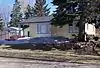 Laura M. Welch House |
March 7, 2000 (#00000122) |
1218 S. Willow Ave. 43°32′06″N 96°45′00″W |
Sioux Falls | |
| 102 | Williams Piano Company House |  Williams Piano Company House |
October 12, 2000 (#00001223) |
1019 S. Norton 43°32′09″N 96°44′06″W |
Sioux Falls | |
| 103 | Willow Grove Farm |  Willow Grove Farm |
May 30, 2003 (#03000497) |
47480 258th Ave. 43°40′24″N 96°43′36″W |
Renner |
Former listings
| [3] | Name on the Register | Image | Date listed | Date removed | Location | City or town | Summary |
|---|---|---|---|---|---|---|---|
| 1 | Blackstone Court Apartments | June 17, 1982 (#82003932) | January 12, 1988 | 303 W. 12th St. |
Sioux Falls | ||
| 2 | South Dakota Department of Transportation Bridge No. 50-122-155 | August 5, 1999 (#99000956) | March 26, 2008 | Local Rd. over Skunk Creek |
Brandon Township | ||
| 3 | South Dakota Department of Transportation Bridge No. 50-192-132 | January 14, 2000 (#99001694) | March 26, 2008 | Local Rd. over Big Sioux R. (Mapleton Township) |
Renner | ||
| 4 | South Dakota Department of Transportation Bridge No. 50-200-035 | .jpg.webp) South Dakota Department of Transportation Bridge No. 50-200-035 |
December 9, 1993 (#93001267) | December 15, 1999 | County road over the Big Sioux River |
Dell Rapids vicinity | |
| 5 | Summit Avenue Viaduct | December 9, 1993 (#93001307) | March 26, 2008 | Summit Ave. over the former Chicago and North Western railroad tracks 43°32′27″N 96°44′08″W |
Sioux Falls |
See also
| Wikimedia Commons has media related to National Register of Historic Places in Minnehaha County, South Dakota. |
References
- The latitude and longitude information provided in this table was derived originally from the National Register Information System, which has been found to be fairly accurate for about 99% of listings. Some locations in this table may have been corrected to current GPS standards.
- "National Register of Historic Places: Weekly List Actions". National Park Service, United States Department of the Interior. Retrieved on January 29, 2021.
- Numbers represent an alphabetical ordering by significant words. Various colorings, defined here, differentiate National Historic Landmarks and historic districts from other NRHP buildings, structures, sites or objects.
- "National Register Information System". National Register of Historic Places. National Park Service. April 24, 2008.
- The eight-digit number below each date is the number assigned to each location in the National Register Information System database, which can be viewed by clicking the number.
- According to personal email correspondence with the South Dakota State Historic Preservation Office, the "Building at 330 S. 1st Avenue" and the "Texaco Super Service Station" (same address) are separate listings. The address of the Texaco station was 200 E. 12th St. until 1974, when the owner of 330 S. 1st Ave. (Sid's Crown Liquor) purchased the building and expanded his business to include that space.
- "Baltic barn listed on National Register". argusleader.com. Sioux Falls, South Dakota: Argus Leader. August 31, 2010. Retrieved September 2, 2010.
| Topics | |
|---|---|
| Lists by state |
|
| Lists by insular areas | |
| Lists by associated state | |
| Other areas | |
| Related | |
| |
Municipalities and communities of Minnehaha County, South Dakota, United States | ||
|---|---|---|
| Cities | | |
| Towns | ||
| CDPs | ||
| Other unincorporated communities | ||
| Townships | ||
| Footnotes | ‡This populated place also has portions in an adjacent county or counties | |
| ||
This article is issued from Wikipedia. The text is licensed under Creative Commons - Attribution - Sharealike. Additional terms may apply for the media files.