National Register of Historic Places listings in Sangamon County, Illinois
This is a list of the National Register of Historic Places listings in Sangamon County, Illinois.
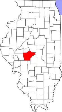
Location of Sangamon County in Illinois
This is intended to be a complete list of the properties and districts on the National Register of Historic Places in Sangamon County, Illinois, United States. Latitude and longitude coordinates are provided for many National Register properties and districts; these locations may be seen together in a map.[1]
There are 64 properties and districts listed on the National Register in the county, including 5 National Historic Landmarks. Another property was once listed but has been removed.
- This National Park Service list is complete through NPS recent listings posted January 29, 2021.[2]
Current listings
| [3] | Name on the Register | Image | Date listed[4] | Location | City or town | Description |
|---|---|---|---|---|---|---|
| 1 | Bolivia Road Bridge | 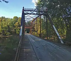 Bolivia Road Bridge |
January 28, 2004 (#03001464) |
Across the North Fork of the Sangamon River 39°46′03″N 89°20′44″W |
Bolivia | Extends into Christian County |
| 2 | H. P. Boult House | 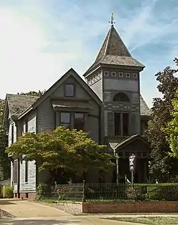 H. P. Boult House |
June 3, 1982 (#82002598) |
1123 S. 2nd St. 39°47′19″N 89°39′14″W |
Springfield | |
| 3 | Bressmer-Baker House | 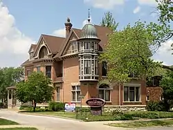 Bressmer-Baker House |
June 29, 1982 (#82002599) |
913 6th St. 39°47′32″N 89°38′54″W |
Springfield | |
| 4 | John F. Bretz House and Warehouse | 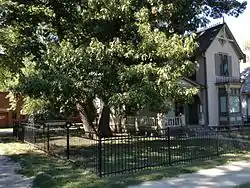 John F. Bretz House and Warehouse |
August 10, 2000 (#00000945) |
1113 N. Fifth St. 39°48′50″N 89°38′58″W |
Springfield | |
| 5 | George M. Brinkerhoff House | 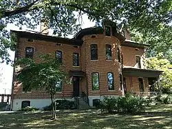 George M. Brinkerhoff House |
December 18, 1978 (#78001186) |
1500 N. 5th St. 39°49′16″N 89°38′54″W |
Springfield | |
| 6 | Brunk Farmstead | 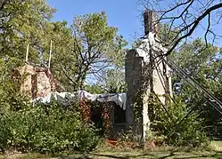 Brunk Farmstead |
December 17, 1999 (#99001569) |
KOA Campground Rd., 1 mile south of E. Lake Dr. 39°41′51″N 89°35′12″W |
Rochester | |
| 7 | Caldwell Farmstead | 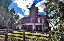 Caldwell Farmstead |
August 16, 1984 (#84001145) |
Illinois Route 4 39°42′09″N 89°42′21″W |
Chatham | |
| 8 | Camp Butler National Cemetery | 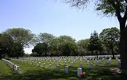 Camp Butler National Cemetery |
August 15, 1997 (#97000891) |
5063 Camp Butler Rd. 39°49′58″N 89°33′21″W |
Springfield | |
| 9 | Camp Lincoln Commissary Building | 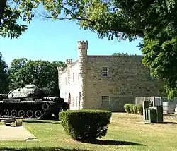 Camp Lincoln Commissary Building |
November 13, 1984 (#84000333) |
1301 N. MacArthur Boulevard 39°49′15″N 89°40′08″W |
Springfield | |
| 10 | Central Springfield Historic District | 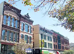 Central Springfield Historic District |
August 29, 1978 (#78001187) |
Roughly bounded by 14th, 7th, Jefferson, and Washington Sts.; also 6th St. from Capitol to Monroe St.; also roughly Jefferson, Jackson, 2nd & 7th Sts. 39°48′01″N 89°38′56″W |
Springfield | Second set of boundaries represents a boundary increase of November 19, 1986; third set of boundaries represents a boundary increase of April 26, 2016 |
| 11 | Christ Episcopal Church | 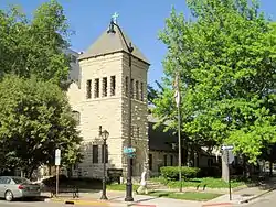 Christ Episcopal Church |
September 12, 1980 (#80001410) |
611 E. Jackson St. 39°47′50″N 89°38′51″W |
Springfield | |
| 12 | Clayville Tavern | 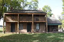 Clayville Tavern |
May 8, 1973 (#73000718) |
0.5 miles southeast of Pleasant Plains on Illinois Route 125 39°52′00″N 89°53′49″W |
Pleasant Plains | |
| 13 | Dr. Charles Compton House | 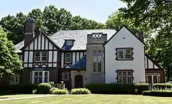 Dr. Charles Compton House |
May 8, 2017 (#100000964) |
1303 S. Wiggins 39°47′11″N 89°40′46″W |
Springfield | |
| 14 | Susan Lawrence Dana House | 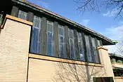 Susan Lawrence Dana House |
July 30, 1974 (#74000774) |
301 Lawrence Ave. 39°47′39″N 89°39′05″W |
Springfield | |
| 15 | Edwards Place | 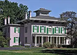 Edwards Place |
December 17, 1969 (#69000058) |
700 N. 4th St. 39°48′34″N 89°39′01″W |
Springfield | |
| 16 | Executive Mansion | 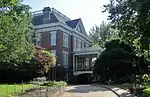 Executive Mansion |
July 19, 1976 (#76000728) |
4th and Jackson Sts. 39°47′48″N 89°39′00″W |
Springfield | |
| 17 | Fisher Building-Latham Block | 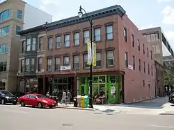 Fisher Building-Latham Block |
April 28, 2000 (#00000411) |
111, 113, and 115 N. 6th St. 39°48′08″N 89°38′53″W |
Springfield | |
| 18 | Cornelius Flagg Farmstead | 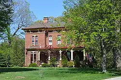 Cornelius Flagg Farmstead |
February 3, 1993 (#92001848) |
Tipton School Rd., 0.4 miles (0.64 km) west of Interstate 55 Business and 0.4 miles south of Andrew Rd. 39°53′27″N 89°36′57″W |
Sherman | |
| 19 | Clarkson W. Freeman House | 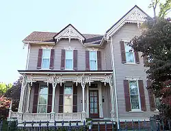 Clarkson W. Freeman House |
September 29, 1980 (#80001411) |
704 W. Monroe St. 39°47′57″N 89°39′49″W |
Springfield | |
| 20 | Hugh M. Garvey House | 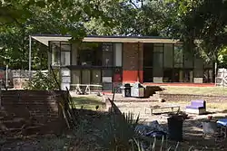 Hugh M. Garvey House |
November 10, 2009 (#09000898) |
8 Fair Oaks Dr. 39°46′54″N 89°41′13″W |
Leland Grove | |
| 21 | Fred Gottschalk Grocery Store | 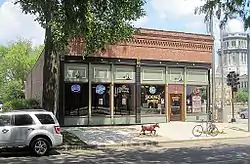 Fred Gottschalk Grocery Store |
March 18, 1985 (#85000607) |
301 W. Edwards St. 39°47′47″N 89°39′28″W |
Springfield | |
| 22 | Cong. James M. Graham House | 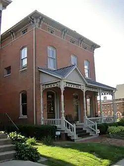 Cong. James M. Graham House |
May 1, 1989 (#89000342) |
413 S. 7th St. 39°47′52″N 89°38′48″W |
Springfield | |
| 23 | Great Western Railroad Depot | 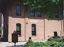 Great Western Railroad Depot |
August 25, 2014 (#14000510) |
930 E. Monroe St. 39°47′57″N 89°38′33″W |
Springfield | |
| 24 | Heimberger House | 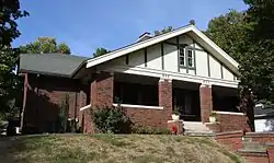 Heimberger House |
April 21, 2014 (#14000154) |
653-655 W. Vine St. 39°47′18″N 89°39′55″W |
Springfield | |
| 25 | Hickox Apartments | 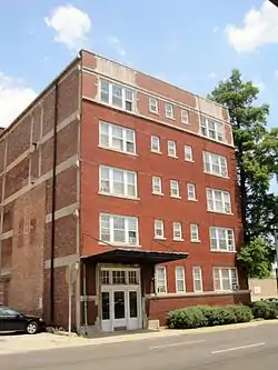 Hickox Apartments |
November 13, 1984 (#84000337) |
4th and Cook Sts. 39°47′43″N 89°39′04″W |
Springfield | |
| 26 | Virgil Hickox House | 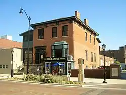 Virgil Hickox House |
March 5, 1982 (#82002600) |
518 E. Capitol Ave. 39°47′53″N 89°38′55″W |
Springfield | |
| 27 | Elijah Iles House | 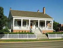 Elijah Iles House |
February 23, 1978 (#78001188) |
628 S. 7th St. 39°47′43″N 89°38′47″W |
Springfield | |
| 28 | Illinois Department of Mines and Minerals-Springfield Mine Rescue Station | 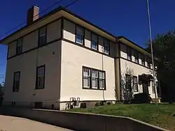 Illinois Department of Mines and Minerals-Springfield Mine Rescue Station |
July 5, 1985 (#85001481) |
609 Princeton Ave. 39°46′29″N 89°38′53″W |
Springfield | |
| 29 | Illinois Route 4-North of Auburn | 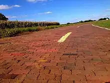 Illinois Route 4-North of Auburn |
August 6, 1998 (#98000979) |
Curran and Snell Rd. 39°37′01″N 89°44′48″W |
Auburn | |
| 30 | Illinois State Capitol |  Illinois State Capitol |
November 21, 1985 (#85003178) |
Capitol Ave. and 2nd St. 39°47′54″N 89°39′16″W |
Springfield | |
| 31 | Illinois State Fairgrounds | 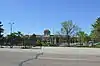 Illinois State Fairgrounds |
May 14, 1990 (#90000720) |
Junction of Sangamon Ave. and Peoria Rd. 39°50′11″N 89°38′27″W |
Springfield | |
| 32 | Jennings Ford Automobile Dealership | 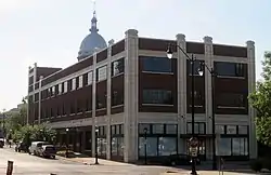 Jennings Ford Automobile Dealership |
May 31, 2006 (#06000450) |
431 S. 4th St. 39°47′51″N 89°39′04″W |
Springfield | |
| 33 | Alvin S. Keys House | 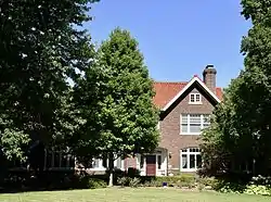 Alvin S. Keys House |
May 6, 1994 (#94000432) |
1600 Park Dr. 39°46′55″N 89°41′03″W |
Leland Grove | |
| 34 | Lazy A Motel | 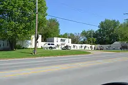 Lazy A Motel |
November 8, 1994 (#94001268) |
2840 Peoria Rd. 39°50′21″N 89°37′59″W |
Springfield | |
| 35 | John L. Lewis House | 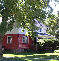 John L. Lewis House |
September 10, 1979 (#79000867) |
1132 W. Lawrence Ave. 39°47′38″N 89°40′22″W |
Springfield | |
| 36 | Lincoln Colored Home | August 6, 1998 (#98000985) |
427 S. 12th St. 39°47′51″N 89°38′23″W |
Springfield | ||
| 37 | Lincoln Home National Historic Site | 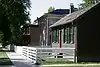 Lincoln Home National Historic Site |
August 18, 1971 (#71000076) |
8th and Jackson Sts. 39°47′50″N 89°38′41″W |
Springfield | |
| 38 | Lincoln Tomb | 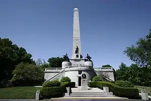 Lincoln Tomb |
October 15, 1966 (#66000330) |
Oak Ridge Cemetery 39°49′23″N 89°39′23″W |
Springfield | |
| 39 | Abraham Lincoln Memorial Garden | 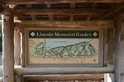 Abraham Lincoln Memorial Garden |
August 12, 1992 (#92001016) |
2301 E. Lake Dr. 39°41′51″N 89°35′46″W |
Springfield | |
| 40 | Vachel Lindsay House | 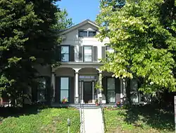 Vachel Lindsay House |
November 11, 1971 (#71000297) |
603 S. 5th St. 39°47′45″N 89°38′59″W |
Springfield | |
| 41 | Maid-Rite Sandwich Shop | 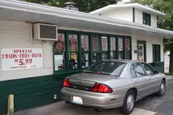 Maid-Rite Sandwich Shop |
August 16, 1984 (#84001146) |
118 N. Pasfield St. 39°48′09″N 89°39′30″W |
Springfield | |
| 42 | Bell Miller Apartments | 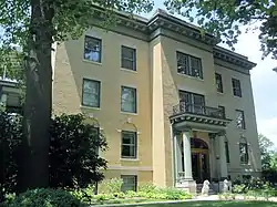 Bell Miller Apartments |
November 7, 1995 (#95001242) |
835 S. 2nd St. 39°47′33″N 89°39′14″W |
Springfield | |
| 43 | Joseph Miller House | November 24, 1980 (#80001408) |
Buckhart Rd. 39°45′26″N 89°28′28″W |
Rochester | ||
| 44 | Oak Ridge Cemetery | 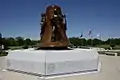 Oak Ridge Cemetery |
August 4, 1995 (#95000986) |
1441 Monument Ave. 39°49′25″N 89°39′28″W |
Springfield | |
| 45 | Old State Capitol | 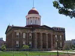 Old State Capitol |
October 15, 1966 (#66000331) |
Bounded by 5th, 6th, Adams, and Washington Sts. 39°48′04″N 89°38′53″W |
Springfield | |
| 46 | Power Farmstead | 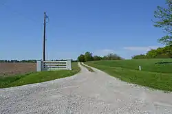 Power Farmstead |
May 1, 1989 (#89000341) |
County Road 9500N, 0.5 miles east of Cantrall 39°56′39″N 89°39′45″W |
Cantrall | |
| 47 | Price-Prather House | 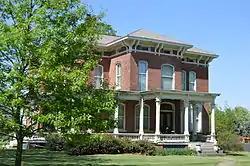 Price-Prather House |
May 13, 1991 (#91000574) |
Junction of Main and Elkhart Sts. 39°57′17″N 89°32′47″W |
Williamsville | |
| 48 | Price/Wheeler House | 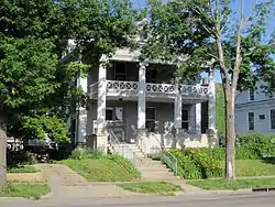 Price/Wheeler House |
February 14, 1985 (#85000269) |
618 S. 7th St. 39°47′43″N 89°38′46″W |
Springfield | |
| 49 | Rippon-Kinsella House | 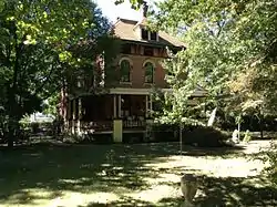 Rippon-Kinsella House |
February 27, 1992 (#92000073) |
1317 N. Third St. 39°49′01″N 89°39′06″W |
Springfield | |
| 50 | Joseph Ross House |  Joseph Ross House |
March 2, 2006 (#06000092) |
5200 Passfield Rd. 39°43′41″N 89°26′04″W |
Rochester | |
| 51 | Route 66 by Carpenter Park |  Route 66 by Carpenter Park |
May 9, 2002 (#02000461) |
Old U.S. Route 66 between Cabin Smoke Trail and north bank of the Sangamon River 39°52′21″N 89°36′51″W |
Springfield | |
| 52 | Route 66 South of Lake Springfield | 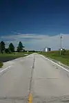 Route 66 South of Lake Springfield |
May 12, 2009 (#09000296) |
Old U.S. Route 66/Olde Carriage Way 39°40′31″N 89°37′29″W |
Springfield | |
| 53 | St. Nicholas Hotel | 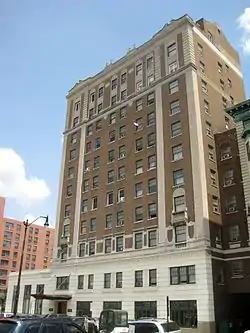 St. Nicholas Hotel |
February 10, 1983 (#83000336) |
400 E. Jefferson St. 39°48′09″N 89°39′01″W |
Springfield | |
| 54 | Strawbridge-Shepherd House | 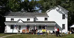 Strawbridge-Shepherd House |
June 8, 2015 (#15000317) |
5255 Shepherd Rd. 39°43′22″N 89°37′00″W |
Springfield | |
| 55 | Sugar Creek Covered Bridge | 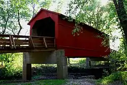 Sugar Creek Covered Bridge |
January 9, 1978 (#78001185) |
Southeast of Chatham off Interstate 55 39°38′25″N 89°39′43″W |
Chatham | |
| 56 | Taft Farmstead | 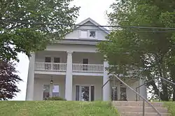 Taft Farmstead |
November 20, 1980 (#80001409) |
County Road 3 39°45′08″N 89°33′34″W |
Rochester | |
| 57 | Taylor Apartments | 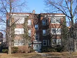 Taylor Apartments |
September 15, 2004 (#04000976) |
117 S. Grand Ave. W 39°47′14″N 89°39′20″W |
Springfield | |
| 58 | Tiger-Anderson House | June 11, 1986 (#86001316) |
County Road 3 North 39°50′39″N 89°42′31″W |
Springfield | ||
| 59 | Town House | 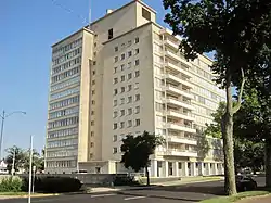 Town House |
June 3, 2005 (#05000603) |
718 7th St. 39°47′39″N 89°38′47″W |
Springfield | |
| 60 | Union Station | 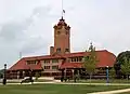 Union Station |
November 27, 1978 (#78001189) |
Madison St. 39°48′13″N 89°38′54″W |
Springfield | |
| 61 | US ARMY Aircraft P-51D-25NA 44-73287 | March 11, 1999 (#99000254) |
Capital Airport, 0.5 miles north of the junction of Illinois Route 29 and Veterans Parkway 39°50′27″N 89°40′33″W |
Springfield | ||
| 62 | Washington Park | 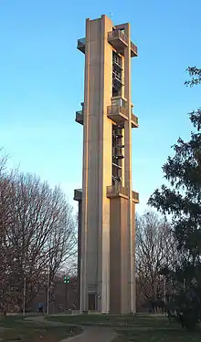 Washington Park |
May 22, 1992 (#92000483) |
Bounded by Fayette Ave., Williams Boulevard, Walnut St., MacArthur Boulevard, S. Grand Ave. and Chatham Rd. 39°47′20″N 89°40′37″W |
Springfield | |
| 63 | Howard K. Weber House | 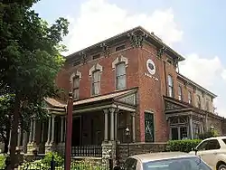 Howard K. Weber House |
October 1, 1979 (#79000868) |
925 S. 7th St. 39°47′31″N 89°38′49″W |
Springfield | |
| 64 | Gov. Richard Yates House | 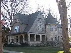 Gov. Richard Yates House |
March 1, 1984 (#84001148) |
1190 Williams Boulevard 39°47′24″N 89°40′20″W |
Springfield |
Former listing
| [3] | Name on the Register | Image | Date listed | Date removed | Location | City or town | Summary |
|---|---|---|---|---|---|---|---|
| 1 | Wheeland Haven | March 12, 1985 (#85000557) | April 17, 2003 | East of Riverton on Interstate 72 |
Riverton | Burned down in 1992[5] |
See also
| Wikimedia Commons has media related to National Register of Historic Places in Sangamon County, Illinois. |
References
- The latitude and longitude information provided in this table was derived originally from the National Register Information System, which has been found to be fairly accurate for about 99% of listings. Some locations in this table may have been corrected to current GPS standards.
- "National Register of Historic Places: Weekly List Actions". National Park Service, United States Department of the Interior. Retrieved on January 29, 2021.
- Numbers represent an alphabetical ordering by significant words. Various colorings, defined here, differentiate National Historic Landmarks and historic districts from other NRHP buildings, structures, sites or objects.
- The eight-digit number below each date is the number assigned to each location in the National Register Information System database, which can be viewed by clicking the number.
- "Wheeland Haven a/k/a The Mansion". SangamonLink, The State Journal-Register. June 25, 2014. Retrieved December 13, 2014.
| Topics | |
|---|---|
| Lists by state |
|
| Lists by insular areas | |
| Lists by associated state | |
| Other areas | |
| Related | |
| |
Municipalities and communities of Sangamon County, Illinois, United States | ||
|---|---|---|
| Cities | Map of Illinois highlighting Sangamon County | |
| Villages | ||
| Townships | ||
| Unincorporated communities | ||
| Footnotes | ‡This city also has portions in adjacent county or counties | |
| ||
This article is issued from Wikipedia. The text is licensed under Creative Commons - Attribution - Sharealike. Additional terms may apply for the media files.