National Register of Historic Places listings in St. Mary Parish, Louisiana
This is a list of the National Register of Historic Places listings in St. Mary Parish, Louisiana.
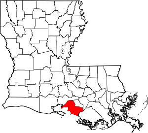
Location of St. Mary Parish in Louisiana
This is intended to be a complete list of the properties and districts on the National Register of Historic Places in St. Mary Parish, Louisiana, United States. The locations of National Register properties and districts for which the latitude and longitude coordinates are included below, may be seen in a map.[1]
There are 29 properties and districts listed on the National Register in the parish.
- This National Park Service list is complete through NPS recent listings posted January 29, 2021.[2]
Current listings
| [3] | Name on the Register[4] | Image | Date listed[5] | Location | City or town | Description |
|---|---|---|---|---|---|---|
| 1 | Albania Plantation House | 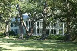 Albania Plantation House |
January 26, 2001 (#01000007) |
1842 Louisiana Highway 182, E. 29°54′12″N 91°38′58″W |
Jeanerette | |
| 2 | Alice C Plantation House |  Alice C Plantation House |
October 24, 2000 (#00001229) |
10736 Louisiana Highway 182 29°46′10″N 91°28′38″W |
Franklin | |
| 3 | Arlington Plantation House | 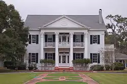 Arlington Plantation House |
October 5, 1982 (#82000457) |
56 E. Main St. 29°46′43″N 91°29′35″W |
Franklin | |
| 4 | Atkinson Memorial Presbyterian Church | 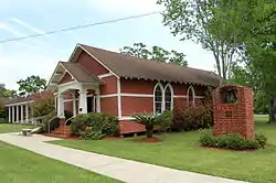 Atkinson Memorial Presbyterian Church |
March 19, 1991 (#91000248) |
214 4th St. 29°41′34″N 91°12′04″W |
Morgan City | |
| 5 | Birg House | June 24, 1982 (#82004837) |
Off Louisiana Highway 182 29°49′32″N 91°30′58″W |
Baldwin | ||
| 6 | Bittersweet |  Bittersweet |
October 28, 1980 (#80004324) |
301 Main St. 29°47′18″N 91°29′21″W |
Franklin | |
| 7 | Boy Scout Troop #1 Log Cabin | September 7, 2001 (#01000944) |
601 Adams 29°47′42″N 91°30′22″W |
Franklin | ||
| 8 | Brubaker House |  Brubaker House |
September 29, 1995 (#95001133) |
1102 2nd St. 29°42′07″N 91°12′42″W |
Morgan City | |
| 9 | Calumet Plantation House | 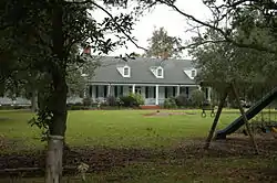 Calumet Plantation House |
October 18, 1984 (#84002859) |
West of Patterson on Louisiana Highway 182 29°42′42″N 91°20′40″W |
Patterson | |
| 10 | Joshua B. Cary House |  Joshua B. Cary House |
August 11, 1982 (#82004677) |
U.S. Route 90 and Louisiana Highway 317 29°45′32″N 91°25′41″W |
Centerville | |
| 11 | Darby House |  Darby House |
August 11, 1982 (#82004678) |
102 Main St. 29°50′14″N 91°32′38″W |
Baldwin | |
| 12 | Dixie Plantation House | May 29, 1987 (#87000851) |
Louisiana Highway 182, 1 mile southeast of Franklin 29°46′30″N 91°29′19″W |
Franklin | ||
| 13 | Franklin Foundation Hospital | October 10, 2017 (#100001713) |
1501 Hospital Ave. 29°48′14″N 91°29′56″W |
Franklin | ||
| 14 | Franklin Historic District | 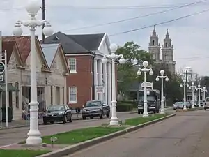 Franklin Historic District |
December 29, 1982 (#82000458) |
U.S. Route 90; also 600-608 Palfrey St. 29°47′32″N 91°30′10″W |
Franklin | Palfrey St. represents a boundary increase of September 15, 2005 |
| 15 | Grevemberg House |  Grevemberg House |
June 6, 1980 (#80004325) |
Sterling Rd. 29°48′09″N 91°29′48″W |
Franklin | |
| 16 | Hanson Lumber Company Office |  Hanson Lumber Company Office |
October 7, 1993 (#93001034) |
10400 Louisiana Highway 182 29°45′56″N 91°27′59″W |
Garden City | |
| 17 | Hanson Lumber Company Owner's House |  Hanson Lumber Company Owner's House |
October 7, 1993 (#93001035) |
10407 Louisiana Highway 182 29°45′54″N 91°28′00″W |
Garden City | |
| 18 | Heaton House |  Heaton House |
October 30, 1980 (#80004328) |
North of Baldwin on Charenton Rd. 29°52′13″N 91°31′26″W |
Baldwin | |
| 19 | Idlewild |  Idlewild |
November 2, 1982 (#82000459) |
South of Patterson on Louisiana Highway 182 29°40′45″N 91°17′34″W |
Patterson | |
| 20 | Hilaire Lancon House | November 9, 2001 (#01001210) |
3934 Irish Bend Rd. 29°50′45″N 91°29′16″W |
Franklin | ||
| 21 | Morgan City City Hall and Courthouse |  Morgan City City Hall and Courthouse |
April 9, 1981 (#81000676) |
Corner of Everett and 1st Sts. 29°41′42″N 91°14′21″W |
Morgan City | |
| 22 | Morgan City Historic District | January 9, 1986 (#86000060) |
Roughly bounded by Greenwood St., Arkansas St., Railroad Ave., and Front St. 29°41′43″N 91°12′31″W |
Morgan City | ||
| 23 | Oaklawn Manor | 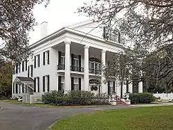 Oaklawn Manor |
March 30, 1973 (#73002162) |
5 miles northeast of Franklin on Irish Bend Rd. 29°50′58″N 91°28′03″W |
Franklin | Plantation home of U.S. Senator Alexander Porter (1785–1844). |
| 24 | Patterson Commercial Historic District | 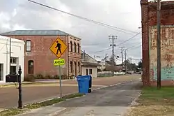 Patterson Commercial Historic District |
May 31, 2016 (#16000303) |
1106, 1110, 1107, 1109 Main St. 29°41′38″N 91°18′09″W |
Patterson | |
| 25 | St. Mary's Episcopal Church | 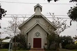 St. Mary's Episcopal Church |
November 21, 1980 (#80004327) |
805 1st St. 29°47′38″N 91°32′38″W |
Franklin | |
| 26 | Smith House |  Smith House |
June 6, 1980 (#80004326) |
909 2nd St. 29°47′42″N 91°30′13″W |
Franklin | |
| 27 | Southwest Reef Lighthouse |  Southwest Reef Lighthouse |
September 12, 1991 (#91001152) |
Junction of Bellevue Front and Canton Sts. 29°41′37″N 91°12′59″W |
Berwick | |
| 28 | Tillandsia | 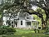 Tillandsia |
August 11, 1982 (#82004679) |
202 Charenton Rd. 29°50′27″N 91°32′32″W |
Baldwin | |
| 29 | US Post Office |  US Post Office |
December 17, 1982 (#82000460) |
1st and Everett Sts. 29°41′39″N 91°12′33″W |
Morgan City |
See also
| Wikimedia Commons has media related to National Register of Historic Places in Saint Mary Parish, Louisiana. |
References
- The latitude and longitude information provided in this table was derived originally from the National Register Information System, which has been found to be fairly accurate for about 99% of listings. Some locations in this table may have been corrected to current GPS standards.
- "National Register of Historic Places: Weekly List Actions". National Park Service, United States Department of the Interior. Retrieved on January 29, 2021.
- Numbers represent an alphabetical ordering by significant words. Various colorings, defined here, differentiate National Historic Landmarks and historic districts from other NRHP buildings, structures, sites or objects.
- "National Register Information System". National Register of Historic Places. National Park Service. March 13, 2009.
- The eight-digit number below each date is the number assigned to each location in the National Register Information System database, which can be viewed by clicking the number.
| Topics | |
|---|---|
| Lists by state |
|
| Lists by insular areas | |
| Lists by associated state | |
| Other areas | |
| Related | |
| |
Municipalities and communities of St. Mary Parish, Louisiana, United States | ||
|---|---|---|
| Cities | | |
| Towns | ||
| CDPs | ||
| Other unincorporated communities |
| |
| Indian reservation | ||
| Footnotes | ‡This populated place also has portions in an adjacent parish or parishes | |
| ||
This article is issued from Wikipedia. The text is licensed under Creative Commons - Attribution - Sharealike. Additional terms may apply for the media files.