National Register of Historic Places listings in Stillwater County, Montana
This is a list of the National Register of Historic Places listings in Stillwater County, Montana. It is intended to be a complete list of the properties and districts on the National Register of Historic Places in Stillwater County, Montana, United States. The locations of National Register properties and districts for which the latitude and longitude coordinates are included below, may be seen in a map.[1]
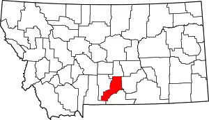
Location of Stillwater County in Montana
There are 14 properties and districts listed on the National Register in the county.
- This National Park Service list is complete through NPS recent listings posted January 29, 2021.[2]
Listings county-wide
| [3] | Name on the Register | Image | Date listed[4] | Location | City or town | Description |
|---|---|---|---|---|---|---|
| 1 | 4K Ranch | February 14, 2002 (#02000049) |
Fiddler Creek Rd. 45°22′48″N 109°41′45″W |
Dean | ||
| 2 | Atlas Block | 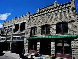 Atlas Block |
August 24, 2011 (#11000588) |
523 & 528 E. Pike Ave. 45°38′13″N 109°15′11″W |
Columbus | |
| 3 | Dean School | December 2, 2019 (#100004713) |
1367 Nye Rd. 45°24′16″N 109°41′24″W |
Dean | One-room schoolhouse | |
| 4 | Halfway House | February 21, 2002 (#02000047) |
3951 Montana Highway 78 45°34′08″N 109°19′57″W |
Columbus | ||
| 5 | Oliver H. Hovda House |  Oliver H. Hovda House |
August 16, 1984 (#84002506) |
N. Woodward St. 45°31′19″N 109°26′23″W |
Absarokee | |
| 6 | Michael Jacobs House | 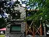 Michael Jacobs House |
January 28, 1987 (#86003676) |
4 W. 1st Ave., N. 45°38′24″N 109°15′33″W |
Columbus | |
| 7 | Mountain View Cemetery | 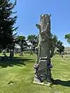 Mountain View Cemetery |
July 16, 1987 (#87001200) |
U.S. Route 10 and Rapelje Rd. 45°38′31″N 109°16′22″W |
Columbus | |
| 8 | W.H. Norton House | 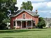 W.H. Norton House |
October 25, 1982 (#82000597) |
3rd Ave. 45°38′27″N 109°15′11″W |
Columbus | |
| 9 | Charles and Gladys Pelton House | April 24, 2017 (#100000916) |
303 W. Rosebud Rd. 45°24′30″N 109°31′32″W |
Fishtail | ||
| 10 | Sandstone and Cobblestone Schools | 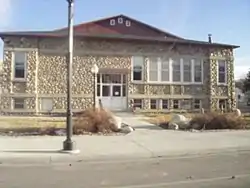 Sandstone and Cobblestone Schools |
January 15, 1987 (#86002949) |
142 S. Woodard Ave. 45°30′37″N 109°26′45″W |
Absarokee | |
| 11 | Stillwater County Courthouse | 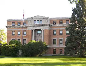 Stillwater County Courthouse |
August 14, 2019 (#100004277) |
400 East 3rd Ave. North 45°38′25″N 109°15′14″W |
Columbus | |
| 12 | Stoltz House | 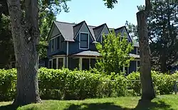 Stoltz House |
April 16, 1991 (#91000422) |
405 SW. 1st St. 45°37′45″N 108°54′44″W |
Park City | |
| 13 | Torgrimson Place | August 31, 2001 (#01000921) |
W. Rosebud Rd. 45°23′39″N 109°32′52″W |
Fishtail | ||
| 14 | United Methodist Episcopal Church | 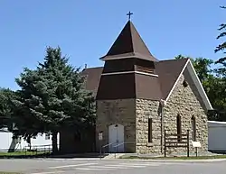 United Methodist Episcopal Church |
July 26, 2010 (#10000497) |
Southeast corner of Clark St. and Second Ave. 45°37′50″N 108°54′54″W |
Park City |
See also
| Wikimedia Commons has media related to National Register of Historic Places in Stillwater County, Montana. |
References
- The latitude and longitude information provided in this table was derived originally from the National Register Information System, which has been found to be fairly accurate for about 99% of listings. Some locations in this table may have been corrected to current GPS standards.
- "National Register of Historic Places: Weekly List Actions". National Park Service, United States Department of the Interior. Retrieved on January 29, 2021.
- Numbers represent an alphabetical ordering by significant words. Various colorings, defined here, differentiate National Historic Landmarks and historic districts from other NRHP buildings, structures, sites or objects.
- The eight-digit number below each date is the number assigned to each location in the National Register Information System database, which can be viewed by clicking the number.
| Topics | |
|---|---|
| Lists by state |
|
| Lists by insular areas | |
| Lists by associated state | |
| Other areas | |
| Related | |
| |
Municipalities and communities of Stillwater County, Montana, United States | ||
|---|---|---|
| Town | Stillwater County map | |
| CDPs | ||
| Unincorporated communities | ||
| Ghost towns | ||
| ||
This article is issued from Wikipedia. The text is licensed under Creative Commons - Attribution - Sharealike. Additional terms may apply for the media files.