Stillwater County, Montana
Stillwater County is a county in the U.S. state of Montana. As of the 2010 United States Census, the population was 9,117.[1] Its county seat is Columbus.[2]
Stillwater County | |
|---|---|
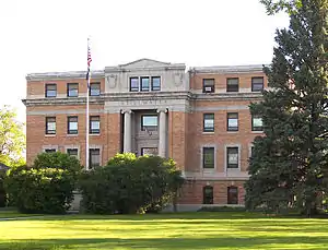 Stillwater County Courthouse in Columbus | |
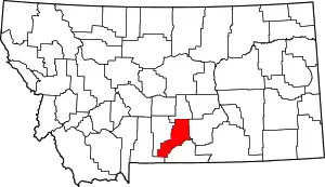 Location within the U.S. state of Montana | |
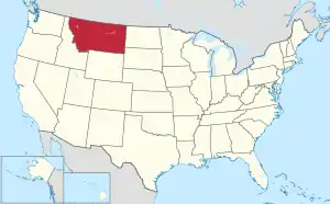 Montana's location within the U.S. | |
| Coordinates: 45°40′N 109°23′W | |
| Country | |
| State | |
| Founded | 1913 |
| Named for | Stillwater River |
| Seat | Columbus |
| Largest town | Columbus |
| Area | |
| • Total | 1,805 sq mi (4,670 km2) |
| • Land | 1,795 sq mi (4,650 km2) |
| • Water | 9.2 sq mi (24 km2) 0.5% |
| Population (2010) | |
| • Total | 9,117 |
| • Estimate (2019) | 9,642 |
| • Density | 5.1/sq mi (2.0/km2) |
| Time zone | UTC−7 (Mountain) |
| • Summer (DST) | UTC−6 (MDT) |
| Congressional district | At-large |
| Website | www |
| |
Geography
According to the U.S. Census Bureau, the county has a total area of 1,805 square miles (4,670 km2), of which 1,795 square miles (4,650 km2) is land and 9.2 square miles (24 km2) (0.5%) is water.[3]
Major highways
 Interstate 90
 U.S. Highway 10 (Former)
 Montana Highway 78
Adjacent counties
- Golden Valley County - north
- Yellowstone County - east
- Carbon County - south
- Park County - southwest
- Sweet Grass County - west
National protected areas
Demographics
| Historical population | |||
|---|---|---|---|
| Census | Pop. | %± | |
| 1920 | 7,630 | — | |
| 1930 | 6,253 | −18.0% | |
| 1940 | 5,694 | −8.9% | |
| 1950 | 5,416 | −4.9% | |
| 1960 | 5,526 | 2.0% | |
| 1970 | 4,632 | −16.2% | |
| 1980 | 5,598 | 20.9% | |
| 1990 | 6,536 | 16.8% | |
| 2000 | 8,195 | 25.4% | |
| 2010 | 9,117 | 11.3% | |
| 2019 (est.) | 9,642 | [4] | 5.8% |
| US Decennial Census[5] 1790-1960[6] 1900-1990[7] 1990-2000[8] 2010-2019[1] | |||
2000 census
As of the 2000 United States Census,[9] there were 8,195 people, 3,234 households, and 2,347 families in the county. The population density was 5 people per square mile (2/km2). There were 3,947 housing units at an average density of 2 per square mile (1/km2). The racial makeup of the county was 96.82% White, 0.13% Black or African American, 0.70% Native American, 0.21% Asian, 0.02% Pacific Islander, 0.94% from other races, and 1.18% from two or more races. 2.01% of the population were Hispanic or Latino of any race. 29.7% were of German, 11.8% Norwegian, 10.8% English, 10.6% Irish and 6.8% American ancestry.
There were 3,234 households, out of which 32.60% had children under the age of 18 living with them, 64.60% were married couples living together, 5.00% had a female householder with no husband present, and 27.40% were non-families. 24.10% of all households were made up of individuals, and 9.60% had someone living alone who was 65 years of age or older. The average household size was 2.48 and the average family size was 2.94.
The county population contained 25.30% under the age of 18, 5.70% from 18 to 24, 26.90% from 25 to 44, 27.60% from 45 to 64, and 14.50% who were 65 years of age or older. The median age was 41 years. For every 100 females there were 104.00 males. For every 100 females age 18 and over, there were 102.80 males.
The median income for a household in the county was $39,205, and the median income for a family was $45,238. Males had a median income of $32,148 versus $19,271 for females. The per capita income for the county was $18,468. About 6.20% of families and 9.80% of the population were below the poverty line, including 12.20% of those under age 18 and 9.20% of those age 65 or over.
2010 census
As of the 2010 United States Census, there were 9,117 people, 3,796 households, and 2,657 families in the county.[10] The population density was 5.1 inhabitants per square mile (2.0/km2). There were 4,803 housing units at an average density of 2.7 per square mile (1.0/km2).[11] The racial makeup of the county was 96.8% white, 0.8% American Indian, 0.3% Asian, 0.1% black or African American, 0.4% from other races, and 1.6% from two or more races. Those of Hispanic or Latino origin made up 2.3% of the population.[10] In terms of ancestry, 34.7% were German, 14.1% were Irish, 14.0% were English, 10.8% were Norwegian, and 6.9% were American.[12]
Of the 3,796 households, 28.9% had children under the age of 18 living with them, 60.6% were married couples living together, 6.0% had a female householder with no husband present, 30.0% were non-families, and 25.8% of all households were made up of individuals. The average household size was 2.37 and the average family size was 2.84. The median age was 45.7 years.[10]
The median income for a household in the county was $57,227 and the median income for a family was $65,438. Males had a median income of $51,830 versus $26,909 for females. The per capita income for the county was $27,168. About 6.0% of families and 9.5% of the population were below the poverty line, including 17.9% of those under age 18 and 7.2% of those age 65 or over.[13]
Politics
Stillwater County voters have selected the Democratic Party nominee in only three national elections in the more than a century since its organization as a separate county (as of 2016).
| Year | Republican | Democratic | Third parties |
|---|---|---|---|
| 2020 | 77.9% 4,462 | 20.1% 1,156 | 1.8% 106 |
| 2016 | 75.1% 3,661 | 18.6% 908 | 6.2% 304 |
| 2012 | 71.0% 3,337 | 26.5% 1,248 | 2.5% 117 |
| 2008 | 64.1% 2,991 | 32.4% 1,512 | 3.5% 164 |
| 2004 | 73.3% 3,090 | 24.3% 1,025 | 2.3% 98 |
| 2000 | 70.6% 2,765 | 23.6% 925 | 5.8% 228 |
| 1996 | 49.2% 1,871 | 33.7% 1,282 | 17.0% 647 |
| 1992 | 38.2% 1,390 | 32.4% 1,178 | 29.5% 1,072 |
| 1988 | 56.8% 1,920 | 41.6% 1,407 | 1.5% 52 |
| 1984 | 65.0% 2,118 | 33.8% 1,100 | 1.2% 40 |
| 1980 | 61.3% 1,828 | 30.8% 919 | 8.0% 237 |
| 1976 | 54.9% 1,446 | 43.4% 1,143 | 1.8% 46 |
| 1972 | 68.0% 1,698 | 28.7% 716 | 3.4% 85 |
| 1968 | 61.2% 1,347 | 30.7% 676 | 8.1% 178 |
| 1964 | 50.2% 1,140 | 49.8% 1,130 | 0.0% 1 |
| 1960 | 58.4% 1,455 | 41.6% 1,036 | 0.0% 0 |
| 1956 | 60.3% 1,540 | 39.7% 1,013 | 0.0% 0 |
| 1952 | 67.0% 1,689 | 32.4% 816 | 0.6% 15 |
| 1948 | 54.5% 1,137 | 42.6% 890 | 2.9% 60 |
| 1944 | 56.1% 1,201 | 43.6% 934 | 0.3% 7 |
| 1940 | 50.7% 1,255 | 48.5% 1,201 | 0.8% 19 |
| 1936 | 42.7% 1,034 | 53.3% 1,292 | 4.0% 96 |
| 1932 | 44.2% 1,085 | 52.2% 1,281 | 3.6% 87 |
| 1928 | 70.1% 1,687 | 29.5% 711 | 0.4% 10 |
| 1924 | 59.9% 1,412 | 15.9% 375 | 24.2% 571 |
| 1920 | 70.5% 1,721 | 27.2% 664 | 2.3% 56 |
| 1916 | 42.0% 918 | 54.8% 1,197 | 3.2% 70 |
Communities
Town
- Columbus (county seat)
Census-designated places
Unincorporated communities
Ghost towns
See also
- List of lakes in Stillwater County, Montana
- List of mountains in Stillwater County, Montana
- National Register of Historic Places listings in Stillwater County MT
References
- "State & County QuickFacts". US Census Bureau. Retrieved September 16, 2013.
- "Find a County". National Association of Counties. Archived from the original on May 31, 2011. Retrieved June 7, 2011.
- "2010 Census Gazetteer Files". US Census Bureau. August 22, 2012. Archived from the original on December 5, 2014. Retrieved November 30, 2014.
- "Population and Housing Unit Estimates". Retrieved October 25, 2020.
- "US Decennial Census". US Census Bureau. Retrieved November 30, 2014.
- "Historical Census Browser". University of Virginia Library. Retrieved November 30, 2014.
- "Population of Counties by Decennial Census: 1900 to 1990". US Census Bureau. Retrieved November 30, 2014.
- "Census 2000 PHC-T-4. Ranking Tables for Counties: 1990 and 2000" (PDF). US Census Bureau. Retrieved November 30, 2014.
- "U.S. Census website". US Census Bureau. Retrieved January 31, 2008.
- "Profile of General Population and Housing Characteristics: 2010 Demographic Profile Data". US Census Bureau. Archived from the original on February 13, 2020. Retrieved January 10, 2016.
- "Population, Housing Units, Area, and Density: 2010 - County". US Census Bureau. Archived from the original on February 13, 2020. Retrieved January 10, 2016.
- "Selected Social Characteristics in the US – 2006-2010 American Community Survey 5-Year Estimates". US Census Bureau. Archived from the original on February 13, 2020. Retrieved January 10, 2016.
- "Selected Economic Characteristics – 2006-2010 American Community Survey 5-Year Estimates". US Census Bureau. Archived from the original on February 13, 2020. Retrieved January 10, 2016.
- Leip, David. "Atlas of US Presidential Elections". uselectionatlas.org. Retrieved April 3, 2018.
- Meyers Creek MT Google Maps (accessed January 7, 2019)
- Reed Point MT Google Maps (accessed January 7, 2019)
Further reading
- Hooker, Patty; Museum of the Beartooths (2011). Columbus and Stillwater County. Images of America. Charleston SC: Arcadia Pub. ISBN 9780738574622.
- Hooker, Patty (2013). Moccasins, Mining & Montana's 34th county: A Centennial Celebration of Stillwater County. Virginia Beach VA: Donning Co. ISBN 9781578648122.
Places adjacent to Stillwater County, Montana | ||||||||||
|---|---|---|---|---|---|---|---|---|---|---|
| ||||||||||
Municipalities and communities of Stillwater County, Montana, United States | ||
|---|---|---|
| Town | Stillwater County map | |
| CDPs | ||
| Unincorporated communities | ||
| Ghost towns | ||
| ||
| Authority control |
|---|