National Register of Historic Places listings in White County, Illinois
This is a list of the National Register of Historic Places listings in White County, Illinois.
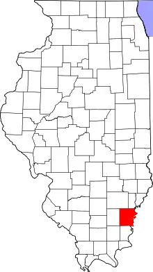
Location of White County in Illinois
This is intended to be a complete list of the properties and districts on the National Register of Historic Places in White County, Illinois, United States. Latitude and longitude coordinates are provided for many National Register properties and districts; these locations may be seen together in a map.[1]
There are 11 properties and districts listed on the National Register in the county.
- This National Park Service list is complete through NPS recent listings posted February 5, 2021.[2]
Current listings
| [3] | Name on the Register[4] | Image | Date listed[5] | Location | City or town | Description |
|---|---|---|---|---|---|---|
| 1 | Bieker-Wilson Village Site |  Bieker-Wilson Village Site |
November 21, 1978 (#78001197) |
Sandy Slough, southeast of the junction of County Road 300N and 1650E[6] 37°55′02″N 88°04′34″W |
New Haven | |
| 2 | Carmi Chapter House | 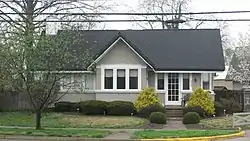 Carmi Chapter House |
November 28, 1980 (#80001416) |
604 W. Main St. 38°05′07″N 88°10′06″W |
Carmi | |
| 3 | William W. Gray House |  William W. Gray House |
February 13, 1992 (#92000049) |
119 N. Court St. 38°15′31″N 87°59′46″W |
Grayville | Designed by architect George Franklin Barber |
| 4 | L. Haas Store | 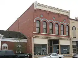 L. Haas Store |
February 4, 1994 (#94000026) |
219 E. Main St. 38°05′26″N 88°09′34″W |
Carmi | |
| 5 | Harmony Way Bridge | 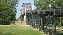 Harmony Way Bridge |
October 3, 2007 (#07001030) |
Indiana State Road 66/Illinois Route 14 38°07′52″N 87°56′32″W |
Crossville | Extends into Posey County, Indiana |
| 6 | Hubele Mounds and Village Site |  Hubele Mounds and Village Site |
August 25, 1978 (#78001196) |
East of the junction of County Roads 950N and 1900E[7] 38°01′00″N 88°01′56″W |
Maunie | |
| 7 | Old Morrison Mill | 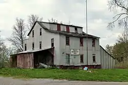 Old Morrison Mill |
July 11, 1984 (#84001169) |
Off Liberty Rd. 38°15′08″N 88°15′29″W |
Burnt Prairie | |
| 8 | Ratcliff Inn | 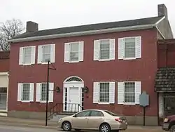 Ratcliff Inn |
June 4, 1973 (#73000719) |
214 E. Main St. 38°05′25″N 88°09′33″W |
Carmi | |
| 9 | Robinson-Stewart House | 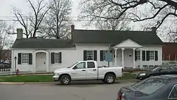 Robinson-Stewart House |
August 17, 1973 (#73000720) |
110 S. Main Cross St. 38°05′25″N 88°09′31″W |
Carmi | |
| 10 | James Robert Williams House | 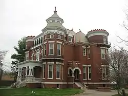 James Robert Williams House |
January 29, 1987 (#86003716) |
310 E. Main St. 38°05′27″N 88°09′29″W |
Carmi | Designed by George Franklin Barber |
| 11 | Wilson Mounds and Village Site | 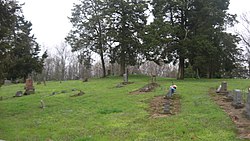 Wilson Mounds and Village Site |
November 16, 1977 (#77000491) |
Within and surrounding the Marshall Ferry Cemetery at Rising Sun[8] 37°59′57″N 88°01′55″W |
Maunie |
See also
| Wikimedia Commons has media related to National Register of Historic Places in White County, Illinois. |
References
- The latitude and longitude information provided in this table was derived originally from the National Register Information System, which has been found to be fairly accurate for about 99% of listings. Some locations in this table may have been corrected to current GPS standards.
- "National Register of Historic Places: Weekly List Actions". National Park Service, United States Department of the Interior. Retrieved on February 5, 2021.
- Numbers represent an alphabetical ordering by significant words. Various colorings, defined here, differentiate National Historic Landmarks and historic districts from other NRHP buildings, structures, sites or objects.
- "National Register Information System". National Register of Historic Places. National Park Service. March 13, 2009.
- The eight-digit number below each date is the number assigned to each location in the National Register Information System database, which can be viewed by clicking the number.
- Maruszak, Kathleen. National Register of Historic Places Inventory/Nomination: Bieker-Wilson Village Site. National Park Service, 1977-06, 3.
- Bodner, Connie. National Register of Historic Places Inventory/Nomination: Hubele Mounds and Village Site. National Park Service, 1976-07, 5.
- Bodner, Connie. National Register of Historic Places Inventory/Nomination: Wilson Mounds and Village Site. National Park Service, 1976-07, 6.
| Topics | |
|---|---|
| Lists by state |
|
| Lists by insular areas | |
| Lists by associated state | |
| Other areas | |
| Related | |
| |
Municipalities and communities of White County, Illinois, United States | ||
|---|---|---|
| Cities | Map of Illinois highlighting White County | |
| Villages | ||
| Townships | ||
| Unincorporated communities |
| |
| Footnotes | ‡This populated place also has portions in an adjacent county or counties | |
| ||
This article is issued from Wikipedia. The text is licensed under Creative Commons - Attribution - Sharealike. Additional terms may apply for the media files.