Nimule Airport
Nimule Airport is a small civilian and military airport serving the town of Nimule and surrounding communities, in South Sudan.
Nimule Airport | |||||||||||
|---|---|---|---|---|---|---|---|---|---|---|---|
| Summary | |||||||||||
| Airport type | Public, Civilian & Military | ||||||||||
| Owner | Civil Aviation Authority of South Sudan | ||||||||||
| Serves | Nimule, South Sudan | ||||||||||
| Location | Nimule, | ||||||||||
| Elevation AMSL | 2,230 ft / 680 m | ||||||||||
| Coordinates | 03°35′53″N 32°05′24″E | ||||||||||
| Map | |||||||||||
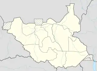 Nimule Location of Nimule Airport in South Sudan | |||||||||||
| Runways | |||||||||||
| |||||||||||
Sources:[1] | |||||||||||
Location
Nimule Airport (IATA: n/a, ICAO: HSNM) is located in Magwi County in Imatong State, in the town of Nimule, near the International border with Uganda. The airport is located approximately 4 kilometres (2.5 mi) southeast of the central business district of Nimule in Nimule National Park.
This location lies approximately 150 kilometres (93 mi), by air, southeast of Juba International Airport, South Sudan's largest airport.[2] The geographic coordinates of this airport are: 3° 35' 52.80"N, 32° 5' 24.00"E (Latitude: 3.5980; Longitude: 32.0900). Nimule Airport is situated 680 metres (2,230 ft) above sea level. The airport has a single unpaved runway, 1188m. in length.
References
- "Distance between Juba () (Airport) and Nimule (Al Wilayah al Istiwa'iyah) (Sudan)". distancecalculator.globefeed.com. Retrieved 2018-08-24.
External links
| Counties | 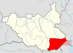 | |
|---|---|---|
| Principal towns | ||
| Airports | ||
| Rivers | ||
| Mountains | ||
| Communities | ||