North Hulu Sungai Regency
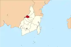
North Hulu Sungai Regency (Sungai means "River" in Indonesian) is one of the nine regencies in the Indonesian province of South Kalimantan. It has an area of 892.7 km2, and had a population of 209,246 at the 2010 Census and 225,386 at the 2015 Census; the latest official estimate (for mid 2019) is 237,573.[1] The capital of the regency is Amuntai.
North Hulu Sungai Regency
Kabupaten Hulu Sungai Utara | |
|---|---|
 Coat of arms | |
| Motto(s): Agung (Great) | |
 | |
| Country | Indonesia |
| Province | South Kalimantan |
| Capital | Amuntai |
| Area | |
| • Total | 892.70 km2 (344.67 sq mi) |
| Population (2019) | |
| • Total | 237,573 |
| • Density | 270/km2 (690/sq mi) |
| Time zone | UTC+8 (WITA) |
| Area code(s) | +62 527 |
| Website | hulusungaiutarakab.go.id |

Administrative districts
North Hulu Sungai Regency is divided into ten districts (kecamatan), listed below with their areas and their 2010 Census[2] and 2015 Census[3] populations. The table includes the number of administrative villages (rural desa and urban kelurahan) in each district, and its post code.
| Name | Area in km2 | Pop'n Census 2010 | Pop'n Census 2015 | No. of vill. | Post code |
|---|---|---|---|---|---|
| Danau Panggang | 224.49 | 19,593 | 21,296 | 16 | 71453 |
| Paminggir | 156.13 | 7,377 | 8,071 | 7 | 71451 |
| Babirik | 77.44 | 17,833 | 19,493 | 23 | 71454 |
| Sungai Pandan (Pandan River) | 45.00 | 25,905 | 28,056 | 33 | 71455 |
| Sungai Tabukan (Tabukan River) | 29.24 | 13,801 | 14,833 | 17 | 71456 |
| Amuntai Selatan (South Amuntai) | 183.16 | 26,466 | 28,755 | 30 | 71452 |
| Amuntai Tengah (Central Amuntai) | 57.00 | 47,961 | 52,420 | 29 | 71412 -71419 |
| Banjang | 41.00 | 16,185 | 15,455 | 20 | 71416 |
| Amuntai Utara (North Amuntai) | 45.09 | 19,955 | 21,954 | 26 | 71471 |
| Haur Gading | 34.15 | 14,170 | 15,053 | 18 | 71472 |
| Totals | 892.70 | 209,246 | 225,386 | 219 |
Climate
Amuntai has a tropical rainforest climate (Af) with moderate rainfall from July to September and heavy rainfall in the remaining months.
| Climate data for Amuntai | |||||||||||||
|---|---|---|---|---|---|---|---|---|---|---|---|---|---|
| Month | Jan | Feb | Mar | Apr | May | Jun | Jul | Aug | Sep | Oct | Nov | Dec | Year |
| Average high °C (°F) | 29.6 (85.3) |
30.1 (86.2) |
30.4 (86.7) |
30.8 (87.4) |
30.9 (87.6) |
30.5 (86.9) |
30.6 (87.1) |
31.2 (88.2) |
31.4 (88.5) |
31.5 (88.7) |
30.7 (87.3) |
30.1 (86.2) |
30.6 (87.2) |
| Daily mean °C (°F) | 26.1 (79.0) |
26.4 (79.5) |
26.6 (79.9) |
26.9 (80.4) |
27.1 (80.8) |
26.5 (79.7) |
26.4 (79.5) |
26.7 (80.1) |
26.9 (80.4) |
27.1 (80.8) |
26.7 (80.1) |
26.5 (79.7) |
26.7 (80.0) |
| Average low °C (°F) | 22.6 (72.7) |
22.8 (73.0) |
22.9 (73.2) |
23.1 (73.6) |
23.3 (73.9) |
22.6 (72.7) |
22.2 (72.0) |
22.3 (72.1) |
22.5 (72.5) |
22.7 (72.9) |
22.8 (73.0) |
22.9 (73.2) |
22.7 (72.9) |
| Average rainfall mm (inches) | 274 (10.8) |
273 (10.7) |
248 (9.8) |
217 (8.5) |
193 (7.6) |
133 (5.2) |
122 (4.8) |
97 (3.8) |
113 (4.4) |
135 (5.3) |
233 (9.2) |
300 (11.8) |
2,338 (91.9) |
| Source: Climate-Data.org[4] | |||||||||||||
References
- Badan Pusat Statistik, Jakarta, 2020.
- Biro Pusat Statistik, Jakarta, 2011.
- Badan Pusat Statistik, Jakarta, 2020.
- "Climate: Amuntai". Climate-Data.org. Retrieved 24 November 2020.
External links
Regencies and cities of South Kalimantan | ||
|---|---|---|
Capital: Banjarbaru | ||
| Regencies | ||
| Cities | ||
