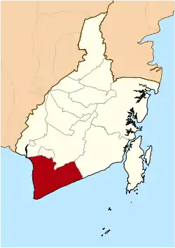
Tanah Laut Regency
Tanah Laut Regency is one of the regencies in the Indonesian province of South Kalimantan. The area is 3,631.35 km2, and the population at the 2010 Census was 296,333; the latest official estimate (as at mid 2017) is 334,328.[2] The capital is Pelaihari. Motto: "Tuntung Pandang" (Banjarese). Tuntung Pandang have meaning as "nice to see until forever"
Tanah Laut Regency
Kabupaten Tanah Laut | |
|---|---|
 Coat of arms | |
| Motto(s): Tuntung Pandang | |
 | |
| Country | Indonesia |
| Province | South Kalimantan |
| Capital | Pelaihari |
| Area | |
| • Total | 3,631.35 km2 (1,402.07 sq mi) |
| Population (2017) | |
| • Total | 334,328 |
| • Density | 92/km2 (240/sq mi) |
| [1] | |
| Time zone | UTC+8 (WITA) |
| Area code(s) | +62 512 |
| Website | tanahlautkab.go.id |
Administrative Districts
The Regency is divided into eleven districts (kecamatan), listed below with their areas and their 2010 Census populations,[3] together with the latest (as at mid 2017) official estimates.[4] The table includes the number of administrative villages (rural desa and urban kelurahan) in each district, and its post code.
| Name | Area in km2 | Pop'n Census 2010 | Pop'n Estimate 2017 | No. of vill. | Post code |
|---|---|---|---|---|---|
| Panyipatan | 336.00 | 21,151 | 22,446 | 10 | 70871 |
| Takisung | 343.00 | 27,998 | 29,066 | 12 | 70861 |
| Kurau | 127.00 | 11,578 | 11,902 | 11 | 70851 |
| Bumi Makmur | 141.00 | 11,831 | 13,787 | 11 | 70853 |
| Bati-Bati | 234.75 | 38,645 | 39,538 | 14 | 70852 |
| Tambang Ulang | 160.75 | 14,925 | 16,703 | 9 | 70854 |
| Pelaihara | 379.45 | 63,895 | 65,251 | 20 | 70812 -70815 |
| Bajuin | 196.30 | 15,957 | 17,410 | 9 | 70815 |
| Batu Ampar | 548.10 | 11,831 | 26,739 | 14 | 70882 |
| Jorong | 628.00 | 29,002 | 40,233 | 11 | 70881 |
| Kintap | 537.00 | 38,118 | 51,253 | 14 | 70883 |
| Totals | 3,631.35 | 296,333 | 334,328 | 135 |
Climate
Pelaihari, the seat of the regency has a tropical rainforest climate (Af) with moderate rainfall from July to October and heavy to very heavy rainfall from November to June.
| Climate data for Pelaihari | |||||||||||||
|---|---|---|---|---|---|---|---|---|---|---|---|---|---|
| Month | Jan | Feb | Mar | Apr | May | Jun | Jul | Aug | Sep | Oct | Nov | Dec | Year |
| Average high °C (°F) | 30.0 (86.0) |
30.4 (86.7) |
30.8 (87.4) |
31.5 (88.7) |
31.7 (89.1) |
31.3 (88.3) |
31.2 (88.2) |
31.8 (89.2) |
32.3 (90.1) |
32.6 (90.7) |
31.6 (88.9) |
30.5 (86.9) |
31.3 (88.4) |
| Daily mean °C (°F) | 26.5 (79.7) |
26.7 (80.1) |
27.0 (80.6) |
27.4 (81.3) |
27.6 (81.7) |
26.9 (80.4) |
26.5 (79.7) |
26.8 (80.2) |
27.2 (81.0) |
27.7 (81.9) |
27.3 (81.1) |
26.8 (80.2) |
27.0 (80.7) |
| Average low °C (°F) | 23.0 (73.4) |
23.1 (73.6) |
23.2 (73.8) |
23.4 (74.1) |
23.5 (74.3) |
22.5 (72.5) |
21.8 (71.2) |
21.8 (71.2) |
22.1 (71.8) |
22.8 (73.0) |
23.1 (73.6) |
23.1 (73.6) |
22.8 (73.0) |
| Average rainfall mm (inches) | 344 (13.5) |
287 (11.3) |
282 (11.1) |
215 (8.5) |
151 (5.9) |
150 (5.9) |
97 (3.8) |
61 (2.4) |
98 (3.9) |
107 (4.2) |
252 (9.9) |
421 (16.6) |
2,465 (97) |
| Source: Climate-Data.org[5] | |||||||||||||
External links
References
- Badan Pusat Statistik, Jakarta, 2020.
- Badan Pusat Stratistik, Jakarta, 2020.
- Biro Pusat Statistik, Jakarta, 2011.
- Badan Pusat Statistik, Jakarta, 2020.
- "Climate: Pelaihari". Climate-Data.org. Retrieved 24 November 2020.
Regencies and cities of South Kalimantan | ||
|---|---|---|
Capital: Banjarbaru | ||
| Regencies | ||
| Cities | ||