Tapin Regency
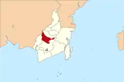
Tapin Regency is one of regencies in the Indonesian province of South Kalimantan; the capital is Rantau. The regency's motto is "Ruhui Rahayu". It covers an area of 2,174.95 km2 and had a population of 167,877 at the 2010 Census and 181,372 at the 2015 Census; the latest official estimate (as at 2019) is 191,372.[2]
Tapin Regency | |
|---|---|
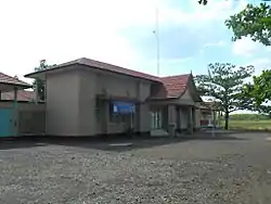 Bungur district office in Tapin Regency | |
 Coat of arms | |
| Motto(s): Barelok | |
 | |
| Country | Indonesia |
| Province | South Kalimantan |
| Capital | Rantau |
| Area | |
| • Total | 2,174.95 km2 (839.75 sq mi) |
| Population (2019) | |
| • Total | 191,372 |
| • Density | 88/km2 (230/sq mi) |
| [1] | |
| Time zone | UTC+8 (WITA) |
| Area code(s) | +62 517 |
| Website | tapinkab.go.id |

Administrative districts
Tapin Regency is composed of twelve districts (kecamatan), listed below with their present areas and their 2010 and 2015 Census populations, together with the latest (as at 2019) official estimates.[3] The table includes the number of administrative villages (desa) in each district, and its post code.
| Name | Area in km2 | Pop'n Census 2010 | Pop'n Census 2015 | Pop'n Estimate 2019 | No. of vill. | Post code |
|---|---|---|---|---|---|---|
| Binuang | 132.39 | 27,281 | 30,008 | 31,744 | 11 | 71183 |
| Hatungun | 95.60 | 8,023 | 8,627 | 9,204 | 8 | 71184 |
| Tapin Selatan (South Tapin) | 153.44 | 17,990 | 19,747 | 20,906 | 11 | 71181 |
| Salam Babaris | 72.80 | 11,063 | 11,980 | 12,613 | 6 | 71185 |
| Tapin Tengah (Central Tapin) | 309.56 | 17,635 | 18,713 | 19,616 | 17 | 71161 |
| Bungur | 91.26 | 11,625 | 12,869 | 13,754 | 12 | 71153 |
| Piani | 200.09 | 5,361 | 5,812 | 6,104 | 8 | 71191 |
| Lokpaikat | 93.89 | 8,904 | 9,709 | 10,221 | 9 | 71154 |
| Tapin Utara (North Tapin) | 32.34 | 23,193 | 24,927 | 26,693 | 16 | 71111 -71114 |
| Bakarangan | 62.57 | 8,621 | 9,329 | 9.638 | 12 | 71152 |
| Candi Laras Selatan (South Candi Laras) | 249.61 | 12,060 | 12,891 | 13,234 | 12 | 71162 |
| Candi Laras Utara (North Candi Laras) | 681.40 | 16,121 | 17,166 | 17,645 | 13 | 71171 |
| Totals | 2,174.95 | 167,877 | 181,778 | 191,372 | 135 |
Climate
Rantau, the seat of the regency has a tropical rainforest climate (Af) with moderate rainfall from July to September and heavy to very heavy rainfall from October to June.
| Climate data for Rantau | |||||||||||||
|---|---|---|---|---|---|---|---|---|---|---|---|---|---|
| Month | Jan | Feb | Mar | Apr | May | Jun | Jul | Aug | Sep | Oct | Nov | Dec | Year |
| Average high °C (°F) | 29.8 (85.6) |
30.3 (86.5) |
30.6 (87.1) |
31.2 (88.2) |
31.3 (88.3) |
30.9 (87.6) |
30.8 (87.4) |
31.6 (88.9) |
31.9 (89.4) |
32.1 (89.8) |
31.2 (88.2) |
30.3 (86.5) |
31.0 (87.8) |
| Daily mean °C (°F) | 26.3 (79.3) |
26.6 (79.9) |
26.8 (80.2) |
27.2 (81.0) |
27.3 (81.1) |
26.7 (80.1) |
26.3 (79.3) |
26.8 (80.2) |
27.0 (80.6) |
27.4 (81.3) |
27.1 (80.8) |
26.6 (79.9) |
26.8 (80.3) |
| Average low °C (°F) | 22.8 (73.0) |
22.9 (73.2) |
23.0 (73.4) |
23.2 (73.8) |
23.3 (73.9) |
22.5 (72.5) |
21.9 (71.4) |
22.0 (71.6) |
22.2 (72.0) |
22.7 (72.9) |
23.0 (73.4) |
23.0 (73.4) |
22.7 (72.9) |
| Average rainfall mm (inches) | 347 (13.7) |
318 (12.5) |
341 (13.4) |
250 (9.8) |
198 (7.8) |
129 (5.1) |
121 (4.8) |
113 (4.4) |
109 (4.3) |
189 (7.4) |
269 (10.6) |
351 (13.8) |
2,735 (107.6) |
| Source: Climate-Data.org[4] | |||||||||||||
References
- Badan Pusat Statistik, Jakarta, 2020.
- Badan Pusat Statistik, Jakarta, 2020.
- Badan Pusat Statistik, Jakarta, 2020.
- "Climate: Rantau". Climate-Data.org. Retrieved 24 November 2020.
| Wikimedia Commons has media related to Tapin Regency. |
Regencies and cities of South Kalimantan | ||
|---|---|---|
Capital: Banjarbaru | ||
| Regencies | ||
| Cities | ||