Ortaköy, Aksaray
Ortaköy is a town and district of Aksaray Province in the Central Anatolia region of Turkey, located north of the city of Aksaray. According to 2000 census, population of the district is 58,873 of which 26,961 live in the town of Ortaköy.[3][4] The district covers an area of 725 km2 (280 sq mi),[5] and the average elevation is 1,140 m (3,740 ft).
Ortaköy | |
|---|---|
District | |
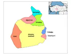 Location of Ortaköy, Aksaray within Turkey. | |
 Ortaköy Location of Ortaköy, Aksaray within Turkey. | |
| Coordinates: 38°44′10″N 34°02′25″E | |
| Country | |
| Region | Central Anatolia |
| Province | Aksaray |
| Government | |
| • Governor | Harun BAŞIBÜYÜK |
| • Mayor | Ali Riza Özdemir(AKP) |
| Area | |
| • District | 725.19 km2 (280.00 sq mi) |
| Elevation | 1,140 m (3,740 ft) |
| Population (2012)[2] | |
| • Urban | 18,384 |
| • District | 35,519 |
| • District density | 49/km2 (130/sq mi) |
| Time zone | UTC+2 (EET) |
| • Summer (DST) | UTC+3 (EEST) |
| Postal code | 68xxx |
| Area code(s) | 0382 |
| Licence plate | 68 |
| Website | www.ortakoy.gov.tr |
This is a rural district centred on the small, quiet town of Ortaköy.
Places of interest
- Yunus Emre Türbesi - a tomb 25 km from the town, one of the many places in Turkey that claims to be the final resting place of the legendary folk-poet Yunus Emre.
Notes
- "Area of regions (including lakes), km²". Regional Statistics Database. Turkish Statistical Institute. 2002. Retrieved 2013-03-05.
- "Population of province/district centers and towns/villages by districts - 2012". Address Based Population Registration System (ABPRS) Database. Turkish Statistical Institute. Retrieved 2013-02-27.
- Turkish Statistical Institute. "Census 2000, Key statistics for urban areas of Turkey" (XLS) (in Turkish). Retrieved 2008-04-03.
- GeoHive. "Statistical information on Turkey's administrative units". Retrieved 2008-04-03.
- Statoids. "Statistical information on districts of Turkey". Retrieved 2008-04-21.
References
- Falling Rain Genomics, Inc. "Geographical information on Ortaköy, Turkey". Retrieved 2008-04-03.
- Turkish Ministry of Culture and Tourism. "General information on Ortaköy, Aksaray" (in Turkish). Archived from the original on 2016-03-04. Retrieved 2008-04-03.
External links
- District governor's official website (in Turkish)
- District municipality's official website (in Turkish)
- Aksaray governor's office (in Turkish, English, and French)
- Aksaray (in Turkish)
Ortaköy, Aksaray in Aksaray Province of Turkey | |||||||||||||||||||||||||||
|---|---|---|---|---|---|---|---|---|---|---|---|---|---|---|---|---|---|---|---|---|---|---|---|---|---|---|---|
| Districts | Districts of Aksaray | ||||||||||||||||||||||||||
| |||||||||||||||||||||||||||
Metropolitan municipalities are bolded. | |||||||||||||||||||||||||||
| Authority control |
|
|---|
This article is issued from Wikipedia. The text is licensed under Creative Commons - Attribution - Sharealike. Additional terms may apply for the media files.