Oubliette Mountain
Oubliette Mountain is a 3,070 meter mountain summit located on the shared border of Jasper National Park in Alberta, and Mount Robson Provincial Park in British Columbia, Canada. Situated in the Tonquin Valley, Oubliette Mountain is part of The Ramparts in the Canadian Rockies. Its nearest higher peak is Dungeon Peak, 1.0 km (0.62 mi) to the northwest.[1] Not coincidentally, an oubliette is a secret dungeon with access only through a trapdoor in its ceiling. The descriptive name was coined by Cyril G. Wates.[1]
| Oubliette Mountain | |
|---|---|
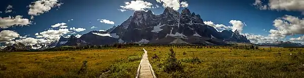
 Oubliette Mountain above Amethyst Lakes | |
| Highest point | |
| Elevation | 3,070 m (10,070 ft) [1] |
| Prominence | 160 m (520 ft) [1] |
| Parent peak | Dungeon Peak (3129 m)[1] |
| Coordinates | 52°40′40″N 118°17′15″W [1] |
| Geography | |
 Oubliette Mountain Location in Alberta and British Columbia  Oubliette Mountain Oubliette Mountain (Canada) | |
| Location | Alberta British Columbia |
| Parent range | Park Ranges Canadian Rockies |
| Topo map | NTS 83D/09 |
| Geology | |
| Age of rock | Cambrian[2] |
| Type of rock | Quartzite [2] |
| Climbing | |
| First ascent | 1932 W.R. Hainsworth, M.M. Strumia, Hans Fuhrer |
History
The first ascent was made in July 1932 by William Hainsworth and Max Strumia, with guide Hans Fuhrer.[1]
The first ascent of the East Buttress was made July 27, 1962 by Fred Beckey, Brian Greenwood, and Don Gordon. This climbing route is included in Beckey's book titled "Fred Beckey's 100 Favorite North American Climbs".[2]
Climate
Based on the Köppen climate classification, Oubliette Mountain is located in a subarctic climate with cold, snowy winters, and mild summers.[3] Temperatures can drop below -20 °C with wind chill factors below -30 °C. In terms of favorable weather, July and August present the best months for climbing. However, these months coincide with mosquito season, which requires effective defenses. Precipitation runoff from Oubliette Mountain drains into tributaries of the Athabasca River on its east side, and the headwaters of the Fraser River from the west side.
Geology
Oubliette Mountain is composed of quartzite laid down during the Cambrian period. This rock was pushed east and over the top of younger rock during the Laramide orogeny.[4]
See also
- List of peaks on the British Columbia-Alberta border
- Mountains of Alberta
- Mountains of British Columbia
References
- "Oubliette Mountain". Bivouac.com. Retrieved 2019-01-15.
- Fred Beckey's 100 Favorite North American Climbs, Fred Beckey, Patagonia Books, 2011, ISBN 978-0-9801227-1-8
- Peel, M. C.; Finlayson, B. L.; McMahon, T. A. (2007). "Updated world map of the Köppen−Geiger climate classification". Hydrol. Earth Syst. Sci. 11: 1633–1644. ISSN 1027-5606.
- Gadd, Ben (2008). "Geology of the Rocky Mountains and Columbias". Cite journal requires
|journal=(help)
External links
- Parks Canada web site: Jasper National Park
- Provincial Park web site: Mount Robson Provincial Park
- Labelled panorama of The Ramparts: Summitsearch.org
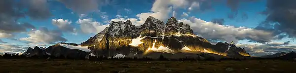
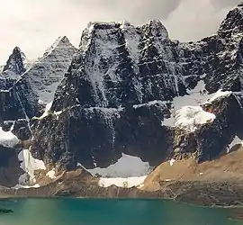
Gallery