Panipat district
Panipat district ![]() pronunciation is one of the 22 districts of Haryana in north India. The historical town of Panipat is the administrative headquarters of the district. The district occupies an area of 1,268 km2 (490 sq mi), making it the nineteenth largest in the state with Gurugram and Panchkula following it.
pronunciation is one of the 22 districts of Haryana in north India. The historical town of Panipat is the administrative headquarters of the district. The district occupies an area of 1,268 km2 (490 sq mi), making it the nineteenth largest in the state with Gurugram and Panchkula following it.
Panipat district | |
|---|---|
District of Haryana | |
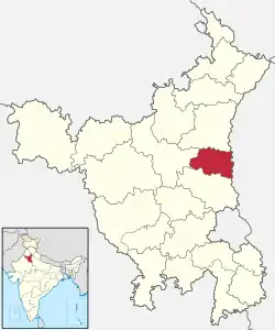 Location of Panipat district in Haryana | |
| Coordinates (Panipat): 29.39°N 76.97°E | |
| Country | India |
| State | Haryana |
| Division | Karnal |
| Headquarters | Panipat |
| Tehsils | 1. Panipat, 2. Samalkha, 3. Israna, 4. Madlauda, 5. Bapoli |
| Area | |
| • Total | 1,268 km2 (490 sq mi) |
| Population (2011) | |
| • Total | 1,205,437 |
| • Density | 950/km2 (2,500/sq mi) |
| • Urban | 555,085 |
| Demographics | |
| • Literacy | 75.94%
|
| • Sex ratio | 864 |
| Time zone | UTC+05:30 (IST) |
| Major highways | NH1, NH71A, NH709AD, SH16 |
| Lok Sabha constituencies | Karnal (shared with Karnal district) |
| Vidhan Sabha constituencies | 1. Panipat Rural, 2. Panipat City, 3. Israna, 4. Samalkha |
| Website | http://panipat.nic.in/ |
History
Panipat district was carved out from the erstwhile Karnal district on 1 November 1989. On 24 July 1991 it was again merged with Karnal district. On 1 January 1992 it again became a separate district.
Divisions
The district is divided into two sub-divisions:
These sub-divisions are further divided into three tehsils:
There are four Vidhan Sabha constituencies in this district:
- Panipat Rural
- Panipat City
- Israna
- Samalkha
Panipat district is a part of the Karnal Lok Sabha constituency.
Demographics
| Year | Pop. | ±% p.a. |
|---|---|---|
| 1951 | 238,834 | — |
| 1961 | 298,232 | +2.25% |
| 1971 | 382,445 | +2.52% |
| 1981 | 507,164 | +2.86% |
| 1991 | 698,103 | +3.25% |
| 2001 | 967,449 | +3.32% |
| 2011 | 1,205,437 | +2.22% |
| source:[1] | ||
According to the 2011 census Panipat district has a population of 1,205,437,[2] roughly equal to the nation of Bahrain[3] or the US state of New Hampshire.[4] This gives it a ranking of 396th in India (out of a total of 640).[2] The district has a population density of 951 inhabitants per square kilometre (2,460/sq mi) .[2] Its population growth rate over the decade 2001-2011 was 24.60%.[2] Panipat has a sex ratio of 864 females for every 1000 males,[2] and a literacy rate of 75.94%.
At the time of the 2011 Census of India, 92.14% of the population in the district spoke Hindi, 6.09% Punjabi and 0.79% Urdu as their first language.[5]
Education
There are several engineering colleges in Panipat district:
Notable people
- Deshbandhu Gupta (1901-1951), independence campaigner
- Altaf Hussain Hali
- Bu Ali Shah Qalandar
- Mubashir Hassan (co-founder of Pakistan Peoples Party)
- Asees Kaur
- Jasvir Singh (kabaddi)
- Advocate Satyam Aneja
- Satyen Kappu Indian Bollywood Actor
References
- Decadal Variation In Population Since 1901
- "District Census 2011". Census2011.co.in. 2011. Retrieved 30 September 2011.
- US Directorate of Intelligence. "Country Comparison:Population". Retrieved 1 October 2011.
Bahrain 1,214,705 July 2011 est.
- "2010 Resident Population Data". U. S. Census Bureau. Retrieved 30 September 2011.
New Hampshire 1,316,470
- 2011 Census of India, Population By Mother Tongue
- APIIT SD India
- P.I.E.T - Panipat Institute Of Engineering & Technology
- Geeta group of institutions
- "NCCE – Top and Best Engineering Colleges in Panipat, Haryana, India".
External links
Places adjacent to Panipat district | ||||||||||
|---|---|---|---|---|---|---|---|---|---|---|
| ||||||||||