Paquetville Parish, New Brunswick
Paquetville is a civil parish in Gloucester County, New Brunswick, Canada.[2]
Paquetville | |
|---|---|
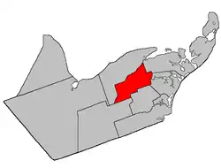 Location within Gloucester County, New Brunswick | |
| Coordinates: 47.625°N 65.215°W | |
| Country | |
| Province | |
| County | Gloucester |
| Erected | 1897 |
| Area | |
| • Land | 220.51 km2 (85.14 sq mi) |
| Population (2016)[1] | |
| • Total | 2,329 |
| • Density | 10.6/km2 (27/sq mi) |
| • Pop 2011-2016 | |
| • Dwellings | 1,159 |
| Time zone | UTC-4 (AST) |
| • Summer (DST) | UTC-3 (ADT) |
For governance purposes it is divided between the villages of Bertrand[lower-alpha 1] and Paquetville, and the local service districts of the Paroisse Notre-Dame-des-Érables, the parish of Saint-Isidore,[lower-alpha 2] and the parish of Paquetville, all of which are members of the Acadian Peninsula Regional Service Commission (APRSC).[3]
Origin of name
The parish may have been named in honour of Joseph-Marie Paquet,[4] a priest influential in New Brunswick church politics[5] and parish priest at Caraquet for two decades before his death in 1869.
History
Paquetville was erected in 1897 from Caraquet Parish.[6]
In 1903 the spelling was changed to Pacquetville[7] then changed back in 1941.[8]
Delineation
Paquetville Parish is defined in the Territorial Division Act[2] as being bounded:
- Beginning at a point in the southern bank or shore of the southwest branch of Caraquet River at the northwest angle of lot numbered fourteen, granted to Francis Godin and others; thence southerly along the west limit of said lot and said limit of lot number twenty, in the second and third tiers, south of the aforesaid river, to the southwest angle of lot number twenty west, granted to Aug. Gionet; thence easterly along the southern limit of the aforesaid third tier, to the southeast angle of lot number eight in said tier, granted to Laurent Duguay; thence southerly in a direct line to the northwest angle of lot number two hundred and fifty-two, granted to J.A. Paulin, west side of the Maltempec Road;[lower-alpha 3] thence southerly along the rear line of lots fronting on said side of the said road to the southwest angle of lot number two hundred and seventy-two, granted to B.D. Ferguson; thence in a southwesterly direction to a point in the southern bank or shore of the Pokemouche River where the same is intersected by the east limit of lot number one, range six, Val-Doucet;[lower-alpha 4] thence in a southerly direction along said limit of said lot to the southeast angle of the same; thence in a westerly direction along the south limit of range six, Val-Doucet, to the northeast angle of lot number ten, range A, Saint-Isidore [Settlement]; thence in a southerly direction along the east limit of said lot to the southeast angle of the same; thence in a westerly direction along the south limit of said range A to the southwest angle of lot number twenty-five in said range; thence in a southerly direction along the west limit of lot number two hundred and sixteen in ranges one and two, Saint-Isidore, to a point where the same is intersected by the east prolongation of the northern Limit of tier one north, Allardville East [Settlement]; thence in a westerly direction along said prolongation and said limit of Allardville East to a point where the same is intersected by the southwest prolongation of a line connecting the northeast and southwest angles of a timber block number five, range five; thence along said prolongation and said line to the northeast angle of said block; thence in a northerly direction along the east limit of timber block number five, ranges four and three, to a point where the same is intersected by the west prolongation of the north limit of range three, Paquetville [Settlement]; thence in an easterly direction along said prolongation and said limit of said range to the northeast angle of lot number sixty in range three aforesaid; thence in a direct line to the mouth of Innishannon Brook; and thence in a northeasterly direction following the various courses of the Caraquet River, down stream to the place of beginning.
Communities
Parish population total does not include incorporated municipalities (in bold):
|
|
Demographics
Population
| Canada census – Paquetville Parish, New Brunswick community profile | |||
|---|---|---|---|
| 2016 | 2011 | 2006 | |
| Population: | 2,329 (-7.0% from 2011) | 2,700 (+9.9% from 2006) | 2,457 (-7.2% from 2001) |
| Land area: | 220.51 km2 (85.14 sq mi) | 220.30 km2 (85.06 sq mi) | 220.30 km2 (85.06 sq mi) |
| Population density: | 10.6/km2 (27/sq mi) | 12.3/km2 (32/sq mi) | 11.2/km2 (29/sq mi) |
| Median age: | 51.3 (M: 51.5, F: 51.0) | 47.7 (M: 47.6, F: 47.8) | 43.5 (M: 42.8, F: 44.3) |
| Total private dwellings: | 1,159 | 1,142 | 1,079 |
| Median household income: | $41,440 | $.N/A | $30,082 |
| Notes: 2011 income data for this area has been suppressed for data quality or confidentiality reasons. – References: 2016[9] 2011[10] 2006[11] earlier[12] | |||
|
|
| ||||||||||||||||||||||||||||||
(E) corrections and updates: Population and dwelling count amendments 2011 [13][14][15][1] | ||||||||||||||||||||||||||||||||
Language
| Canada Census Mother Tongue - Paquetville Parish, New Brunswick[13] | ||||||||||||||||||
|---|---|---|---|---|---|---|---|---|---|---|---|---|---|---|---|---|---|---|
| Census | Total | French |
English |
French & English |
Other | |||||||||||||
| Year | Responses | Count | Trend | Pop % | Count | Trend | Pop % | Count | Trend | Pop % | Count | Trend | Pop % | |||||
2011 |
2,680 |
2,590 | 96.64% | 65 | 2.43% | 25 | 0.93% | 0 | 0.00% | |||||||||
2006 |
2,430 |
2,365 | 97.33% | 55 | 2.26% | 0 | 0.00% | 10 | 0.41% | |||||||||
2001 |
2,595 |
2,500 | 96.34% | 95 | 3.66% | 0 | 0.00% | 0 | 0.00% | |||||||||
1996 |
2,865 |
2,750 | n/a | 95.99% | 75 | n/a | 2.62% | 40 | n/a | 1.40% | 0 | n/a | 0.00% | |||||
See also
Notes
- Bertrand's extension into Paquetville Parish is often described in provincial government materials as being in New Bandon Parish, even in the original Regulation incorporating the village.
- An area between the parish line and the south bank of the Pokemouche River and Trout Brook.
- Chemin Lavigne
- Actually Paquetville South Settlement.
References
- "Census Profile, 2016 Census Paquetville, Parish [Census subdivision], New Brunswick". Statistics Canada. Retrieved 30 August 2019.
- "Chapter T-3 Territorial Division Act". Government of New Brunswick. Retrieved 13 November 2020.
- "Communities in each of the 12 Regional Service Commissions (RSC) / Les communautés dans chacune des 12 Commissions de services régionaux (CSR)" (PDF), Government of New Brunswick, July 2017, retrieved 2 February 2021
- "Paquetville Parish". Provincial Archives of New Brunswick. Retrieved 23 October 2020.
- "Paquet, Joseph-Marie". Dictionary of Canadian Biography. Retrieved 23 October 2020.
- "60 Vic. c. 49 An Act to divide the Parish of Caraquet, in the County of Gloucester, into two Separate Parishes.". Acts of the General Assembly of Her Majesty's Province of New Brunswick. Passed in the Month of March, 1897. Fredericton: Government of New Brunswick. 1897. pp. 362–365.
- "2 Edward 7 c. 29 An Act to amend Chapter 8 of 59 Victoria intituled 'An Act to revise and codify an Act to provide for the division of the Province into Counties, Towns and Parishes' for the purpose of re-establishing a correct line between the City of Saint John and the Parish of Simonds at Drury Cove (so called) in the City and County of Saint John.". Acts of the Legislative Assembly of His Majesty's Province of New Brunswick. Passed in the Month of April, 1902. Fredericton: Government of New Brunswick. 1902. pp. 102–103.
- "5 Geo. VI c. 54 An Act to amend an Act respecting the Division of the Province into Counties, Towns, and Parishes, so far as it relates to the County of Gloucester.". Acts of the Legislative Assembly of New Brunswick Passed During the Session of 1941. Fredericton: Government of New Brunswick. 1941. pp. 139–143.
- "2016 Community Profiles". 2016 Canadian Census. Statistics Canada. 21 February 2017. Retrieved 30 August 2019.
- "2011 Community Profiles". 2011 Canadian Census. Statistics Canada. 5 July 2013. Retrieved 6 April 2014.
- "2006 Community Profiles". 2006 Canadian Census. Statistics Canada. 30 March 2011. Retrieved 6 April 2014.
- "2001 Community Profiles". 2001 Canadian Census. Statistics Canada. 17 February 2012.
- Statistics Canada: 1996, 2001, 2006, 2011 census
- 2011 Statistics Canada Census Profile: Paquetville Parish, New Brunswick
- "Corrections and updates: Population and dwelling count amendments, 2011 Census". Statistics Canada. 14 February 2013. Retrieved 15 February 2013.
Places adjacent to Paquetville Parish, New Brunswick | |
|---|---|
| Subdivisions | |
|---|---|
| Cities | |
| Counties | |
| |