Prince William Parish, New Brunswick
Prince William is a civil parish in York County, New Brunswick, Canada.[2]
Prince William | |
|---|---|
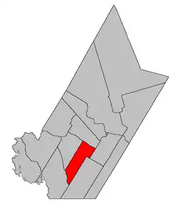 Location within York County, New Brunswick. | |
| Coordinates: 45.905°N 67.03°W | |
| Country | |
| Province | |
| County | York |
| Erected | 1786 |
| Area | |
| • Land | 287.71 km2 (111.09 sq mi) |
| Population (2016)[1] | |
| • Total | 930 |
| • Density | 3.2/km2 (8/sq mi) |
| • Change 2011-2016 | |
| • Dwellings | 672 |
| Time zone | UTC-4 (AST) |
| • Summer (DST) | UTC-3 (ADT) |
For governance purposes it forms the local service district of the parish of Prince William,[3] which is a member of Regional Service Commission 11 (RSC11).[4]
Origin of name
The parish is named in honour of Prince William, patron of the King's American Dragoons who settled the area.[5]
History
Prince William was erected in 1786 as one of the county's original parishes.[6] It extended as far inland as the rear line of Kingsclear Parish, which was twelve miles from the Saint John River, and well as any islands in front of it in the river.
In 1833 the western part of Prince William was included in the newly erected Dumfries Parish.[7]
In 1847 four islands were transferred to Queensbury Parish.[8] Little Coac, Big Coac, and Great Bear all appear on the cadastral map of the area;[9] Bloodworth appears as Heustis Island, which was granted to N. Bloodworth.
In 1855 an interior area was included in the newly erected Manners Sutton Parish.[10]
In 1895 the rear of Prince William was included in the newly erected McAdam Parish.[11]
In 1973 all reference to islands in the Saint John River was removed.[12] The islands were flooded by the Mactaquac Dam.
Delineation
Prince William Parish is defined in the Territorial Division Act[2] as being bounded:
- Southeast by Kingsclear and Manners Sutton Parishes; southwest by the eastern lines of the grants to the New Brunswick and Canada Railway and Land Company, east of the Canadian Pacific Railroad, said lines being commonly called, “The Belt Line,” northwest by the lower line of lot numbered one hundred and forty-three, granted to the rector, church wardens and vestry of Saint Clement's [Anglican] church, in said parish, and its southwesterly prolongation; northeast by the Saint John River.
Communities
Parish population total does not include incorporated municipalities (in bold):
|
|
Bodies of water
Bodies of water at least partly in the parish
- Saint John River
Demographics
PopulationPopulation trend[13][14][15][1]
|
LanguageMother tongue (2016)[1]
|
See also
References
- "Census Profile, 2016 Census: Prince William, Parish [Census subdivision], New Brunswick". Statistics Canada. Retrieved October 7, 2019.
- "Chapter T-3 Territorial Division Act". Government of New Brunswick. Retrieved 13 November 2020.
- "New Brunswick Regulation 84-168 under the Municipalities Act (O.C. 84-582)". Government of New Brunswick. Retrieved 25 July 2020.
- "Communities in each of the 12 Regional Service Commissions (RSC) / Les communautés dans chacune des 12 Commissions de services régionaux (CSR)" (PDF), Government of New Brunswick, July 2017, retrieved 2 February 2021
- Ganong, William F. (1896). A Monograph of the Place-Nomenclature of the Province of New Brunswick. Royal Society of Canada. p. 264.
- "26 Geo. III Chapter I. An Act for the better ascertaining and confirming the Boundaries of the several Counties within this Province, and for subdividing them into Towns or Parishes.". Acts of the General Assembly of His Majesty's Province of New-Brunswick, passed in the year 1786. Saint John, New Brunswick: Government of New Brunswick. 1786. pp. 3–12.
- "3 Wm. IV c. 38 An Act to alter the Names of certain Parts of Three Parishes in the County of York, and to erect Two separate Parishes therein.". Acts of the General Assembly of His Majesty's Province of New Brunswick, Passed in the Year 1833. Fredericton: Government of New Brunswick. 1833. pp. 181–182.
- "9 Vic. c. 39 An Act to annex certain Islands in the River Saint John to the Parish of Queensbury, in the County of York.". Acts of the General Assembly of Her Majesty's Province of New Brunswick, Passed in the Year 1846. Fredericton: Government of New Brunswick. 1846. p. 42.
- "No. 125". Provincial Archives of New Brunswick. Department of Natural Resources and Energy Development. Retrieved 24 October 2020.
- "18 Vic. c. 46 An Act to erect a part of the Parishes of Kingsclear and Prince William, in the County of York, into a separate Town or Parish.". Acts of the General Assembly of Her Majesty's Province of New Brunswick, Passed in the Month of November, 1854, and in the Months of February, March, and April, 1855. Fredericton: Government of New Brunswick. 1855. p. 175.
- "57 Vic. c. 34 An Act to erect part of the Parishes of Prince William and Dumfries, in the County of York, into a separate Parish.". Acts of the General Assembly of Her Majesty's Province of New Brunswick. Passed in the Month of April, 1894. Fredericton: Government of New Brunswick. 1894. pp. 157–160.
- "Chapter T-3 Territorial Division Act". Revised Statutes of New Brunswick 1973 Volume IV. Fredericton: Government of New Brunswick. 1973. pp. 1–70. The original printed version is cited separately to distinguish it from the edited version available online.
- Statistics Canada: 1996, 2001, 2006 census
- 2006 Statistics Canada Community Profile: Prince William Parish, New Brunswick
- 2011 Statistics Canada Census Profile: Prince William Parish, New Brunswick
Places adjacent to Prince William Parish, New Brunswick | ||||||||||
|---|---|---|---|---|---|---|---|---|---|---|
| ||||||||||
| Subdivisions | |
|---|---|
| Cities | |
| Counties | |
| |