Pukwana, South Dakota
Pukwana is a town in Brule County, South Dakota, United States. The population was 285 at the 2010 census.
Pukwana, South Dakota | |
|---|---|
Town | |
 Location in Brule County and the state of South Dakota | |
| Coordinates: 43°46′44″N 99°10′58″W | |
| Country | United States |
| State | South Dakota |
| County | Brule |
| Founded | 1881[1] |
| Area | |
| • Total | 0.76 sq mi (1.97 km2) |
| • Land | 0.76 sq mi (1.97 km2) |
| • Water | 0.00 sq mi (0.00 km2) |
| Elevation | 1,558 ft (475 m) |
| Population | |
| • Total | 285 |
| • Estimate (2019)[4] | 305 |
| • Density | 400.79/sq mi (154.65/km2) |
| Time zone | UTC-6 (Central (CST)) |
| • Summer (DST) | UTC-5 (CDT) |
| ZIP code | 57370 |
| Area code(s) | 605 |
| FIPS code | 46-52220[5] |
| GNIS feature ID | 1257243[6] |
Pukwana was laid out in 1881.[7]
Geography
Pukwana is located at 43°46′44″N 99°10′58″W (43.778940, -99.182743).[8]
According to the United States Census Bureau, the town has a total area of 0.76 square miles (1.97 km2), all land.[9]
Pukwana has been assigned the ZIP code 57370 and the FIPS place code 52220.
Demographics
| Historical population | |||
|---|---|---|---|
| Census | Pop. | %± | |
| 1910 | 164 | — | |
| 1920 | 192 | 17.1% | |
| 1930 | 307 | 59.9% | |
| 1940 | 258 | −16.0% | |
| 1950 | 302 | 17.1% | |
| 1960 | 247 | −18.2% | |
| 1970 | 208 | −15.8% | |
| 1980 | 234 | 12.5% | |
| 1990 | 263 | 12.4% | |
| 2000 | 287 | 9.1% | |
| 2010 | 285 | −0.7% | |
| 2019 (est.) | 305 | [4] | 7.0% |
| U.S. Decennial Census[10] | |||
2010 census
As of the census[3] of 2010, there were 285 people, 115 households, and 70 families residing in the town. The population density was 375.0 inhabitants per square mile (144.8/km2). There were 133 housing units at an average density of 175.0 per square mile (67.6/km2). The racial makeup of the town was 79.6% White, 10.9% Native American, 0.7% Asian, 0.4% from other races, and 8.4% from two or more races. Hispanic or Latino of any race were 4.2% of the population.
There were 115 households, of which 29.6% had children under the age of 18 living with them, 47.8% were married couples living together, 7.8% had a female householder with no husband present, 5.2% had a male householder with no wife present, and 39.1% were non-families. 29.6% of all households were made up of individuals, and 7% had someone living alone who was 65 years of age or older. The average household size was 2.48 and the average family size was 3.19.
The median age in the town was 41.5 years. 26% of residents were under the age of 18; 7% were between the ages of 18 and 24; 21.1% were from 25 to 44; 32% were from 45 to 64; and 14% were 65 years of age or older. The gender makeup of the town was 50.2% male and 49.8% female.
2000 census
As of the census[5] of 2000, there were 287 people, 116 households, and 78 families residing in the town. The population density was 369.6 people per square mile (142.1/km2). There were 131 housing units at an average density of 168.7 per square mile (64.8/km2). The racial makeup of the town was 97.21% White, 2.44% Native American, and 0.35% from two or more races. Hispanic or Latino of any race were 0.70% of the population.
There were 116 households, out of which 31.0% had children under the age of 18 living with them, 53.4% were married couples living together, 10.3% had a female householder with no husband present, and 31.9% were non-families. 29.3% of all households were made up of individuals, and 11.2% had someone living alone who was 65 years of age or older. The average household size was 2.47 and the average family size was 3.10.
In the town, the population was spread out, with 28.9% under the age of 18, 7.7% from 18 to 24, 29.6% from 25 to 44, 22.6% from 45 to 64, and 11.1% who were 65 years of age or older. The median age was 36 years. For every 100 females, there were 102.1 males. For every 100 females age 18 and over, there were 96.2 males.
As of 2000 the median income for a household in the town was $27,500, and the median income for a family was $31,667. Males had a median income of $24,375 versus $15,208 for females. The per capita income for the town was $11,978. About 5.6% of families and 12.1% of the population were below the poverty line, including 17.5% of those under the age of eighteen and 9.4% of those 65 or over.
Climate
This climatic region is typified by large seasonal temperature differences, with warm to hot (and often humid) summers and cold (sometimes severely cold) winters. According to the Köppen Climate Classification system, Pukwana has a humid continental climate, abbreviated "Dfa" on climate maps.[11]
| Climate data for Pukwana, South Dakota | |||||||||||||
|---|---|---|---|---|---|---|---|---|---|---|---|---|---|
| Month | Jan | Feb | Mar | Apr | May | Jun | Jul | Aug | Sep | Oct | Nov | Dec | Year |
| Average high °C (°F) | −1 (30) |
2 (35) |
7 (45) |
17 (62) |
23 (73) |
28 (82) |
33 (92) |
32 (89) |
27 (80) |
19 (67) |
8 (47) |
1 (34) |
16 (61) |
| Average low °C (°F) | −15 (5) |
−12 (11) |
−6 (21) |
1 (34) |
7 (45) |
13 (56) |
16 (61) |
15 (59) |
9 (49) |
2 (36) |
−6 (22) |
−12 (11) |
1 (34) |
| Average precipitation mm (inches) | 7.6 (0.3) |
13 (0.5) |
23 (0.9) |
41 (1.6) |
66 (2.6) |
91 (3.6) |
53 (2.1) |
51 (2) |
38 (1.5) |
25 (1) |
15 (0.6) |
7.6 (0.3) |
440 (17.2) |
| Source: Weatherbase [12] | |||||||||||||
References
- "SD Towns" (PDF). South Dakota State Historical Society. Retrieved 2010-02-15.
- "2019 U.S. Gazetteer Files". United States Census Bureau. Retrieved July 30, 2020.
- "U.S. Census website". United States Census Bureau. Retrieved 2012-06-21.
- "Population and Housing Unit Estimates". United States Census Bureau. May 24, 2020. Retrieved May 27, 2020.
- "U.S. Census website". United States Census Bureau. Retrieved 2008-01-31.
- "US Board on Geographic Names". United States Geological Survey. 2007-10-25. Retrieved 2008-01-31.
- Federal Writers' Project (1940). South Dakota place-names, v.1-3. University of South Dakota. p. 57.
- "US Gazetteer files: 2010, 2000, and 1990". United States Census Bureau. 2011-02-12. Retrieved 2011-04-23.
- "US Gazetteer files 2010". United States Census Bureau. Archived from the original on 2012-01-24. Retrieved 2012-06-21.
- "Census of Population and Housing". Census.gov. Retrieved June 4, 2015.
- Climate Summary for Pukwana, South Dakota
- "Weatherbase.com". Weatherbase. 2013. Retrieved on October 13, 2013.
Municipalities and communities of Brule County, South Dakota, United States | ||
|---|---|---|
| Cities | 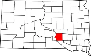 | |
| Town | ||
| CDPs | ||
| Unincorporated community | ||
| Townships |
| |
| Unorganized Territory |
| |
| ||
External links
| Authority control |
|---|