Spikebuck Town Mound and Village Site
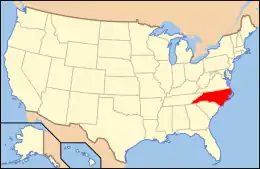
The Spikebuck Town Mound and Village Site is a prehistoric and historic archaeological site near the Hiwassee River in present-day Hayesville, North Carolina. The site encompasses the former area of the Cherokee village of Quanassee (also spelled Qunassee on a colonial map) and associated farmsteads. The village was centered on what is known as Spikebuck Mound, an earthwork platform mound, likely built about 1,000 CE by ancestral indigenous peoples during the South Appalachian Mississippian culture period.
Spikebuck Town Mound and Village Site | |
 | |
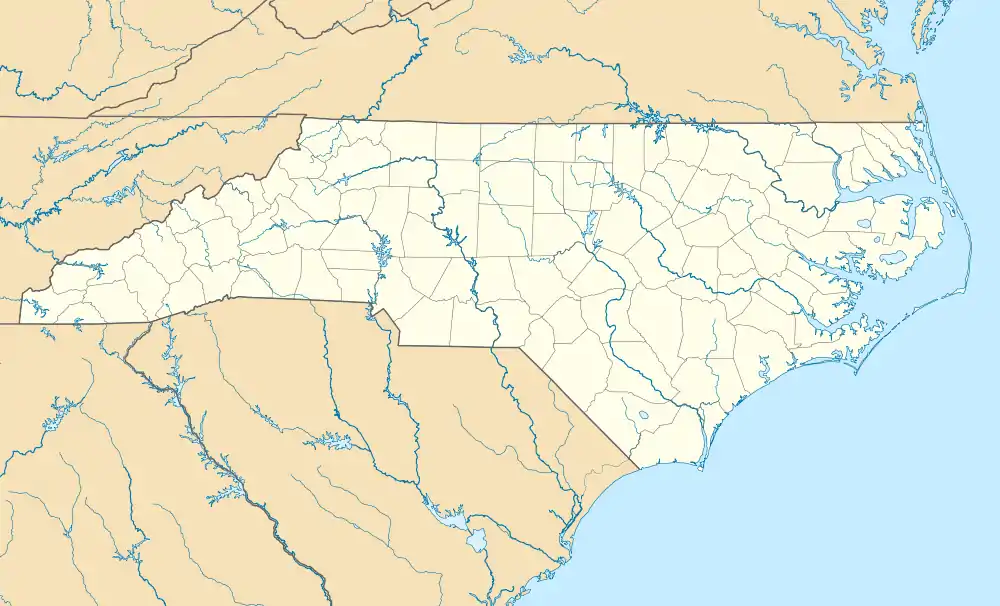  | |
| Location | Hayesville, North Carolina |
|---|---|
| Coordinates | 35.046111°N 83.808889°W |
| Area | 145 acres (59 ha) |
| NRHP reference No. | 82003443[1] |
| Added to NRHP | August 17, 1982 |
Quanassee was known by the English in the colonial period as one of the historic Cherokee "Valley Towns", located along the upper Hiwassee River. The mound and village site was listed as an archeological site on the National Register of Historic Places in 1982.
History
Indigenous peoples lived for more than a thousand years along the river. People of the South Appalachian Mississippian culture era are believed to have constructed and earthen platform mound and village as the expression of their stratified society.
In their time, the historic Cherokee settled here, building their communal townhouse on top of the platform mound. It was their chief expression of public architecture, designed to provide a place for the community to gather for ceremony and for taking care of town issues. The townhouse would be regularly replaced and maintenance accomplished on the mound as well.
The town of Quanassee was documented by European colonists during the early colonial period as one of the Cherokee "Valley Towns" along the Hiwassee River, appearing on a 1725 map as Qunassee. The Cherokee occupied it from the 17th century into the 19th century. Some historic documents suggest that it was one of the towns attacked and damaged by American rebels in 1776 during the Revolutionary War, as the Cherokee supported the British.[2]
The Cherokee in the late 1830s were forced by the United States to cede their land here and other areas of the region. Many were gathered and held in this area prior to being forced on the Trail of Tears, beginning in 1838 in Tennessee, to Indian Territory west of the Mississippi River.[2]
20th century to present
The mound and village areas were long held in private ownership by European Americans who settled here after the Cherokee. The larger town area was cultivated, disturbing the topsoil layer.
In the 1960s and 1970s, excavations were conducted at the town site, revealing both Cherokee and European artifacts.[2] "House patterns, fire pits, European trade goods, storage pits, burned timbers, and a variety of pottery, pipes, and beads" were found.[2] These documented likely European contact, as well as the Cherokee connection to wide Native American trading networks that spanned much of the continent, reaching to the Great Lakes.[2]
The site was listed on the National Register of Historic Places in 1982.[1]
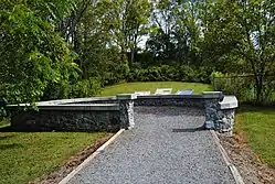
In 2000, the mound was acquired by Clay County, which is protecting it.[2] It developed an overlook sitting area near the mound. (See image). The Veterans Recreational Park off Anderson Street was developed nearby, in downtown Hayesville.[3]
In addition, the Clay County Communities Revitalization Association is working to preserve other Cherokee resources in Hayesville: the Quanassee Path, which highlights five Cherokee features near Hayesville; the Cherokee Homestead Exhibit, with reconstructions of typical summer and winter houses and a corn crib; and the Cherokee Botanical Sanctuary.[4]
The Archeological Conservancy acquired the former town and farmstead site in 2011, and are working to conserve it. Believing that the site has great possibilities for research, they have permitted Western Carolina University to conduct archeological field schools there in an effort to map out more findings and try to create a town layout. Students have used remote sensing to establish data about possible structures in a non-invasive way. Following up with a targeted excavation has revealed "a large feature", likely a house.[5]
References
- "National Register Information System". National Register of Historic Places. National Park Service. July 9, 2010.
- "Update E: Important Cherokee Valley Town Site, 5th Anniversary of Preservation". Archeological Conservancy. 22 Jan 2016. Retrieved 10 January 2021.
- "Spikebuck Mound". Clay County Communities Revitalization Association. Retrieved 2014-04-15.
- "Cherokee Culture". Clay County Communities Revitalization Association. 2019–2021. Retrieved 10 Jan 2021.CS1 maint: date format (link)
- "Update E: Important Cherokee Valley Town Site, 5th Anniversary of Preservation". Archeological Conservancy. 22 Jan 2016. Retrieved 10 Jan 2021.
| Wikimedia Commons has media related to Spikebuck Town Mound and Village Site. |
[[Category:Archaeological sites on the National Register of Historic Places in North Carolina [[Category: