Quebec Route 125
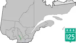
Route 125 is a Quebec highway running from Montreal (on Pie-IX Boulevard near the Olympic Stadium) to Saint-Donat, Lanaudière, Quebec in the Lanaudière. The southern section of Route 125 runs parallel to Autoroute 25 in Laval, Mascouche, and Terrebonne. At Saint-Esprit, the Autoroute ends, and 125 continues northwards until the entrance to the Mont Tremblant Provincial Park north of Saint-Donat.
| ||||
|---|---|---|---|---|
 | ||||
| Route information | ||||
| Maintained by Transports Québec | ||||
| Length | 131.3 km[1] (81.6 mi) | |||
| Major junctions | ||||
| South end | ||||
| North end | Mont-Tremblant National Park in Saint-Donat | |||
| Highway system | ||||
| ||||
Major intersections
| RCM | Location | km[2] | mi | Destinations | Notes |
|---|---|---|---|---|---|
| Montréal | Montréal | 0.0 | 0.0 | Borough of Rosemont–La Petite-Patrie | |
| 3.9 | 2.4 | Exit 76 on A-40; borough of Villeray–Saint-Michel–Parc-Extension | |||
| Rivière des Prairies | 8.9 | 5.5 | Pont Le Caron | ||
| Laval | 9.5 | 5.9 | Boulevard de la Concorde / Boulevard Lévesque | Interchange | |
| 10.4 | 6.5 | Boulevard Saint-Martin | Interchange | ||
| 11.1 | 6.9 | Boulevard Lite | Interchange | ||
| 11.5 | 7.1 | Exit 30 on A-440; southern terminus of concurrency with A-440 | |||
| 12.5 | 7.8 | Montée Saint-François | Exit 31 on A-440 | ||
| 14.9 | 9.3 | Exit 34 on A-440; northern terminus of A-440 | |||
| 16.0 | 9.9 | Exit 17 on A-25 | |||
| Rivière des Mille Îles | 20.3 | 12.6 | Pont Sophie-Masson | ||
| Lanaudière | Terrebonne | 21.2 | 13.2 | Southern terminus of concurrency with Route 344 | |
| 21.4 | 13.3 | Northern terminus of concurrency with Route 344 | |||
| 23.7 | 14.7 | Exit 24 on A-25 | |||
| Saint-Roch-Ouest | 43.1 | 26.8 | |||
| 43.5 | 27.0 | Exit 44 on A-25 | |||
| Saint-Esprit | 46.3 | 28.8 | Traffic circle; southern terminus of concurrency with Route 158 | ||
| 46.5 | 28.9 | Northern terminus of A-25; exit 46 on A-25 | |||
| 49.9 | 31.0 | Northern terminus of concurrency with Route 158 | |||
| Sainte-Julienne | 58.3 | 36.2 | Southern terminus of concurrency with Route 337; western terminus of Route 346 | ||
| 63.1 | 39.2 | Northern terminus of concurrency with Route 337 | |||
| | 67.3 | 41.8 | Western terminus of Route 348 | ||
| | 74.1 | 46.0 | Northern terminus of Route 341 | ||
| | 77.4 | 48.1 | Northern terminus of Route 335 | ||
| Notre-Dame-de-la-Merci | 105.2 | 65.4 | Northern terminus of Route 347 | ||
| Saint-Donat-de-Montcalm | 120.1 | 74.6 | Northern terminus of Route 329 | ||
| 132.6 | 82.4 | Parc national du Mont-Tremblant | |||
1.000 mi = 1.609 km; 1.000 km = 0.621 mi
| |||||
References
- Ministère des transports, "Distances routières", page 61, Les Publications du Québec, 2005
- Google (May 17, 2019). "Quebec Route 125" (Map). Google Maps. Google. Retrieved May 17, 2019.
This article is issued from Wikipedia. The text is licensed under Creative Commons - Attribution - Sharealike. Additional terms may apply for the media files.
